Antique Europe Maps & Atlases
Shop by Date Range


123,481 results
Vintage Admiralty Charts 1960s-1980’s
£7.99£7.00 postageHERTFORDSHIRE County Map in1610 by John Speed - Uncoloured
£6.99£2.90 postageNew listingOLD Framed MAP OF WILTSHIRE
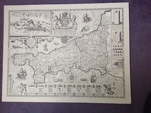
£15.00£3.69 postageCORNWALL 1610 MAP by John Speed - Uncoloured
£9.99£3.00 postageNew listingBacon's Tourist Map of the Lake District, linen backed
£3.000 bidsEnding 30 Apr at 11:32AM BST6d 23h£2.10 postageNew listingLincolnshire Saxton Kip Camden Antique Map 1637 Original G
£149.99£7.65 postageantique geological map England Wales R Murchison 1842 British geology art poster
£18.90£7.50 postage111 soldVINTAGE GEOGRAPHIA 1950s SCHOOL EDUCATIONAL GLASGOW STREET PLAN WALL MAP PRE M8!
£145.00£12.95 postage13 watching1901 Folding Map or Central Wirral Cheshire Footpath Society
£40.00£3.05 postagePalestine Tatreez Pattern Mug
£12.00£3.00 postageNew listing1838 Oxfordshire England UK Map J. & C. Walker London G
£52.99£5.64 postageNew listingOld Map Of Norwich 1899
£1.000 bids£4.00 postageEnding 3 May at 10:07AM BST9d 22hMetric Based USNG Topographical Map Scale Protractor 3 Kinds of Scale Plastic
£7.32Was: £7.71Free postageNew listingLetts Antique 1881 Map Of Lancashire
£15.000 bids£3.60 postageEnding 30 Apr at 10:16AM BST6d 22hOld Antique Victorian map Manchester & Salford early 1800's Cole & Roper Reprint
£5.99£2.50 postage5 watchingHyde, Haughton, old map Cheshire 1910: 11NW A
£23.99£4.00 postageImperial Airways Route Map LONDON to PARIS 1928
£125.00£3.99 postage1902 Map of Scotland antique vintage Britannica 10th
£6.50£2.40 postage1909 Map of area around London vintage antique street plan Baedeker
£10.00£1.00 postageRARE Antique Map , W Pinnock , 1833 , NEW PLAN OF LONDON , Large A2 SIZE
£199.99Free postage100% ORIGINAL FOX HOUNDS HUNTING MAP OF GREAT BRITAIN BY HAMPTON C1984 VGC
£25.00£3.95 postageOld Antique map Cumberland Cumbria England c1830's Moule: Reprint Carlisle View
£5.99£2.50 postage10 watchingOld map Environs of Rugby, Warwickshire - 1898
£15.99£4.00 postageNew listingOS Map 24 Lancaster And Fleetwood 1910 Large Sheet Series Two Shillings
£4.990 bids£2.10 postageEnding 29 Apr at 11:36PM BST6d 11h"Whitby Orderaround" A3 Pub Map Poster
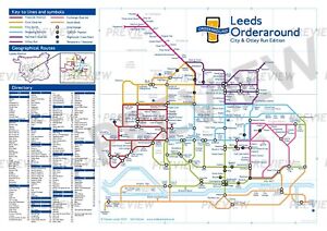
£13.00Free postage"Leeds Orderaround - City & Otley Run Edition" Pub Map poster.
£12.50Free postage1736 Augsburg, Germany Antique Map by Claude Du Bosc
£40.00£4.50 postageMiddlesbrough , old map Yorkshire 1920: 6 SW antiqued
£23.99£4.00 postageNew listingGermany - DZT Map -1993
£4.00£2.70 postageNew listingA-to-Z Map - Devon & Cornwall
£4.00£2.70 postageNew listingGIBRALTAR GREAT BRITAIN Spain Original Map 1911
£13.79£11.76 postageOld map of Poulton le Fylde, Lancashire in 1913: 51NW repro
£18.99£4.00 postageOld Map of Leek (N) , Staffordshire in 1887- Repro 8 NW
£18.99£4.00 postageOld map Folkestone (N), Hawkinge, Arpinge OS Kent 75-NW-1938 A2
£17.99£4.00 postageCaledonian Railway - Grangemouth Docks (85 X 39cm)
£15.00Free postageOld map Environs of Carlisle, Cumbria - 1898
£15.99£4.00 postageTrusham - old Devon map 101-3-1905
£19.99£4.00 postageOld map of Maghull, Melling, Kirkby, Lancashire 1909: 99NE repro
£18.99£4.00 postageNew listingVintage Ordnance Survey road map, cloth, DARLINGTON, 1930, Sheet 14 Pre War
£4.500 bidsEnding 29 Apr at 11:49AM BST6d£2.30 postageNew listingTwelve WW1 Maps, from History of the First Division, Published 1922
£79.80£18.21 postage1795 West Yorkshire Original Antique Map by John Stockdale
£24.99£2.00 postage