Antique Europe Maps & Atlases
Shop by Date Range
124,017 results
Vintage Admiralty Charts 1960s-1980’s
£7.99£7.00 postageNew listingOliver's Tourist Road Map & Guide BRISTOL area for Motorist & Cyclist 1956
£0.800 bids£1.55 postageEnding 25 Apr at 7:57PM BST6d 13hOld Antique Victorian map Manchester & Salford early 1800's Cole & Roper Reprint
£5.99£2.50 postage5 watching"Whitby Orderaround" A3 Pub Map Poster
£13.00Free postageVintage decorative sheet map of Devonshire John Speede 1610 Devon
£9.99Free postage46 soldantique geological map England Wales R Murchison 1842 British geology art poster
£18.90£7.50 postage111 soldLONDON UNDERGROUND tube plan map. Heathrow Terminal 4 complete. #1 1986
£18.00£4.00 postageBMW WEST EUROPE ROUTE 2024-1 with FSC CODE USB UPDATE
£62.99Free postageNew listingMAP IRELAND EIRE . IRISH TOURIST BOARD . SCALE 1 inch to 10 miles
£1.990 bidsEnding 28 Apr at 9:24PM BST9d 15h£2.50 postage100% ORIGINAL FOX HOUNDS HUNTING MAP OF GREAT BRITAIN BY HAMPTON C1984 VGC
£25.00£3.95 postageNew listingVintage Shell folding Road Maps Sets No’s 1, 2 & 3 England, Scotland & Wales
£5.000 bids£2.94 postageEnding 25 Apr at 7:09PM BST6d 13hPalestine Tatreez Pattern Mug
£12.00£3.00 postageOLD COPY OF JOHN SPEED MAP OF LINCOLNSHIRE LINCOLN TOWN PLAN
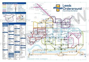
£9.99Free postage72 sold"Leeds Orderaround - City & Otley Run Edition" Pub Map poster.
£12.50Free postageNew listingSAILING CHART 807 GUERNSEY AND HERM 1980 (METROPOLITAN POLICE COVER)
£2.000 bids£5.00 postageEnding 28 Apr at 9:11PM BST9d 15hNew listingSAILING CHART 2669 THE CHANNEL ISLANDS 1980 (METROPOLITAN POLICE COVER)
£2.000 bids£9.00 postageEnding 28 Apr at 9:11PM BST9d 15hTrusham - old Devon map 101-3-1905
£19.99£4.00 postageNew listingAntique Map "France" Bossuet, 1722
£4.990 bids£7.00 postageEnding 28 Apr at 7:17PM BST9d 13hOld map Environs of Carlisle, Cumbria - 1898
£15.99£4.00 postageNew listingThe Complete Safety Cycling Map of England Antique Victorian Gall & Inglis
£15.000 bids£2.70 postageEnding 28 Apr at 10:55PM BST9d 16hAntique 1881 Victorian City Map of SHEFFIELD By G W Bacon 21 x 13”
£9.99£4.00 postageNew listingChapman & Hall's (Double size) Pocket map of WALES c 1835
£21.500 bids£1.55 postageEnding 25 Apr at 7:53PM BST6d 13hNew listingGeographia Plan of Plymouth Large Colour Map 1950's Antique
£5.990 bids£2.99 postageEnding 28 Apr at 8:55PM BST9d 14hAntique 1901 Oxfordshire large map. 120 years old. Oxford, Banbury.
£12.89£3.60 postageVINTAGE GEOGRAPHIA 1950s SCHOOL EDUCATIONAL GLASGOW STREET PLAN WALL MAP PRE M8!
£145.00£12.95 postage1736 Augsburg, Germany Antique Map by Claude Du Bosc
£40.00£4.50 postage1728 VERY RARE Herman Moll Map , Genuine Antique, The Persian Empire
£249.99Free postageNew listingAntique Map "Liguria o Stato della Repubblica di Genova" (Italy) Blaeu, c. 1640
£399.000 bids£7.00 postageEnding 28 Apr at 7:11PM BST9d 13hVINTAGE ADMIRALTY CHART SCOTLAND
£16.99£6.20 postageNew listingJoshua Archer Yorkshire East West Riding 1808 Antique Original Hand Colour Roper
£8.950 bidsEnding 25 Apr at 7:32PM BST6d 13h£3.29 postageNew listingGeographia Large Street Plan of Exeter Map 1950's Antique
£1.990 bids£2.99 postageEnding 28 Apr at 9:12PM BST9d 15hNew listingAntique Map "Lisabona Magnificentissima Regia Sedes Portugalliae" Seutter, 1755
£1,299.000 bids£7.00 postageEnding 28 Apr at 7:04PM BST9d 12h1907 Stoke Newington Highbury Kingsland Dalston Hackney London Street Plan
£24.99£2.00 postage1830 Worcestershire by Hoare & Reeves Large Antique Hand Coloured Map
£34.99£4.50 postageNew listingAntique Map "Dresden" SDUK - Baldwin & Cradock, 1836
£19.990 bids£7.00 postageEnding 28 Apr at 7:18PM BST9d 13hNew listingSTANFORDS SEA CHART NUMBER 16 THE CHANNEL ISLANDS (METROPOLITAN POLICE COVER)
£2.000 bids£5.00 postageEnding 28 Apr at 9:11PM BST9d 15hVintage decorative sheet map of Northumberland John Speede 1610
£9.99Free postage20 soldNew listingMUNICH MÜNCHEN GERMANY 1832 S.D.U.K. UNUSUAL ANTIQUE STEEL ENGRAVED CITY MAP
ANTIQUE STEEL ENGRAVED CITY MAP OF MUNICH MÜNCHEN 1832£16.060 bids£20.08 postageEnding 29 Apr at 6:03AM BST9d 23hOld Antique Victorian picture map of Liverpool: early 1800's: SDUK Reprint
£4.99£2.50 postage4 watching1893 Greece & Part of Turkey in Europe Original Antique Map by G.W. Bacon
£19.99£4.50 postage1830 Nottinghamshire by Hoare & Reeves Large Antique Hand Coloured Map
£34.99£4.50 postage