Picture 1 of 3


Gallery
Picture 1 of 3


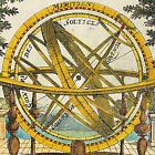
map Berkshire by John Aikin England Delineated Original with text 1803

raremapsandprints
(1637)
Business
£37.00
Condition:
“Good Condition - Please see description below”
- Buy it nowmap Berkshire by John Aikin England Delineated Original with text 1803
Oops! Looks like we're having trouble connecting to our server.
Refresh your browser window to try again.
Returns:
No returns accepted.
Payments:
Get more time to pay. See payment informationfor PayPal Credit - opens in a new window or tab
Shop with confidence
About this item
Seller assumes all responsibility for this listing.
eBay item number:157424950057
Item specifics
- Seller notes
- “Good Condition - Please see description below”
- Antique
- Yes
- Printing Technique
- Copper Plate
- Cartographer/Publisher
- John Aikin
- City
- Reading
- County
- Berkshire
- Maker
- John Aikin
- Date Range
- 1800-1899
- Type
- County Map
- Format
- Atlas Map
- Year
- 1803
- Era
- 1800s
- Original/Reproduction
- Antique Original
- Country/Region
- England
- Antique/ Modern
- Antique
Item description from the seller
Seller business information
CRN: 11235906
Extended Producer Responsibility (EPR) numbers:
A seller has an EPR number if they've registered with the government as a producer of a certain type of product and taken responsibility for managing the waste that product creates.
About this seller
raremapsandprints
100% positive Feedback•4.0K items sold
Registered as a business seller
Popular categories from this shop
Seller Feedback (1,884)
- 3***r (890)- Feedback left by buyer.Past 6 monthsVerified purchaseShipping: Perfect. USPS Priority. Packaging: In a good, sturdy tube. Came all the way with barely a dent. As described: YES. I surely got the better end of the deal. Value: For me, priceless. Thank you. I'll be looking for your items again. AND AND AND I avoided any tariff !!
- r***1 (162)- Feedback left by buyer.Past 6 monthsVerified purchaseExactly as described. Great communications, and fast shipping. If you are from the states, don’t let the tariff stuff dissuade you. Seller made it a seamless transaction. I’ll be shopping there again!Road Map London to Montgomery by Bowles original early 1782 (#167530988249)
- k***t (118)- Feedback left by buyer.Past monthVerified purchaseExcellent communication and packaging. The print was as described and it was a good value. Thank you!
More to explore:
- John Bartholomew Berkshire Antique Europe Maps & Atlases,
- John Speed Berkshire Antique Europe Maps & Atlases,
- John Cary Berkshire Antique Europe Maps & Atlases,
- Berkshire Antique Original Antique European Maps & Atlases,
- Berkshire Antique Original Antique Europe Sheet Maps,
- Berkshire Antique Original Antique Europe Atlas Maps,
- Berkshire Antique Original Antique Europe County Maps,
- Emanuel Bowen Berkshire Antique Original Antique Europe Maps & Atlases,
- Antique European Maps & Atlases Oxford Berkshire,
- Berkshire Antique Europe Ordnance Survey Maps
Popular categories from this shop
Seller Feedback (1,884)
- 3***r (890)- Feedback left by buyer.Past 6 monthsVerified purchaseShipping: Perfect. USPS Priority. Packaging: In a good, sturdy tube. Came all the way with barely a dent. As described: YES. I surely got the better end of the deal. Value: For me, priceless. Thank you. I'll be looking for your items again. AND AND AND I avoided any tariff !!
- r***1 (162)- Feedback left by buyer.Past 6 monthsVerified purchaseExactly as described. Great communications, and fast shipping. If you are from the states, don’t let the tariff stuff dissuade you. Seller made it a seamless transaction. I’ll be shopping there again!Road Map London to Montgomery by Bowles original early 1782 (#167530988249)
- k***t (118)- Feedback left by buyer.Past monthVerified purchaseExcellent communication and packaging. The print was as described and it was a good value. Thank you!