
Antique Europe Maps & Atlases
Shop by Date Range
127,480 results
Vintage Admiralty Charts 1960s-1980’s
£7.50£7.00 postageOld map Environs of Windsor, Berkshire 1898
£15.99£4.00 postage"Barnsley Town Orderaround" A3 Pub Map poster
£12.50Free postageNew listingVintage Maps - job lot of five - road maps and OS
£5.990 bidsFree postageEnding 15 May at 10:46AM BST4d 23hJack the Ripper Locations Map - Whitechapel, London 1888
£21.99£4.00 postage110 soldOLD COPY OF JOHN SPEED MAP OF LINCOLNSHIRE LINCOLN TOWN PLAN
£9.99Free postage73 soldOld Vintage EUROPE Map 1925 Collectors Or Scrapbook Junk Journal Ephemera
£0.990 bidsEnding Saturday at 9:14AM BST22h£4.00 postageantique map hemisphae alis coeli map globe map earth
£19.99£3.99 postage1794 Country Around Manchester Large Folding Map by Stockdale 84 cm x 81 cm
£175.00£2.00 postageVintage decorative sheet map of Devonshire John Speede 1610 Devon
£9.99Free postage50 soldBarnsley E, Cudworth, Grimethorpe, old map Yorkshire 1938: 275NW repro
£18.99£4.00 postageOld Antique colour map views vignettes York, England 1800's 1851 Tallis Reprint
£5.99£2.50 postage7 watchingHEREFORD Street Plan / Map of the Town - Vintage Folding Map 1938
£5.99£0.99 postageOLD COPY OF JOHN SPEED MAP OF WILSHIRE WILTSHIRE STONE HENGE SALISBURY TOWN PLAN
£9.99Free postage69 soldNew listing1994: Physical Map Of Europe Physical Print #4/5
£4.95Free postageNew listing1994: Physical Map Of Spain & Portugal Print #18
£4.95Free postageNew listing1994: Physical Map Of Middle East Print #19
£4.95Free postageOriginal Antique Map Print Exeter, Devon - by Mutlow 1800 Around 200 Years Old.
£200.00£10.00 postage11 watchingc1895 Map of Central London England antique vintage Britannica 9th
£6.50£2.50 postage1902 Map of Scotland antique vintage Britannica 10th
£6.50£2.50 postageOld map of Kent - Framed - Antique ?
£115.00£12.95 postageBIRMINGHAM CITY CENTRE antique town plan. BAEDEKER 1910 old map chart
£8.00£4.00 postageIRELAND, KINGDOM OF, 1610 by J. Speed - reproduction old map - fits A2 frame
£20.99£4.00 postageNew listingBLOIS FRANCE 1588 BRAUN & HOGENBERG UNUSUAL ANTIQUE COPPER ENGRAVED VIEW
ANTIQUE COPPER ENGRAVED CITY VIEW OF BLOIS FRANCE 1588£15.981 bid£19.98 postageEnding 20 May at 6:11AM BST9d 18hHyde, Haughton, old map Cheshire 1910: 11NW A
£23.99£4.00 postageantique Tombleson's map of river Thames with 9 inset views 1850 art print poster
£28.70£7.50 postage17 watchingOld map Environs of Stoke on Trent, Longton, Hanley, Staffordshire - 1898
£15.99£4.00 postageantique geological map England Wales R Murchison 1842 British geology art poster
£18.90£7.50 postage111 soldantique guide map early plan of London Westminster Bowles 1800 art print poster
£23.70£7.50 postage38 soldOld map Environs of Wigan, Lancashire - 1898
£15.99£4.00 postagePoole Parkstone, Longfleet, St Aldhelms, old map Dorset 1902: 44SW
£18.99£4.00 postageBattle of Waterloo plan 2 A K Johnston map Alison's Atlas 1850 art print poster
£18.90£7.50 postage7 watchingCaledonian Railway - Grangemouth Docks (85 X 39cm)
£10.00Free postageOld map Environs of Middlesbrough, North Yorkshire -1898
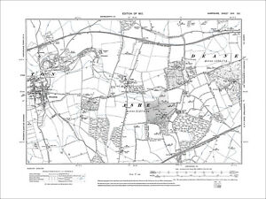
£15.99£4.00 postageOverton, Ashe, Dean, Old Map Hampshire 1912: 17SE
£18.99£4.00 postageRyde, Binstead, Swanmore, Old Map Hampshire Isle Of Wight 1909: 91SW
£18.99£4.00 postageChulmleigh, Bridge Reeve, Old Map Devon 1906: 42NE
£18.99£4.00 postageMiddlesbrough , old map Yorkshire 1920: 6 SW antiqued
£23.99£4.00 postageCaledonian Railway - Grangemouth Docks (85 X 39cm)
£15.00Free postageCaledonian Railway - Grangemouth Docks: Land Progress Plan (85 X 39cm)
£10.00Free postageEUROPE. European. General Map; Inset map of Population map 1907 old
£10.00£5.00 postagePenge Crystal Palace Forest Hill Map 1888 Gtr London #39
£18.99£4.00 postageCARDIFF 1910 ANTIQUE CITY PLAN Colour Map - Mounted For Framing
£7.99£2.99 postageFRAMED ANTIQUE MAP OF SCOTLAND
£195.00Free postage


You may also like


Deals for you
Grab a further 10% with code BLUEBELL10Shop nowMin spend £9.99. Max discount £75.T&Cs apply.

![Ninja Foodi FlexDrawer Air Fryer - Certified Refurbished [AF500UK] 10.4L](https://i.ebayimg.com/thumbs/images/g/7MAAAOSwXvNl-rZs/s-l225.jpg)


