Cambridge European Antique Maps & Atlases Cambridgeshire 1700-1799 Date Range
SPONSOREDSPONSOREDSPONSOREDSPONSORED
All
Auction
Buy it now
15 results
Wimpole Hall Cambridgeshire Cambridge Engraving Copperplate Van Der Aa 1707
£21.61£12.84 postageBRISTOL TO WEYMOUTH, CAMBRIDGE TO COVENTRY, antique road map, SENEX, 64-65, 1762
£33.00Click & CollectCAMBRIDGESHIRE CAMBRIDGE BY EMANUEL BOWEN c1720 GENUINE ANTIQUE ENGRAVED MAP
£39.99Click & CollectHUNTINGDONSHIRE HUNTINGDON CAMBRIDGE BY EMANUEL BOWEN c1720 GENUINE ANTIQUE MAP
£34.99Click & CollectHUNTINGDONSHIRE CAMBRIDGE BY THOMAS KITCHIN c1770 GENUINE COPPER ENGRAVED MAP
£39.99Click & Collect1722 MAP OF CAMBRIDGESHIRE BY ROBERT MORDEN CAMBRIDGE ELY NEWMARKET MILDENHALL *
£59.99Click & Collector Best Offer£6.00 postageHUNTINGDONSHIRE HUNTINGDON CAMBRIDGE BY JOHN CARY GENUINE ANTIQUE MAP c1793
£34.99Click & CollectCAMBRIDGESHIRE CAMBRIDGE BY JOHN CARY GENUINE ANTIQUE MAP c1793
£39.99Click & CollectHUNTINGDONSHIRE CAMBRIDGE BY BADESLADE & TOMS GENUINE ANTIQUE MAP c1742
£29.99Click & CollectOLD ANTIQUE ROAD MAP CAMBRIDGE CAMBRIDGESHIRE by OWEN BOWEN c1740's NORFOLK
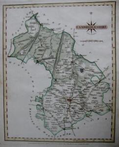
£22.49£2.20 postageCAMBRIDGESHIRE CAMBRIDGE BY THOMAS KITCHIN c1769 GENUINE ANTIQUE ENGRAVED MAP
£44.99Click & CollectHUNTINGDONSHIRE HUNTINGDON CAMBRIDGE c1704 BY ROBERT MORDEN GENUINE ANTIQUE MAP
£49.99Click & CollectCAMBRIDGE. Genuine antique map of Cambridgeshire by Emanuel Bowen ca. 1763
£105.00Click & Collect£15.00 postageCAMBRIDGESHIRE CAMBRIDGE BY JOHN ROCQUE GENUINE ANTIQUE ENGRAVED MAP c1753
£44.99Click & CollectMadingley Hall Cambridgeshire Cambridge Engraving Copperplate Van Der Aa 1707
£21.61£12.89 postage
Deals for you
Grab a further 10% with code BLUEBELL10Shop nowMin spend £9.99. Max discount £75.T&Cs apply.
More to explore
- Bacon Map London in Antique Europe Maps & Atlases
- Bacon Map in Antique Europe Maps & Atlases
- Bromley Map in Antique Europe Maps & Atlases
- East Yorkshire Map
- Fox Hunting Maps
- Geographia Map in Antique Europe Maps & Atlases
- Great Yarmouth Map
- Hull Map in Antique Europe Maps & Atlases
- Jersey Map in Antique Europe Maps & Atlases
- Lambeth Map
- Linen Map in Antique Europe Maps & Atlases
- Map Cheltenham in Antique Europe Maps & Atlases
- Moule Maps
- Northern Ireland Map in Antique Europe Maps & Atlases
- Old Bristol Map
- Ordnance Survey Lake District in Antique Europe Maps & Atlases
- Philips Map in Antique Europe Maps & Atlases
- Plymouth Map in Antique Europe Maps & Atlases
- River Thames Map in Antique Europe Maps & Atlases
- Robert Morden Maps
- Saxon Map
- Saxton Map
- Scarborough Map in Antique Europe Maps & Atlases
- Vintage Michelin Maps in Antique Europe Maps & Atlases
- War Office Map in Antique Europe Maps & Atlases