
Antique Europe Maps & Atlases
Shop by Date Range
127,040 results
1900 Muswell Hill Crouch End Highgate Hornsey Antique London Street Plan
£24.99£2.00 postageVintage Admiralty Charts 1960s-1980’s
£7.50£7.00 postageNew listingAntique / Vintage Map ~ Framed Map Of Shropshire ~ Robert Morden
£39.99£10.00 postageNew listing100% ORIGINAL LARGE ESSEX MAP BY JOHN SPEED C1627 VGC HAND COLOURED
£450.00£8.95 postageNew listing100% ORIGINAL LARGE IRELAND BY ROBERT MORDEN C1722 VGC HAND COLOURED
£249.00£3.95 postageNew listingAntique / Vintage Map ~ Framed Map Of Shropshire ~ J. Cary 1787
£25.99£3.50 postageNew listingPtolemaeus Central Europe Map 1486. Modern Framed Reproduction
£38.00£7.00 postageOriginal Antique Map Print Exeter, Devon - by Mutlow 1800 Around 200 Years Old.
£200.00£10.00 postage11 watchingc1895 Map of Central London England antique vintage Britannica 9th
£6.50£2.50 postageOld map of Kent - Framed - Antique ?
£115.00£12.95 postageNew listing1902 Map of Ireland antique vintage Britannica 10th
£6.50£2.50 postageNew listingThe Hutchinson Double Map of British Isles
£1.99£1.55 postageNew listingAntique / Vintage Map ~ Framed Saxton's Map of Shropshire, 1577
£39.99£10.00 postageNew listingCycling map
£8.000 bidsEnding 20 May at 1:28PM BST6d 22h£1.55 postage"Whitby Orderaround" A3 Pub Map Poster
£13.00Free postageNew listingc1895 Map of Iceland antique vintage Britannica 9th
£6.00£2.50 postageNew listingPtolemy World Map 1486. Modern Framed Reproduction
£38.00£7.00 postagePalestine Tatreez Pattern Mug
£12.00£3.00 postageSHROPSHIRE 1695 by Robert Morden from Camden Britannica
£125.00Free postage1830 Leicestershire by Hoare & Reeves Large Antique Hand Coloured Map
£34.99£4.50 postage1794 Country Around Manchester Large Folding Map by Stockdale 84 cm x 81 cm
£175.00£2.00 postageNew listingSurrey, 1841 genuine antique map
£25.00£5.00 postageantique geological map England Wales R Murchison 1842 British geology art poster
£18.90£7.50 postage111 soldAntique 17th Century Map of Hampshire by Robert Morden
£78.03£6.50 postageNew listingc1895 Map of Hungary antique vintage Britannica 9th
£6.00£2.50 postageNew listing1902 Map of Italy antique vintage Britannica 10th
£6.50£2.50 postage"Chester Orderaround" A3 Pub Map Poster
£12.50Free postage"Barnsley Town Orderaround" A3 Pub Map poster
£12.50Free postageNew listing1949 Philips London Large Print Map Duplex Edition with Index + Outer Districts
£29.990 bids£4.95 postageEnding 20 May at 12:25PM BST6d 21hNew listingLARGE SCALE ANTIQUE Ordnance Map SUFFOLK - HOLBROOK Area 1904
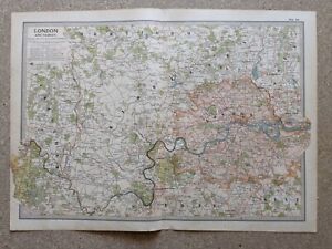
£8.00£7.50 postageNew listing1902 Map of London and Vicinity antique vintage Britannica 10th
£10.00£2.50 postageNew listingLARGE SCALE ANTIQUE Ordnance Map SUFFOLK - RENDLESHAM Area 1904
£14.00£7.50 postageNew listingLARGE SCALE ANTIQUE Ordnance Map SUFFOLK - HEMINGSTONE Area 1904
£10.00£7.50 postageNew listingLARGE SCALE ANTIQUE Ordnance Map SUFFOLK - ASHBOCKING Area 1904
£10.00£7.50 postageOld map Environs of Windsor, Berkshire 1898
£15.99£4.00 postageNew listingc1895 county map of Yorkshire antique vintage Britannica 9th
£6.50£2.50 postagec1895 maps of Scotland antique vintage Britannica 9th
£6.00£2.50 postage100% ORIGINAL LARGE NORTHAMPTONSHIRE MAP BY J BLAEU in 1646 ANTIQUE PRINT
£250.00£10.00 postage


You may also like


Deals for you
Grab a further 10% with code BLUEBELL10Shop nowMin spend £9.99. Max discount £75.T&Cs apply.

![Ninja Foodi FlexDrawer Air Fryer - Certified Refurbished [AF500UK] 10.4L](https://i.ebayimg.com/thumbs/images/g/j3EAAOSwtGpmPiFA/s-l225.jpg)


