Antique Europe Maps & Atlases
Shop by Date Range
128,261 results
New listingFramed Print of John Speed's Map of Northumberland, Originally Created 1611 #250
£19.950 bids£5.99 postageEnding 14 May at 8:00PM BST6d 22hOLD COPY OF JOHN SPEED MAP OF LINCOLNSHIRE LINCOLN TOWN PLAN
£9.99Free postage73 sold100% ORIGINAL FOX HOUNDS HUNTING MAP OF GREAT BRITAIN BY HAMPTON C1984 VGC
£25.00£3.95 postageVintage decorative sheet map of Devonshire John Speede 1610 Devon
£9.99Free postage50 soldOLD COPY OF JOHN SPEED MAP OF WILSHIRE WILTSHIRE STONE HENGE SALISBURY TOWN PLAN
£9.99Free postage69 soldNew listingAntique Denmark & British India Maps by Tallis/Rapkin, hand coloured
£9.990 bids£2.50 postageEnding 14 May at 8:01PM BST6d 22h1900 Dulwich Upper Sydenham Forest Hill Norwood Antique London Street Plan
£24.99£2.00 postageVINTAGE W AK JOHNSTON 1950s SCHOOL EDUCATIONAL ENGLAND & WALES COUNTIES WALL MAP
£125.00£12.95 postage1794 Country Around Manchester Large Folding Map by Stockdale 84 cm x 81 cm
£175.00£2.00 postageVINTAGE ADMIRALTY MAP. No.2649. ENGLISH CHANNEL, WESTERN PORTION 1955
£40.00£3.29 postageNew listingCounty map of Worcestershire, England antique engraving c1843
£7.50£2.40 postageOld Antique colour map views vignettes York, England 1800's 1851 Tallis Reprint
£5.99£2.50 postage7 watchingNew listingCounty map of Wiltshire, England antique engraving c1843
£7.50£2.40 postageNew listingBartholomews Clan Map, Scotland Of Old John Bartholomew And Son
£5.000 bidsEnding Sunday at 7:07PM BST4d 21h£2.50 postageNew listingHistorical Map Of Scotland LG Bullock John Bartholomew And Son
£4.000 bidsEnding Sunday at 6:59PM BST4d 21h£2.50 postageNew listingRare Georgian Antique Panoramic Illustrated Map The Alps & Lake Geneva
£35.000 bids£2.65 postageEnding 14 May at 6:38PM BST6d 21hNew listingOld Map Of Berkshire Replica From 1610 Made 1960
£2.690 bids£2.00 postageEnding 14 May at 6:53PM BST6d 21hNew listingBacons County Map of Berkshire
£13.99£1.55 postageOld map of Kent - Framed - Antique ?
£115.00£12.95 postage100% ORIGINAL LARGE LIVERPOOL AND DOCKS MAP BY BARTHOLOMEW C1890 VGC
£19.95£3.50 postageJob Lot Antique maps of Britain x135 - Decorative Book Plates for framing
£270.00Free postagePalestine Tatreez Pattern Mug
£12.00£3.00 postageOld Tudor Saxton 1500's Map Staffordshire, England Antique Reprint Vintage Rare
£4.99£2.50 postage2 watchingPoole Parkstone, Longfleet, St Aldhelms, old map Dorset 1902: 44SW
£18.99£4.00 postage"Sheffield Orderaround - City Edition" Pub Map poster. (297 x 420mm)
£12.50Free postageLondon ST. PAULS CATHEDRAL Three original engravings by J. Kip ca 1720
£150.00£4.50 postage1728 VERY RARE Herman Moll Map , Genuine Antique, Greece Asia Middle East
£199.99Was: £249.99Free postageBIRMINGHAM CITY CENTRE antique town plan. BAEDEKER 1910 old map chart
£8.00£4.00 postageantique Tombleson's map of river Thames with 9 inset views 1850 art print poster
£28.70£7.50 postage17 watchingHERTFORDSHIRE County Map in1610 by John Speed - Uncoloured
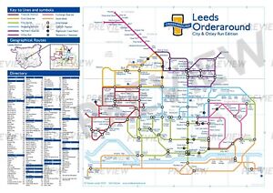
£6.99£2.90 postage"Leeds Orderaround - City & Otley Run Edition" Pub Map poster.
£12.50Free postageNew listingVintage Pocket Folding Map Geographic Ltd
£9.99£4.25 postageOld map Environs of Stoke on Trent, Longton, Hanley, Staffordshire - 1898
£15.99£4.00 postageNew listingReproduction Antique “Carolo” Map Of Wales Framed 1648
£30.00£7.39 postageNew listingVintage Bartholomew's Map Of The Middle East And Near East 1956
£95.00£9.95 postageNew listingANTIQUE MAP NOUVELLE CARTE EMPIRE FRANCAIS 1811 J B POIRSON LARGE LINEN MAP
£5,999.99£12.00 postageIRELAND, KINGDOM OF, 1610 by J. Speed - reproduction old map - fits A2 frame
£20.99£4.00 postageJack the Ripper Locations Map - Whitechapel, London 1888
£21.99£4.00 postage110 sold1728 VERY RARE Herman Moll Map , Genuine Antique, Navigation Of Ulysses, Greek
£199.99Was: £249.99Free postagec1895 maps of Scotland antique vintage Britannica 9th
£6.00£2.40 postage