Antique Europe Maps & Atlases
Shop by Date Range
128,602 results
1900 Dulwich Upper Sydenham Forest Hill Norwood Antique London Street Plan
£24.99£2.00 postage100% ORIGINAL LARGE LIVERPOOL AND DOCKS MAP BY BARTHOLOMEW C1890 VGC
£19.95£3.50 postage1794 Country Around Manchester Large Folding Map by Stockdale 84 cm x 81 cm
£175.00£2.00 postage1902 Map of Scotland antique vintage Britannica 10th
£6.50£2.40 postage100% ORIGINAL FOX HOUNDS HUNTING MAP OF GREAT BRITAIN BY HAMPTON C1984 VGC
£25.00£3.95 postageNew listingJ Roper Westmoreland Map 1807.
£18.50£3.69 postageHEREFORD Street Plan / Map of the Town - Vintage Folding Map 1938
£5.99£0.99 postage"Barnsley Town Orderaround" A3 Pub Map poster
£12.50Free postageVINTAGE ADMIRALTY MAP. No.2649. ENGLISH CHANNEL, WESTERN PORTION 1955
£40.00£3.29 postageOld map of Kent - Framed - Antique ?
£115.00£12.95 postagec1895 maps of Scotland antique vintage Britannica 9th
£6.00£2.40 postageVINTAGE W AK JOHNSTON 1950s SCHOOL EDUCATIONAL ENGLAND & WALES COUNTIES WALL MAP
£110.00£12.95 postageOld Antique colour map views vignettes York, England 1800's 1851 Tallis Reprint
£5.99£2.50 postage7 watchingPoole Parkstone, Longfleet, St Aldhelms, old map Dorset 1902: 44SW
£18.99£4.00 postageBIRMINGHAM CITY CENTRE antique town plan. BAEDEKER 1910 old map chart
£8.00£4.00 postageImber, old map Wiltshire 1926: 45SE repro
£18.99£4.00 postageOld Tudor Saxton 1500's Map Staffordshire, England Antique Reprint Vintage Rare
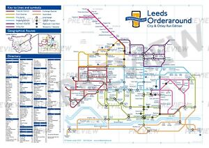
£4.99£2.50 postage2 watching"Leeds Orderaround - City & Otley Run Edition" Pub Map poster.
£12.50Free postageHERTFORDSHIRE County Map in1610 by John Speed - Uncoloured
£6.99£2.90 postageOld map Environs of Stoke on Trent, Longton, Hanley, Staffordshire - 1898
£15.99£4.00 postageJack the Ripper Locations Map - Whitechapel, London 1888
£21.99£4.00 postage110 soldOld map Environs of Middlesbrough, North Yorkshire -1898
£15.99£4.00 postageCool Vintage Admiralty charts 24 joblot Mancave D/Stairs Toilet 1960s/70s/80s
£150.00£10.00 postage1728 VERY RARE Herman Moll Map , Genuine Antique, Greece Asia Middle East
£199.99Was: £249.99c1895 Map of Central London England antique vintage Britannica 9th
£6.50£2.40 postageJob Lot Antique maps of Britain x135 - Decorative Book Plates for framing
£270.00Free postageIRELAND, KINGDOM OF, 1610 by J. Speed - reproduction old map - fits A2 frame
£20.99£4.00 postageHyde, Haughton, old map Cheshire 1910: 11NW A
£23.99£4.00 postageMiddlesbrough , old map Yorkshire 1920: 6 SW antiqued
£23.99£4.00 postageOld map Environs of Wigan, Lancashire - 1898
£15.99£4.00 postageCARDIFF 1910 ANTIQUE CITY PLAN Colour Map - Mounted For Framing
£7.99£2.99 postageRyde, Binstead, Swanmore, Old Map Hampshire Isle Of Wight 1909: 91SW
£18.99£4.00 postageEUROPE. European. General Map; Inset map of Population map 1907 old
£10.00£5.00 postageantique Tombleson's map of river Thames with 9 inset views 1850 art print poster
£28.70£7.50 postage17 watchingPenge Crystal Palace Forest Hill Map 1888 Gtr London #39
£18.99£4.00 postageHebden Bridge Yorkshire 1938 Old Map 27 Repro.
£17.99£4.00 postageCaledonian Railway - Grangemouth Docks (85 X 39cm)
£10.00Free postageBattle of Waterloo plan 2 A K Johnston map Alison's Atlas 1850 art print poster
£18.90£7.50 postage7 watchingCaledonian Railway - Grangemouth Docks (85 X 39cm)
£15.00Free postageOld Map of Redditch (S), Headless Cross, Warwickshire -1938- Repro 30 SE
£18.99£4.00 postageDaventry, old map Northants 1900: 43NW repro
£18.99£4.00 postagePorthcawl, Nottage, old map Glamorgan 1900: 39SE repro Wales
£18.99£4.00 postageTintwistle, Hollingworth, Old Map Derbyshire 1899: 2-NE A
£23.99£4.00 postageOld map of Blackpool (east), Lancashire in 1913: 51SW repro
£18.99£4.00 postageRiver Thames Old London Bridge Elizabethan view map Merian 1638 art poster print
£20.50£7.50 postage19 watchingOld Map of Burton upon Trent, Staffordshire in 1938- Repro 40 SE
£18.99£4.00 postageLondon ST. PAULS CATHEDRAL Three original engravings by J. Kip ca 1720
£150.00£4.50 postageFRAMED ANTIQUE MAP OF SCOTLAND
£195.00Free postage