
Antique Europe Maps & Atlases
Shop by Date Range
126,842 results
1900 Muswell Hill Crouch End Highgate Hornsey Antique London Street Plan
£24.99£2.00 postageVintage Admiralty Charts 1960s-1980’s
£7.50£7.00 postageNew listingW Moegan Cardigan Wales Stoneware Flagan Antique
£24.000 bidsEnding 19 May at 10:49AM BST6d 23h£4.50 postage"Whitby Orderaround" A3 Pub Map Poster
£13.00Free postage"Barnsley Town Orderaround" A3 Pub Map poster
£12.50Free postageOld map Environs of Windsor, Berkshire 1898
£15.99£4.00 postageMiddlesbrough , old map Yorkshire 1920: 6 SW antiqued
£23.99£4.00 postageantique map hemisphae alis coeli map globe map earth
£19.99£3.99 postagePalestine Tatreez Pattern Mug
£12.00£3.00 postagec1895 Map of Central London England antique vintage Britannica 9th
£6.50£2.50 postage"Rotherham Orderaround" A3 Pub Map Poster
£12.50Free postageJack the Ripper Locations Map - Whitechapel, London 1888
£21.99£4.00 postage110 soldNew listingLarge antique 1774 map of Scotland, Thomas Kitchin (undocumented/unrecorded?)
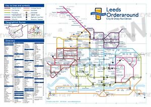
£99.000 bidsEnding 19 May at 8:06AM BST6d 20h£3.95 postage"Leeds Orderaround - City & Otley Run Edition" Pub Map poster.
£12.50Free postageRiver Thames Old London Bridge Elizabethan view map Merian 1638 art poster print
£20.50£7.50 postage20 watchingBarnsley E, Cudworth, Grimethorpe, old map Yorkshire 1938: 275NW repro
£18.99£4.00 postageOld map Environs of Wigan, Lancashire - 1898
£15.99£4.00 postageOverton, Ashe, Dean, Old Map Hampshire 1912: 17SE
£18.99£4.00 postageHoughton Conquest, old map Bedfordshire 1901: 21NE
£18.99£4.00 postageSpitsbergen Archipelago. Svalbard Norway arctic. Sketch map 1885 old
£12.99£4.00 postage1900 Stratford Leytonstone Forest Gate Antique London Street Plan
£24.99£2.00 postageOld Geology Mineral Mining Map Dunfermline Fife Roger Sinclair Aytoun
£9.950 bids£3.93 postageEnding Today at 1:59PM BST2h 40mc1895 maps of Scotland antique vintage Britannica 9th
£6.00£2.50 postageSOUTHWOLD borough/town plan. BOUNDARY COMMISSION. Suffolk. DAWSON 1837 map
£25.00£5.00 postageOld map Environs of Stoke on Trent, Longton, Hanley, Staffordshire - 1898
£15.99£4.00 postageIRELAND, KINGDOM OF, 1610 by J. Speed - reproduction old map - fits A2 frame
£20.99£4.00 postageEUROPE. European. General Map; Inset map of Population map 1907 old
£10.00£5.00 postageOld Antique colour map views vignettes York, England 1800's 1851 Tallis Reprint
£5.99£2.50 postage7 watchingHEREFORD Street Plan / Map of the Town - Vintage Folding Map 1938
£5.99£0.99 postageOriginal Antique Map Print Exeter, Devon - by Mutlow 1800 Around 200 Years Old.
£200.00£10.00 postage11 watching1909 Map of area around London vintage antique street plan Baedeker
£10.00£1.00 postageantique Tombleson's map of river Thames with 9 inset views 1850 art print poster
£28.70£7.50 postage17 watchingPoole Parkstone, Longfleet, St Aldhelms, old map Dorset 1902: 44SW
£18.99£4.00 postageBIRMINGHAM CITY CENTRE antique town plan. BAEDEKER 1910 old map chart
£8.00£4.00 postageOld map Environs of Middlesbrough, North Yorkshire -1898
£15.99£4.00 postageCaledonian Railway - Grangemouth Docks (85 X 39cm)
£15.00Free postageRyde, Binstead, Swanmore, Old Map Hampshire Isle Of Wight 1909: 91SW
£18.99£4.00 postageImber, old map Wiltshire 1926: 45SE repro
£18.99£4.00 postageNortham - old Devon map 12-14-1932
£19.99£4.00 postageDaventry, old map Northants 1900: 43NW repro
£18.99£4.00 postageChulmleigh, Bridge Reeve, Old Map Devon 1906: 42NE
£18.99£4.00 postagePenge Crystal Palace Forest Hill Map 1888 Gtr London #39
£18.99£4.00 postageCaledonian Railway - Grangemouth Docks: Land Progress Plan (85 X 39cm)
£10.00Free postagePorthcawl, Nottage, old map Glamorgan 1900: 39SE repro Wales
£18.99£4.00 postageCaledonian Railway - Grangemouth Docks (85 X 39cm)
£10.00Free postageOld map of Kent - Framed - Antique ?
£115.00£12.95 postage100% ORIGINAL LARGE LIVERPOOL AND DOCKS MAP BY BARTHOLOMEW C1890 VGC
£19.95£3.50 postage


You may also like


Deals for you
Grab a further 10% with code BLUEBELL10Shop nowMin spend £9.99. Max discount £75.T&Cs apply.

![Ninja Foodi FlexDrawer Air Fryer - Certified Refurbished [AF500UK] 10.4L](https://i.ebayimg.com/thumbs/images/g/j3EAAOSwtGpmPiFA/s-l225.jpg)


