
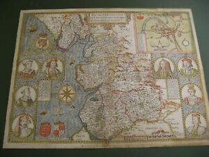
John Speed Antique European Maps & Atlases Lancashire 1600-1699 Date Range
All
Auction
Buy it now
12 results
Lancaster museum map of lancaster print
£10.00Free postageOLD COPY OF JOHN SPEED MAP OF LANCASHIRE LANCASTER TOWN PLAN 1610
£9.99Free postageLARGE FRAMED JOHN SPEED ANTIQUE MAP: THE COUNTIE PALLATINE OF LANCASTER 1610
£50.00£8.00 postageLANCASHIRE 1610 by John Speed - reproduction old map - fits A2 frame
£20.99£4.00 postageVintage decorative sheet map of Lancaster Lancashire John Speede 1610
£9.99Free postage35 sold100% ORIGINAL LARGE LANCASHIRE MAP BY JOHN SPEED C1676 VGC HAND COLOUR
£595.00£7.95 postageLANCASHIRE County Map in1610 by John Speed - Uncoloured
£9.99Free postage3 watching3 x Old Antique Historical maps Lancashire, England: 1600s & 1800's: Reprint
£12.00£3.00 postageOLD MAP OF LANCASHIRE 1611 BY JOHN SPEED 24" x 16" PHOTOGRAPHIC PRINT
£24.00£4.20 postageOLD MAP OF LANCASHIRE 1611 BY JOHN SPEED 30" x 20" PHOTOGRAPHIC PRINT
£28.00£4.20 postageLANCASHIRE County Map in 1610 by John Speed - Uncoloured
£20.99£4.00 postage


You may also like


Deals for you
Grab a further 15% off with code MAYPAY15.Shop nowMin spend £9.99. Max discount £75.T&Cs apply.

![Ninja Foodi Dual Zone Air Fryer - Certified Refurbished [AF300UK] 6 Functions](https://i.ebayimg.com/thumbs/images/g/X6gAAOSwg7RmPiG0/s-l225.jpg)

![Shark FlexBreeze Portable Fan [FA220UK] Cordless](https://i.ebayimg.com/thumbs/images/g/MaQAAOSwlBxl1GfV/s-l225.jpg)


