Lancashire County Map Antique Europe Atlas Maps
SPONSOREDSPONSOREDSPONSOREDSPONSOREDSPONSORED
All
Auction
Buy it now
33 results
New listing1793 CARY MAP WESTMORLAND KENDAL APPLEBY AMBLESIDE WINDERMERE LONSDALE MILNTHORP
£19.00Click & Collector Best Offer£3.30 postagec1895 county Map of Lancashire England antique vintage Britannica 9th
£5.00Click & Collect£2.40 postageCounty map of Lancashire England hand coloured c1860
£9.00Click & Collect£2.40 postage1898 Liverpool, River Mersey & North Wales large map. 126 years old. Chester.
£14.95or Best Offer£3.99 postage1898 Liverpool & Manchester environs large map. 125 years old. Birkenhead Bolton
£14.95or Best Offer£4.20 postageOnly 1 left.1895 Lancashire South county map. Victorian. Liverpool, Manchester, Bolton.
£13.12or Best Offer£1.50 postage1908 large map of Lancashire (North). 114 yrs old. Antique original. Morecambe.
£17.17or Best Offer£3.90 postageAntique 1904 Lancashire large map. 119 yrs old. Lancaster, Barrow in Furness.
£11.99or Best Offer£3.85 postage1922 Lancashire (South) large county map. Antique. Liverpool, Manchester, Wigan.
£14.95or Best Offer£3.99 postageSouth Lancashire, Small Size Antique Map 1892 Philips.
£7.90Click & Collect£1.80 postage1908 North of England large map. 115 years old. Antique. Manchester, Liverpool.
£17.11or Best Offer£3.90 postageNorth Lancashire, Small Size Antique Map 1892 Philips.
£7.90Click & Collect£1.80 postageLANCASHIRE, Darton Hand Coloured Original Miniature Antique County Map c 1822
£40.00Click & CollectFree postage1883 South Lancashire Hand Coloured Original Antique County Map by G.W. Bacon
£19.99Click & Collector Best Offer£4.50 postage1886 South Lancashire Original Antique Hand Coloured County Map by G.W. Bacon
£19.99Click & Collector Best Offer£4.50 postage1883 North Lancashire Hand Coloured Original Antique County Map by G.W. Bacon
£19.99Click & Collector Best Offer£4.50 postageLANCASHIRE North and South PAIR of Edward Weller Original Antique Maps c1870
£48.00Click & CollectFree postage1922 Lancashire (North) large county map. Antique 100 yrs old. Lancaster Cartmel
£14.95or Best Offer£3.99 postage1896 Liverpool & Manchester area map. Victorian England. Bolton, Warrington.
£12.63or Best Offer£1.50 postageLeicestershire And Rutland, Small Size Antique Map 1892 Philips.
£7.90Click & Collect£1.80 postageLancashire, 1784 county map, hand coloured, genuine 240 years old! Mounted.
£30.00Click & Collector Best OfferFree postageOriginal antique miniature county map LANCASHIRE, Samuel Leigh, 1820-31
£18.00Click & CollectFree postageNew listingCounty of Lancaster, Divided into Hundreds, Sayer Bennett Bowen 1777 Framed VGC
£120.00Click & Collect£12.50 postage1834 Antique map - Lancashire - from Pinnock's Guide to Knowledge
£14.99Click & Collect£1.95 postageLANCASHIRE, original antique Victorian county map on 2 sheets, Bacon, 1890
£25.00Click & CollectFree postage1794 Antique County Map; Lancashire - Stockdale
£29.99Click & Collect£1.95 postageOriginal antique map x 2, NORTH & SOUTH LANCASHIRE, RAILWAYS, G.W. Bacon, 1896
£30.00Click & CollectFree postageOriginal 1891 Map of Northern Lancashire County, England by G Philip. Antique
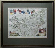
£12.75£11.82 postageLANCASHIRE, original antique county map, JOHN ROCQUE, 1769
£40.00Click & CollectFree postage1838 Antique map - Lancashire - from Pinnock's Guide to Knowledge
£24.99Click & Collect£1.95 postageOriginal 1882 Map LANCASHIRE England Liverpool Manchester Bolton Salford Chorley
£10.35£16.97 postageAntique Map / Print LANCASHIRE, ENGLAND, 1886
£13.91£14.64 postage1882 Antique COLOR Map / COUNT LANCASHIRE, ENGLAND
£15.93£11.92 postage
You may also like
Deals for you
Grab a further 15% with code MAYCLEARANCE15.Shop nowMin spend £9.99. Max discount £100.T&Cs apply.
More to explore
- Bacon Map London in Antique Europe Maps & Atlases
- Bacon Map in Antique Europe Maps & Atlases
- Bromley Map in Antique Europe Maps & Atlases
- East Yorkshire Map
- Fox Hunting Maps
- Geographia Map in Antique Europe Maps & Atlases
- Great Yarmouth Map
- Hull Map in Antique Europe Maps & Atlases
- Jersey Map in Antique Europe Maps & Atlases
- Lambeth Map
- Linen Map in Antique Europe Maps & Atlases
- Map Cheltenham in Antique Europe Maps & Atlases
- Moule Maps
- Northern Ireland Map in Antique Europe Maps & Atlases
- Old Bristol Map
- Ordnance Survey Lake District in Antique Europe Maps & Atlases
- Philips Map in Antique Europe Maps & Atlases
- Plymouth Map in Antique Europe Maps & Atlases
- River Thames Map in Antique Europe Maps & Atlases
- Robert Morden Maps
- Saxon Map
- Saxton Map
- Scarborough Map in Antique Europe Maps & Atlases
- Vintage Michelin Maps in Antique Europe Maps & Atlases
- War Office Map in Antique Europe Maps & Atlases