England Wall Maps
228 results
Ordnance Survey Map Cloth London S.E. England Sheet 171 published 1959
£7.95£2.75 postageVintage 1960s & 1970s Barnett's Maps x13 ~Street Plans with Index~ England UK
£3.990 bids£3.69 postageEnding Saturday at 2:40PM BST4d 18hANTIQUE MAPS - ENGLAND - BEDFORDSHIRE to NORTHAMPTON by Virtue & Co. circa 1875
£3.00 to £5.00£2.60 postageVintage Bartholomews Map Exmoor Sheet 3
£2.99£2.30 postageVintage Ordnance Survey Cloth Backed Maps 1960s One Inch To Mile. 9 Maps
£7.99£2.94 postageOrdnance Survey National Grid Map Of Eastbourne Sheet 183 1960
£4.90£2.40 postageVintage Easy Find Series of Maps For Eastbourne c1960s Thin Paper
£4.95£2.75 postageOrdnance Survey Map Paper Southern England Sheet 16 published 1962
£7.95£2.75 postageOrdnance Survey Map Paper Plymouth England Sheet 187 published 1961
£7.95£2.75 postageRARE Haltwhistle Rings Maps w/ Folder 22 Walks Partnership Northumberland
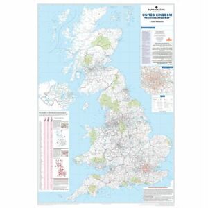
£24.99£3.35 postageUK A B Roads Motorway London Ireland Wall Map Laminated Large Wall Map 120X83cm
£24.99Free postage46 soldOld Ordnance Survey Maps The Godfrey Edition Yeadon 1906
£5.00Free postageOld Ordnance Survey Maps The Godfrey Edition Guiseley 1906
£5.00Free postageOld Ordnance Survey Maps The Godfrey Edition Bingley 1906
£5.00Free postageOrdnance Survey Map Paper South East England Sheet 17 published 1962
£7.95£2.75 postageOrdnance Survey Map Cloth Eastbourne England Sheet 183 published 1960
£7.95£2.75 postageOrdnance Survey Map Cloth London S.W. England Sheet 170 published 1959
£7.95£2.75 postageSt Giles in the Fields parish map 1720 Camden Local History Library 1979
£4.95£3.50 postageGeographia Streetplan Series : Nottingham : Large Scale Full Colour Map
£5.00£3.00 postageNORTHAMPTON, SHEET 133 ~ 1953 OS Ordnance Survey One Inch One Mile Map,
£7.50£2.95 postageVintage Ordnance Survey Map Bundle 60's NW London, Chilterns, Minehead
£7.99£3.45 postageOld Ordnance Survey Maps The Godfrey Edition Huddersfield South 1905
£5.00Free postage1962 OS Ordnance Survey Flat wall map 1" to 1 Mile Sheet 40 ABERDEEN
£7.50£3.95 postageOld Ordnance Survey Maps The Godfrey Edition Huddersfield East 1905
£5.00Free postageNew listingA-Z Road Map of England & Wales - Laminated Wall Map
£4.750 bidsEnding 6 May at 7:41PM BST6d 23h£5.00 postageOld Ordnance Survey Maps The Godfrey Edition Elland 1905
£5.00Free postageWAREHAM ( DORSET ) - ORDNANCE SURVEY MAP , PROVISIONAL EDITION , SHEET SY98
£9.500 bids£5.99 postageEnding 7 May at 1:26PM BST7d 16hOld Ordnance Survey Maps The Godfrey Edition Bradford East 1906
£5.00Free postageOld Ordnance Survey Maps The Godfrey Edition Clayton & Thornton 1933
£5.00Free postageRetro Reprint Ordnance Survey map of Lincoln see full details
£5.500 bidsEnding Tuesday at 4:21PM BST19h 48m£2.50 postageOld Ordnance Survey Maps The Godfrey Edition Halifax NW 1905
£5.00Free postageOld Ordnance Survey Maps The Godfrey Edition Upper Armley 1906
£5.00Free postageOrdnance Survey Explorer Map 1:25,000 Torquay & Dawlish
£3.50£2.00 postage