
Vintage Original Antique Maps, Atlases & Globes 1950-1959 Date Range
2,975 results
New listing1959 set of 5 Chevron tour maps Colorado N/S Dakota Oregon Vancouver Washington
£5.000 bids£4.00 postageEnding 23 May at 7:00PM BST6d 21hSchool Map Of The United Kingdom UK French Vintage Original. 1958 Date.
£125.000 bidsEnding Sunday at 11:40PM BST3d 2h£8.00 postageVINTAGE 1956 NATIONAL GEOGRAPHIC MAP OF ALASKA
£1.990 bids£2.15 postageEnding Friday at 11:09AM BST13h 31mVINTAGE 1954 NATIONAL GEOGRAPHIC MAP OF NORTHERN EUROPE
£1.990 bids£2.15 postageEnding Friday at 11:09AM BST13h 31mVINTAGE 1953 NATIONAL GEOGRAPHIC MAP THE GREAT LAKES REGION U.S.A. AND CANADA
£1.990 bids£2.15 postageEnding Friday at 11:09AM BST13h 31mVINTAGE 1954 NATIONAL GEOGRAPHIC MAP OF THE WEST INDIES
£1.990 bids£2.15 postageEnding Friday at 11:09AM BST13h 31mVintage Bartholomew's half-inch contoured Cloth map No.59 Sutherland
£2.990 bids£2.10 postageEnding 21 May at 10:18AM BST4d 12hVINTAGE 1956 NATIONAL GEOGRAPHIC MAP OF ROUND & ABOUT THE NATIONS CAPITAL
£1.990 bids£2.15 postageEnding Friday at 11:09AM BST13h 31mVINTAGE 1955 NATIONAL GEOGRAPHIC MAP OF EASTERN SOUTH AMERICA
£1.990 bids£2.15 postageEnding Friday at 11:09AM BST13h 31mVINTAGE 1950 NATIONAL GEOGRAPHIC MAP OF NORTHWESTERN UNITED STATES OF AMERICA
£1.990 bids£2.15 postageEnding Friday at 11:09AM BST13h 31mVINTAGE 1952 NATIONAL GEOGRAPHIC MAP OF NORTH AMERICA
£1.990 bids£2.15 postageEnding Friday at 11:09AM BST13h 31mBARTHOLOMEWS & SONS INDIA, PAKISTAN,BURMA & CEYLON. Edinburgh: (1952).Large map.
£50.000 bidsEnding 20 May at 6:42PM BST3d 21h£5.09 postageGeological Map Of The British Islands 4th Edition Sir William Pugh 32” x 25”
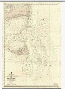
£31.59£32.88 postage1958 Antique Map; Admiralty Chart # 46 Ireland Larne To Bloody Foreland
£29.99£2.94 postageAdmiralty Chart No.2615 - Portland to Christchurch - 1954 Edition
£39.99£3.29 postageBartholomew's Half-Inch Contoured Maps Paper - Sheet 34, English Lakes - 1956
£5.001 bid£2.50 postageEnding 21 May at 7:53AM BST4d 10hVINTAGE ADMIRALTY MAP. No.2649. ENGLISH CHANNEL, WESTERN PORTION 1955
£40.00£3.29 postageVintage John Bartholomew & Sons Children's Map of London 1950s?
£40.000 bids£4.00 postageEnding 22 May at 7:30PM BST5d 21hVintage Map of Birmingham
£5.00£5.00 postageShrewsbury Castle Map and History. Pamplet 1950s
£2.00£2.00 postageMOBILGAS ROAD MAP SOUTH AFRICA _ SUID AFRIKA SECTION 2
£15.00£2.95 postageVintage 1950 View of the Center of Paris taken from the air Map - 28” X 44”
£9.990 bidsEnding 21 May at 8:46PM BST4d 23h£5.00 postageVintage Bartholomew's half-inch contoured Cloth map No.32 Wharfdale
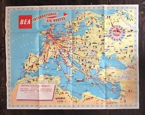
£3.49£2.39 postageBEA BRITISH EUROPEAN AIRWAYS ORIGINAL VINTAGE ROUTE MAP AIRLINE POSTER 1958
£499.95£7.95 postageRARE Framed Vintage 1952 Mid Century V Large Scotland Map,Scottish Clans,Tartan
£350.00£1.99 postage1950 Cork & Killarney Ireland Bartholomew's Map Quarter Inch to Mile
£12.50£2.60 postageVINTAGE ADMIRALTY CHART. No. 3662. LITTLE ADEN HARBOUR. 1957 Edition.
£29.00Free postageVintage map Mountain Huts of the Eastern Alps D.A.V & O.A.V 1957
£19.99Free postageVINTAGE ADMIRALTY CHART. No. 244. PORT of TRIPOLI. 1950 Edition.
£49.00Free postageVintage Astronomical Rand McNally Rare Black 12" World Globe Pre-1958
£76.78Was: £102.38£72.64 postage1951 ORIGINAL VINTAGE MAP OF NEW ORLEANS LOUISIANA DOWNTOWN BUSINESS CENTER
£18.70£7.91 postagebartholomew's map of china with japan and korea,early 1950's
£15.00Free postage1951 Sussex Sheet Map by Ordnance Survey. Sheet 51/52
£3.000 bidsEnding Saturday at 8:08PM BST1d 22hFree postageManchester Map Ordnance Survey. 1953. No. 101.
£6.50£3.90 postageVINTAGE HISTORIAL MAP FRAMED OF " STAFFORDSHIRE " 14 3/4 " X 11 5/8 " HAS FOXING
£12.000 bids£3.75 postageEnding Sunday at 8:08PM BST2d 22hVintage 1953 Hammond’s New Supreme World Atlas Book Hardcover 176 Pages EC
£9.490 bidsEnding Friday at 1:09AM BST3h 30m£17.19 postageVINTAGE 1951 NATIONAL GEOGRAPHIC MAP OF ASIA & ADJACENT AREAS
£5.990 bidsEnding Friday at 10:03PM BST1d£1.55 postageWarwickshire 1951 Bartholomew's Revised Half Inch Contoured Map Sheet 19
£4.50£2.30 postage1956 Antique Map; Admiralty Chart # 2472, Loch Gilp East Loch Tarbert (Cut)
£19.99£2.94 postageVINTAGE ADMIRALTY CHART. No.2108. BORNEO, NORTH WEST COAST. 1961.Edn.
£49.00Free postage


![1950s The Motor, Map of England, Southern Scotland, 37x27cm [26785]](https://i.ebayimg.com/thumbs/images/g/ALIAAOSwpJxj2Upw/s-l300.jpg)


![1950s The Motor, Map of England, Midlands, 37x27cm [26781]](https://i.ebayimg.com/thumbs/images/g/kfkAAOSwlehj2UJs/s-l300.jpg)


You may also like
Vintage Original Antique Maps, Atlases & Globes 1960-1969 Date Range
Vintage Original Antique Maps, Atlases & Globes 1970-1979 Date Range
Vintage Original Antique Maps, Atlases & Globes 1930-1939 Date Range
Vintage Original Antique Maps, Atlases & Globes 1940-1949 Date Range
Vintage Original Antique Maps, Atlases & Globes 1980-1989 Date Range


![Ninja Foodi FlexDrawer Air Fryer - Certified Refurbished [AF500UK] 10.4L](https://i.ebayimg.com/thumbs/images/g/j3EAAOSwtGpmPiFA/s-l225.jpg)


