1800-1899 Date Range County Map Antique Europe Sheet Maps
1,131 results
Genuine Antique 1880s DORSET County Map,Weymouth,Poole,Sandbanks,Mounted,Old
£0.991 bid£4.99 postageEnding Today at 9:15PM BST19h 52mOriginal Antiquarian Framed Map of Kent c1845 - Dugdale - J Archer Gold
£12.99£6.99 postageHertfordshire Map c1810 by J Carey - Framed
£10.000 bids£3.70 postageEnding 19 Jun at 11:09AM BST5d 9hAntique Map of Northamptonshire by Pigot Circa 1830s Set in Hogarth Frame
£45.00£6.00 postage1765 Antique Map; North Wales by Joseph Ellis / William Palmer
£39.99£1.95 postageAntique/Vintage County Map of Shropshire - John Heywood, 1868
£16.99£1.55 postage1850 Genuine Antique Map; Sussex by Joshua Archer
£7.99£1.95 postageAntique/Vintage County Map of Oxfordshire - John Heywood, 1868
£16.99£1.55 postageAntique/Vintage County Map of Lincolnshire - John Heywood, 1868
£16.99£1.55 postageAntique Map "Switzerland" J. Tallis, 1851
£65.00£7.00 postageAntique/Vintage County Map of Dorset - John Heywood, 1868
£16.99£1.55 postageNETHERLANDS LUXEMBOURG & BELGIUM 1828 DE BOUGE UNUSUAL ANTIQUE LITHOGRAPHIC MAP
ANTIQUE ORIGINAL LITHOGRAPHIC MAP OF LOW COUNTRIES 1828£15.581 bid£19.47 postageEnding 22 Jun at 6:21AM BST8d 4hLondon Surrounds Antique Map from c1880 9th Ed. Encyclopedia Britannica
£8.99£2.99 postageA3 size repro/map of County Clare, Ireland, original dated 1897.
£7.50£3.50 postageAn A3 size reproduction map of Perth county, original dated 1891.
£7.50£3.50 postage1868 Antique Map; Middlesex - William Hughes
£12.99£1.95 postage1833 Antique Map: Pembrokeshire by Creighton
£9.99£1.95 postageAntique/Vintage County Map of Durham - John Heywood, 1868
£16.99£1.55 postageRare c.1836 Creuse, Gueret, Aubusson France, Antique Card Map by Bourrut-Le Meri
£23.45£10.42 postageAntique Map "Turkey in Europe" J. Tallis, 1860
£60.00£7.00 postageAntique Maps "North-South Italy" Sidney Hall, 1828
£100.00£7.00 postage1830 Original Pigot & Co. Map: Kent
£14.99£3.90 postage1830 Original Pigot & Co. Map: Wiltshire
£19.99£3.90 postageSuffolk map with coast parks & gentlemans houses, towns roads 1838
£80.15Free postage1830 Original Pigot & Co. Map: Hampshire
£19.99£3.90 postageAntique Lithography "Vue Prise a Brunnen" (Lake Lucerne) Bayot-Jacotett, c. 1820
£400.00£8.00 postageAntique Map "Prussia" J. Tallis, 1860
£80.00£7.00 postageLanark County Antique Map from c1880 9th Ed. Encyclopedia Britannica
£6.99£2.99 postageCumberland County Antique Map from c1880 9th Ed. Encyclopedia Britannica
£6.99£2.99 postageA3 size repro/map of County Cavan, Ireland, original dated 1897.
£7.50£3.50 postage1850 Genuine Antique Map; Denbighshire by Joshua Archer
£7.99£1.95 postageA3 size repro/map of County Mayo, Ireland, original dated 1897.
£7.50£3.50 postage1895 Antique Map: The Counties of Perth & Clackmannan, Scotland
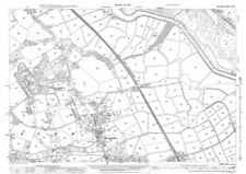
£9.99£1.95 postage1837 Antique Map; Usk, Monmouthshire Boundaries and Plan by Robert Dawson
£24.99£3.90 postage1830 Original Pigot & Co. Map: Yorkshire
£39.99£3.90 postageEssex County Antique Map from c1880 9th Ed. Encyclopedia Britannica
£6.99£2.99 postage1850 Genuine Antique Map; Staffordshire by Joshua Archer
£7.99£1.95 postage1830 Original Pigot & Co. Map: Derbyshire
£19.99£3.90 postage1841 Antique Map; Derbyshire by Thomas Moule
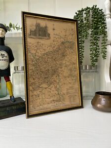
£19.99£1.95 postageVINTAGE COUNTY MAP DEVONSHIRE w/ EXETER GUILDHALL CARTOUCHE FRAMED 18” x 15.5”
£136.29£35.33 postage