London Contemporary 1800-1899 Date Range Antique Europe Maps & Atlases
All
Auction
Buy it now
14 results
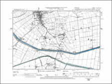
Old map Environs of Enfield, London - 1898
£15.99£4.00 postageOld map Environs of Twickenham, London
£15.99£4.00 postageLONDON PARISHES, DISTRICTS, EXTRA PAROCHIAL PLACES 1884
£25.99£4.00 postageOld map Environs of Tottenham, London 1898
£15.99£4.00 postageOld map Environs of Teddington, London - 1889
£15.99£4.00 postageOld map Environs of Woolwich, London - 1898
£15.99£4.00 postageLondon - environs of London old map 1844 - reproduction - 59.4 x 42 cm (A2)
£17.99£4.00 postageOld map Environs of Harrow on the hill, Middlesex - London - 1898
£15.99£4.00 postageOld map Environs of Stanmore, Edgware, London - 1898
£15.99£4.00 postageOld map Environs of Ealing and Acton, London - 1898
£15.99£4.00 postageMillbank, Lambeth (W), Vauxhall - London map 1813, 4-3
£20.99£4.00 postageRegents Park, Oxford Street Map London 1888 #D14 old map repro
£20.99£4.00 postageEnvirons of London 1855, reproduction old map Colton & Co - 59.4 x 48.47 cm
£17.99£4.00 postageOxford Street area - London map 1813, 2-2
£20.99£4.00 postage


You may also like
Yorkshire Contemporary 1800-1899 Date Range Antique Europe Maps & Atlases
Essex Contemporary 1800-1899 Date Range Antique Europe Maps & Atlases
Hampshire Contemporary 1800-1899 Date Range Antique Europe Maps & Atlases
Sussex Contemporary 1800-1899 Date Range Antique Europe Maps & Atlases
London Antique Reproduction Antique European Maps & Atlases 1800-1899 Date Range