Sponsored
Sponsored
Skip to main content
Hi
!
Hello.
Sign in
or
register
Local
Daily Deals
Fashion
Help & Contact
Sell
Watchlist
Expand Watchlist
My eBay
Expand My eBay
Summary
Recently Viewed
Bids/Offers
Watch List
Purchase History
Selling
Saved feed
Saved Searches
Saved Sellers
My Garage
Preferences
Messages
Expand Notifications
Please
sign in
to view notifications.
Expand Basket
Loading...
eBay Home
Shop by category
All Categories
Search
Advanced
Sponsored
Sponsored
Copper Plate Antique North America Sheet Maps
You may also like
Lithography Antique North America Sheet Maps
Copper Plate Antique North America Atlas Maps
Related searches
Sheet Copper
Antique World Map
Map Antique
Copper Sheet Hammered
Copper Sheet Metal
Copper Etching Plate
Copper Plate Printing
Coal Mine Map
Shell Map
Copper Plating Kit
Victorian Map
Old World Map
breadcrumb
eBay
Collectables & Art
Antiques
Maps, Atlases & Globes
Collectables & Art
Antiques
Maps, Atlases & Globes
North America Maps
Copper Plate Antique North America Sheet Maps
Shop by category
Maps, Atlases & Globes
North America Maps
Africa Maps
Asia Maps
Australia/Oceania Maps
Celestial Maps
Central America/Caribbean Maps
Curiosities Maps
Digital Maps
Europe Maps
Map & Globe Mixed Lots
Map & Globe Reproductions
South America Maps
World & Celestial Globes
World Maps
Shop on eBay
$479.99
Free shipping
Shop on eBay
$479.99
Free shipping
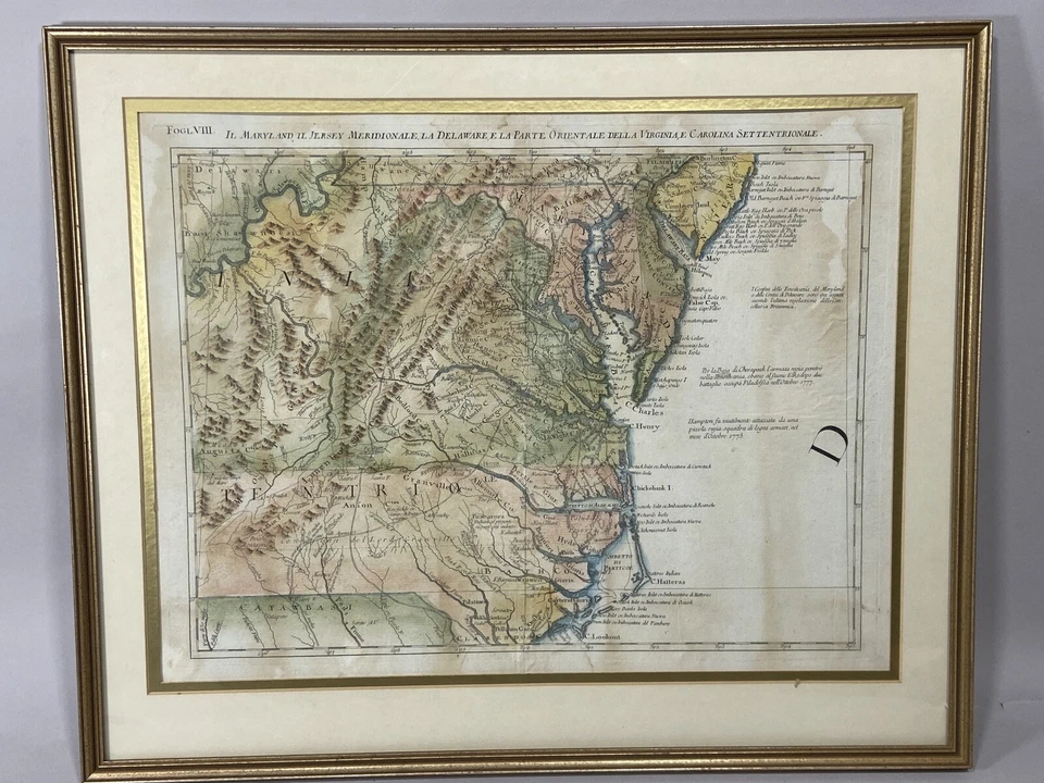
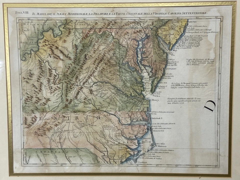
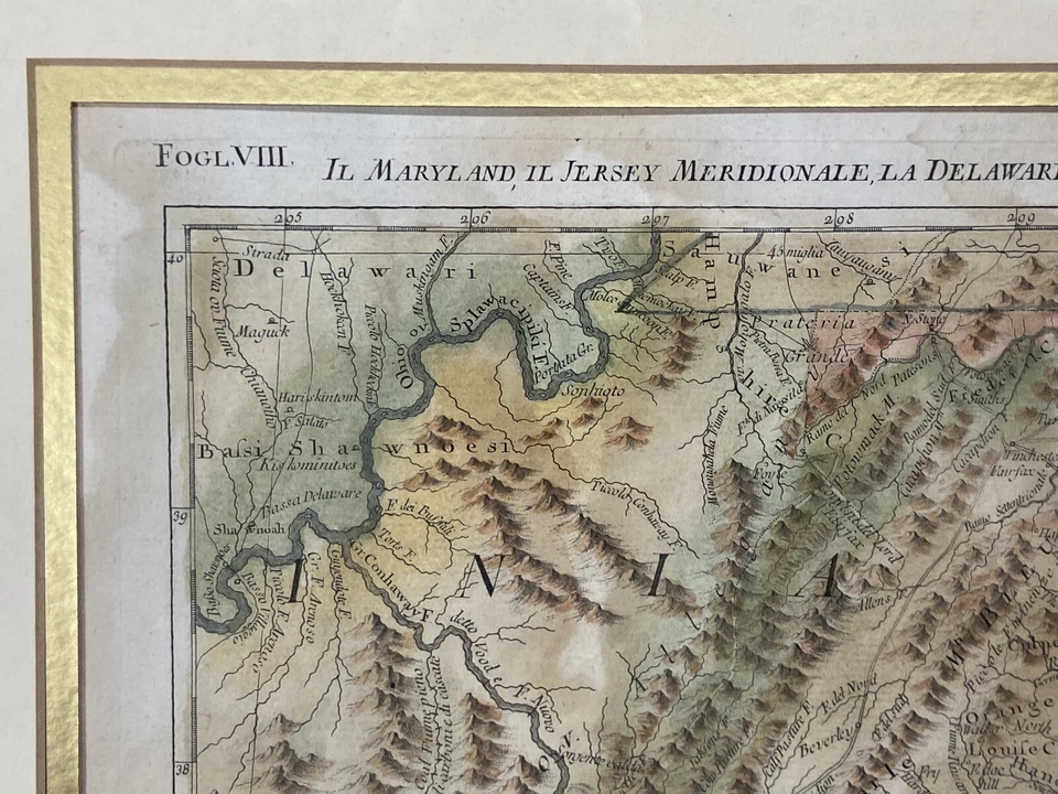
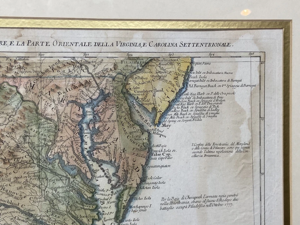
1778 Revolutionary War Era Map Maryland Virginia Delaware NC SC Antonio Zatta
£454.09
£22.26 P&P
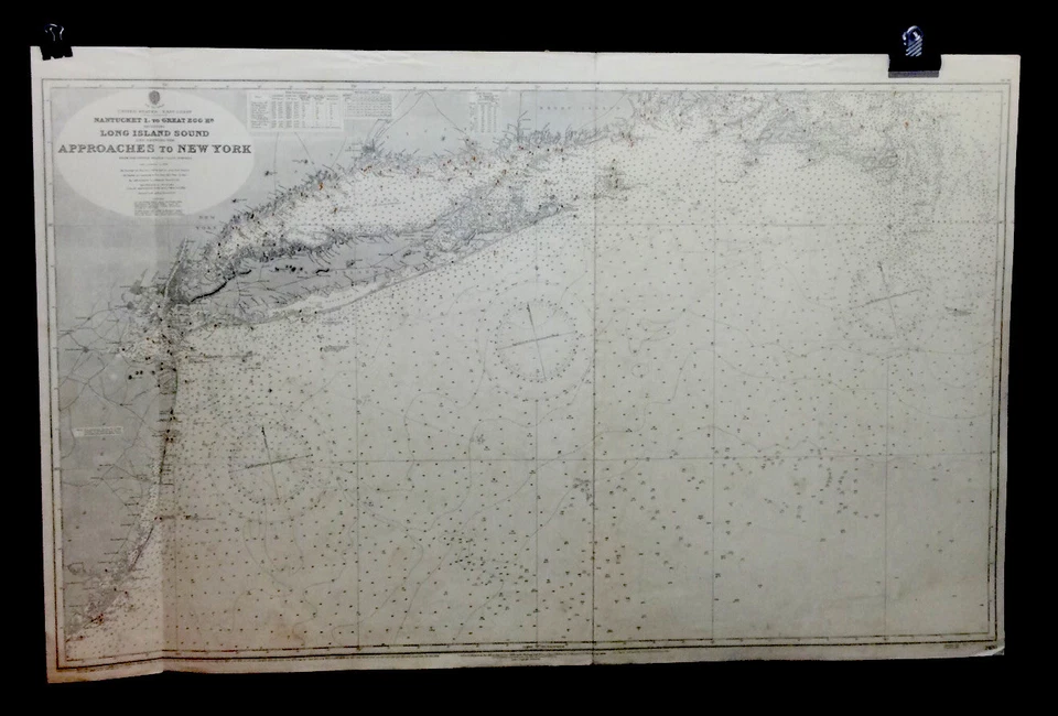
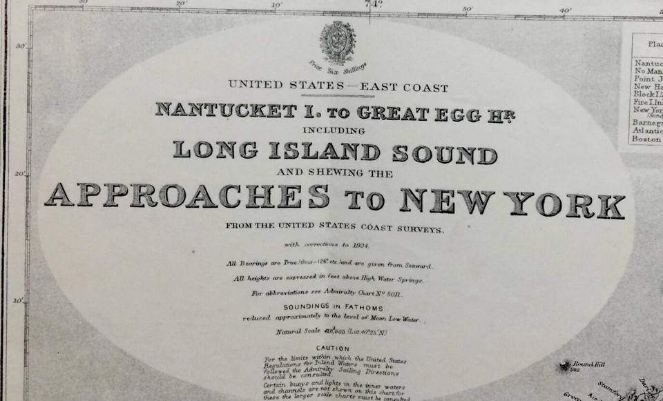
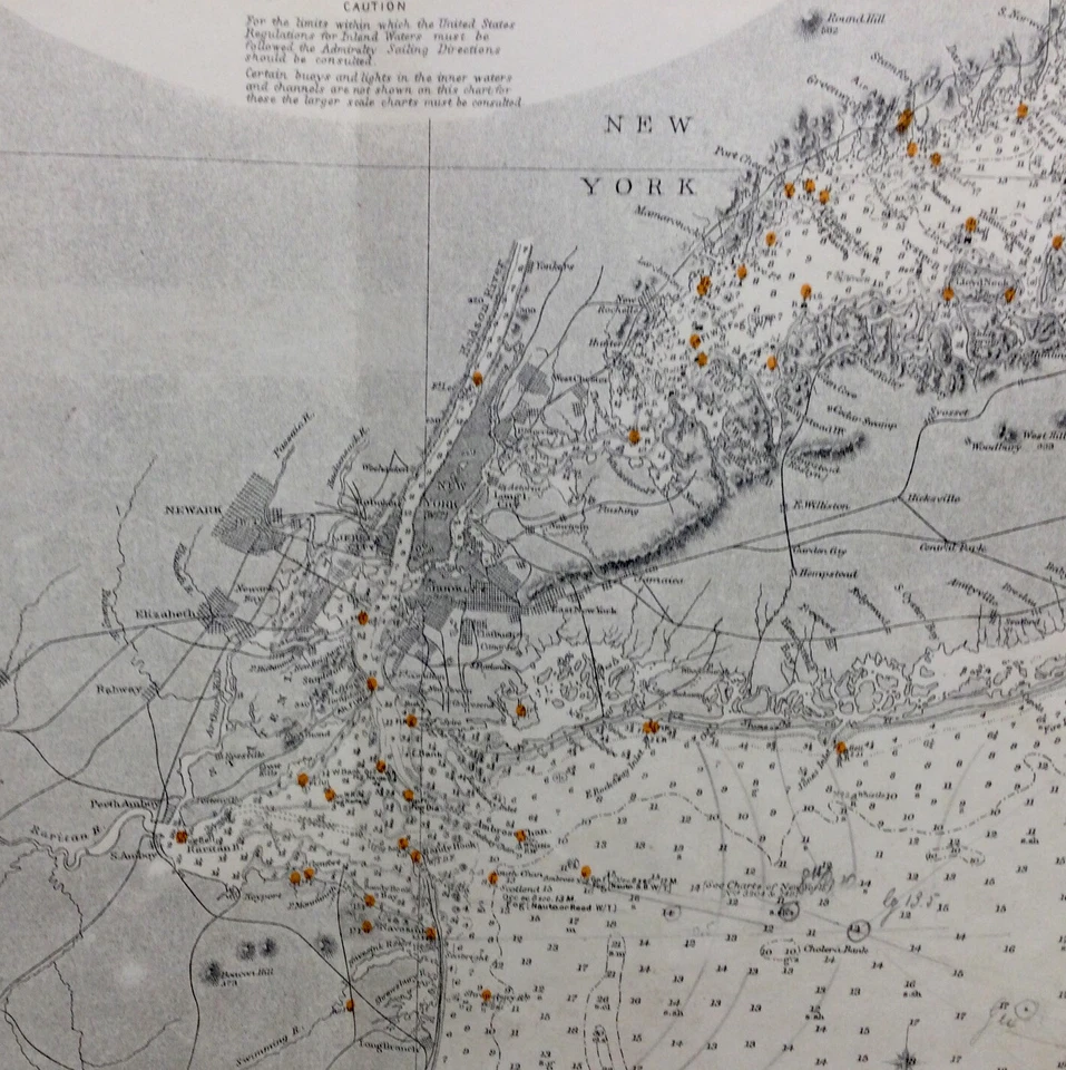
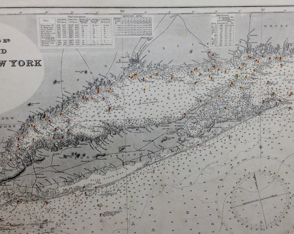
VINTAGE ADMIRALTY CHART. No. 2480. APPROACHES to NEW YORK. 1896.
£37.10
or Best Offer
Free international postage
Click & Collect
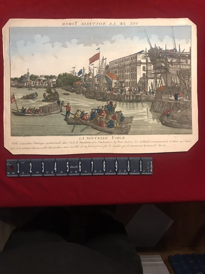
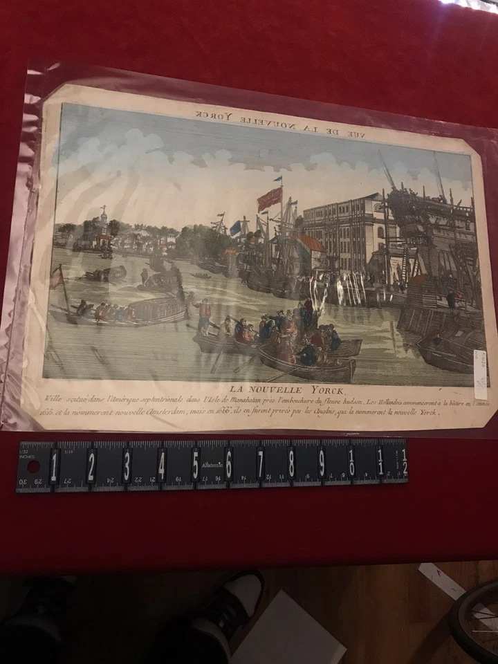
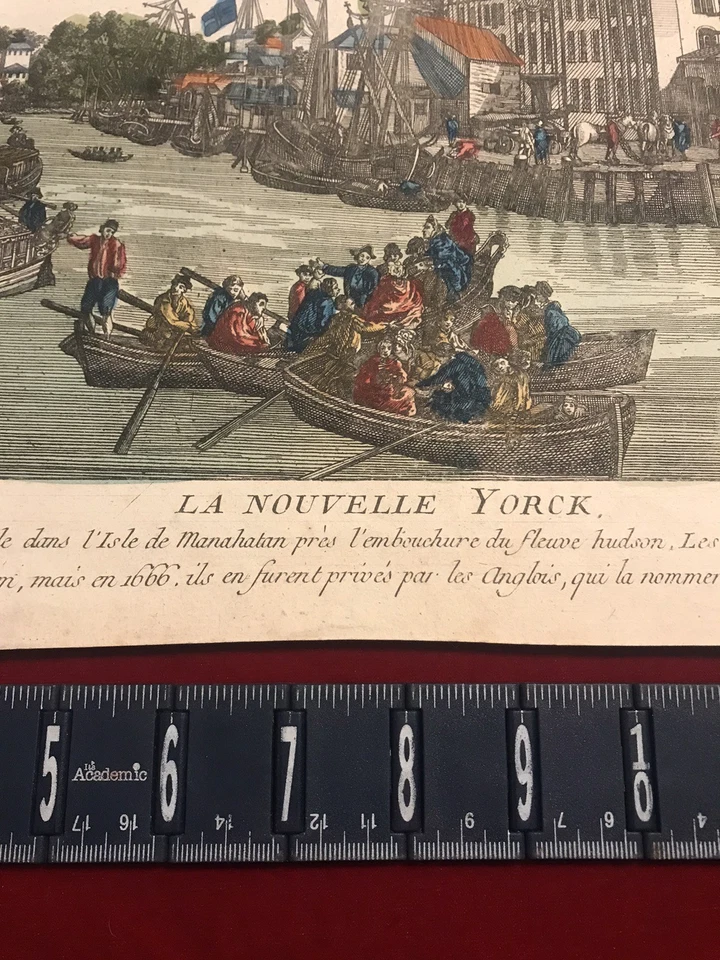
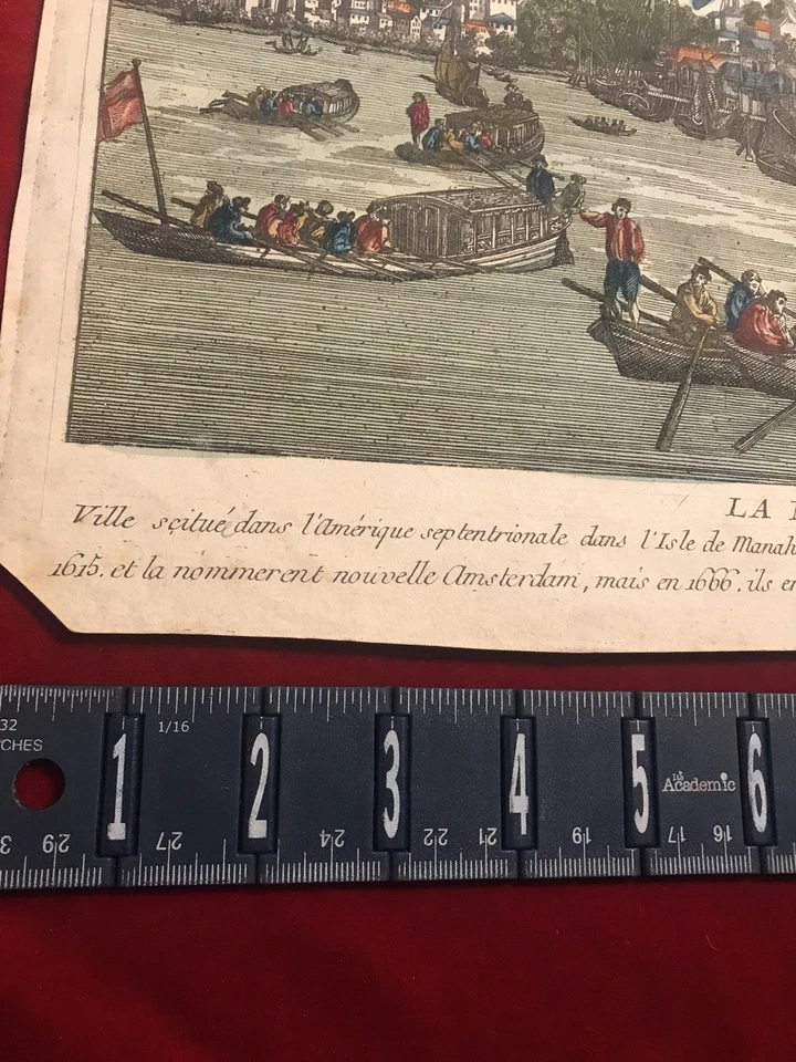
MAP Birdseye View NEW YORK In Year 1615 Harbor Printed 1666 Hand Colored
£291.38
£35.23 P&P
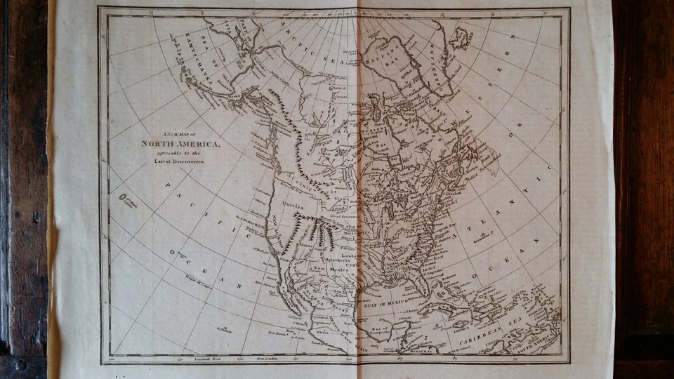
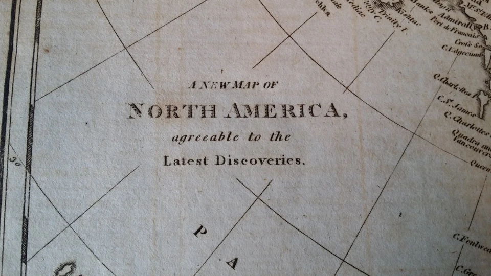
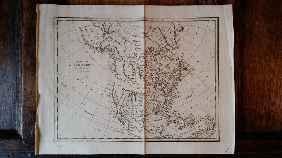
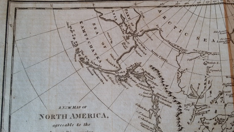
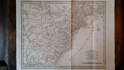
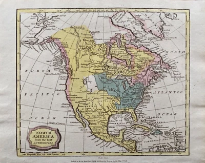
1796 ORIGINAL ANTIQUE COPPERPLATE MAP - A NEW MAP OF NORTH AMERICA
£40.00
£3.90 P&P
Click & Collect
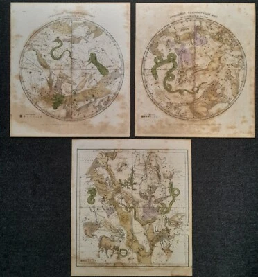
3 CELESTIAL ENGRAVINGS FJ HUNTINGTON 1835 CONNECTICUT ENGRAVED BY WD EVANS NY
£74.93
or Best Offer
£12.28 P&P
1849 AMHERST COLLEGE - MASSACHUSETTS Original Engraved Print (9.5X6.5)
£26.40
£9.64 P&P
Map "Carte de la Nouvelle Angleterre, Nouvelle York et Pensilvanie" Bellin,c1750
£245.00
or Best Offer
£7.00 P&P
1796 ORIGINAL ANTIQUE COPPERPLATE MAP - A MAP OF THE UNITED STATES OF AMERICA
£40.00
£3.90 P&P
Click & Collect
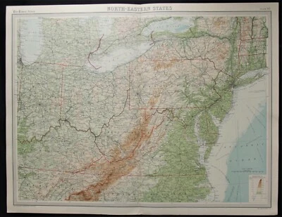
Antique Map: US North Eastern States by John Bartholomew, Times Atlas, 1922
£13.47
or Best Offer
£2.94 P&P
Click & Collect
0 bids
19h 2m
1831 SAVANNAH - UNITED STATES BANK - GEORGIA Original Engraved Print
£34.51
or Best Offer
£13.09 P&P
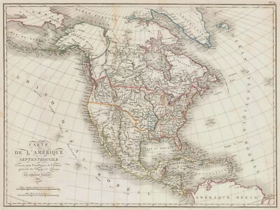
Antique Map "Carte De L'Amerique Septentrionale" (North America) A.Tardieu, 1821
£290.00
or Best Offer
£7.00 P&P
1806 Antique Map; North America by James Barlow
£89.99
£1.95 P&P
Click & Collect
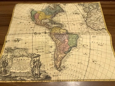
Antique Map – “Americae Mappa Generalis” – Homann Heirs, 1736
£550.00
or Best Offer
£30.00 P&P
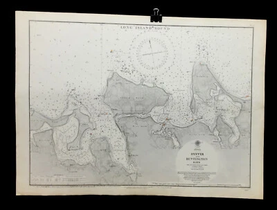
VINTAGE ADMIRALTY CHART. No. 2457. LONG ISLAND SOUND. 1856.
£41.26
or Best Offer
Free international postage
Click & Collect
Antique Map "Chart of Norton Sound and of Bherings Strait" James Cook, 1784
£135.00
or Best Offer
£7.00 P&P
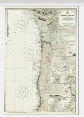
VINTAGE ADMIRALTY CHART. No.2531. VANCOUVER ISLAND, C. MENDOCINO. 1943 EDITION
£35.02
or Best Offer
Free international postage
Click & Collect
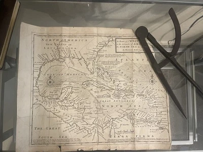
1745 Chart Of Ye West-Indies Islands Americas Map Pirates Herman Moll Calipers
£170.29
or Best Offer
£29.05 P&P
Antique Map: United States American Cities by John Bartholomew, Times Atlas 1922
£13.47
or Best Offer
£2.94 P&P
0 bids
5d 19h
USGS 1951 large Topo Map, Washington, D.C. & Vicinity, 51.5" x 41.5" Rare
£88.93
or Buy It Now
£28.90 P&P
0 bids
2d 22h
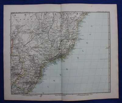
SOUTH AMERICA, BRAZIL, RIO DE JANEIRO, original antique map, Stieler, 1881
£28.45
Free international postage
Click & Collect
CENTRAL AMERICA, MEXICO, GUATEMALA, original antique map, Stieler, 1880
£30.75
or Best Offer
Free international postage
Click & Collect
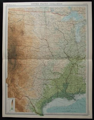
Antique Map: United States Central Section by John Bartholomew, Times Atlas 1922
£13.47
or Best Offer
£2.94 P&P
0 bids
5d 19h
Antique Map: United States Eastern Section by John Bartholomew, Times Atlas 1922
£13.47
or Best Offer
£2.94 P&P
Click & Collect
0 bids
5d 19h
1806 Antique Map; North America by James Barlow
£89.99
£1.95 P&P
Click & Collect
10 watching
Original 1855 Colton's Map of Canada Maritimes Taken from Atlas
£109.74
£21.92 P&P
0 bids
3d 2h
Full Set Of USGS Copper Engraving Plates, Beverly WV, 1922
£548.70
£103.43 P&P
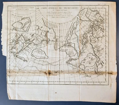
1752 Admiral de Fonte Northwest Passage Delisle Buache Map Carte des Decouvertes
£132.41
or Best Offer
£21.88 P&P
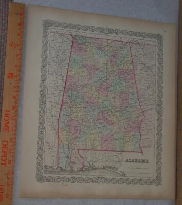
Original 1855 Colton's Map of Alabama Taken from Atlas
£147.58
£23.15 P&P
0 bids
3d 2h
VINTAGE ADMIRALTY CHART. No.2560. WHITEHAVEN, NOVA SCOTIA. 1860 Edition.
£37.10
or Best Offer
Free international postage
Click & Collect
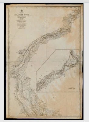
ADMIRALTY CHART. No. 2564. DELAWARE RIVER. 1933.
£37.10
or Best Offer
Free international postage
Click & Collect
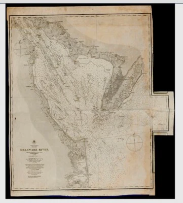
ANTIQUE ADMIRALTY CHART. No.2564. DELAWARE RIVER. SHEET 2. 1915 EDITION
£30.86
or Best Offer
Free international postage
Click & Collect
ANTIQUE ADMIRALTY CHART. No.2563. DELAWARE RIVER. SHEET 1. 1896 EDITION
£30.86
or Best Offer
Free international postage
Click & Collect
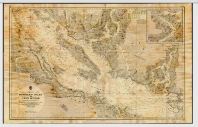
VINTAGE ADMIRALTY CHART. No.579. BURRARD INLET to CAPE MUDGE. 1951 Edition.
£30.86
or Best Offer
Free international postage
Click & Collect
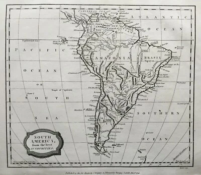
1806 Antique Map; South America, James Barlow
£19.99
£1.95 P&P
Click & Collect
SOUTH AMERICA CITY PLANS, BUENOS AIRES, RIO, original antique map, Stieler, 1881
£28.45
Free international postage
Click & Collect
SOUTH AMERICA, ARGENTINA, CHILE, PATAGONIA, original antique map, Stieler, 1881
£30.75
Free international postage
Click & Collect
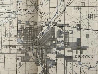
Original 1906 USGS map of Denver, CO & Golden, Morrison ~31.75" x 21"~XL size
£151.37
£29.67 P&P
N.E. SOUTH AMERICA, FRENCH & DUTCH GUIANA original antique map, Stieler 1880
£30.75
Free international postage
Click & Collect
VINTAGE ADMIRALTY CHART. No.312. RIVER St. LAWRENCE. CANADA 1919 Edn.
£30.86
or Best Offer
Free international postage
Click & Collect
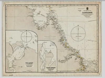
VINTAGE ADMIRALTY CHART. No.1422. LABRADOR, CANADA. 1922. Edition.
£30.86
or Best Offer
Free international postage
Click & Collect
Antonio Zatta- Hand Colored Engraving Map Of Maryland New Jersey- 1778
£298.95
or Best Offer
£78.10 P&P
ANTIQUE ADMIRALTY CHART. No.269. FLORIDA, JACKSONVILLE, CAPE CANAVERAL. 1886 Edn
£30.86
or Best Offer
Free international postage
Click & Collect
1942 Moravia NY Cayuga & Tompkins County New York USGS Topographic Map Vintage
£7.57
or Best Offer
£6.05 P&P
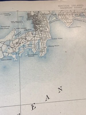
original 1905 USGS map of Newport, Wakefield, Narragansett Pier, Jamestown, RI
£109.74
£23.45 P&P
original 1903 USGS map of Benton, AR Arkansas River ~ Saline River & Brazils
£75.68
£11.10 P&P
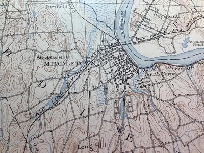
original 1905 USGS map of Middletown, Elmwood, Newington, Glastonbury, CT
£64.33
£22.11 P&P
original 1900 USGS map of Tuscumbia MO
£49.19
£10.32 P&P
The State of New York Samuel Lewis Mathew Carey 1795 Antique Engraved Map
£223.26
or Best Offer
£25.39 P&P
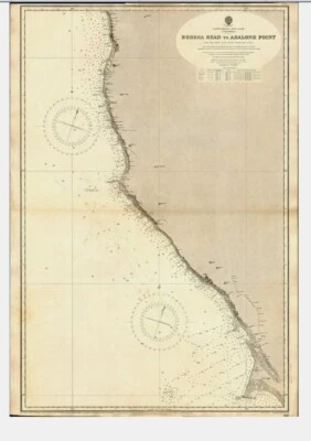
VINTAGE ADMIRALTY CHART. No.3120. BODEGA Hd to ABALONE Pt. CALIFORNIA. 1900 Edn.
£30.86
or Best Offer
Free international postage
Click & Collect
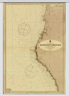
VINTAGE ADMIRALTY CHART. No.3121. ABALONE POINT to REDDING ROCK. 1900 EDITION
£30.86
or Best Offer
Free international postage
Click & Collect
Rare original 1906 USGS map of Idaho Springs, CO SPECIAL MAP
£121.09
£23.79 P&P
original 1903 USGS map of Mt Holly, Medford, Moorestown, Sandtown, Mt Laurel, NJ
£83.25
£22.67 P&P
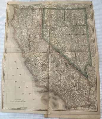
Map-California Nevada Washington Idaho Copper Plate Map From1881 Hand Atlas Book
£18.92
or Best Offer
£24.18 P&P
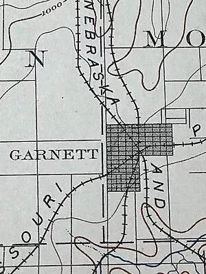
original 1906 USGS map of Garnett, Lane, Blue Mound, Geneva, KS
£56.76
£21.89 P&P
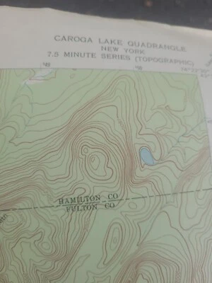
1970 Caroga Lake NY Fulton County New York USGS Topographic Map Antique Vintage
£9.80
or Best Offer
£6.05 P&P
original 1904 USGS map of Nevada, El Dorado Springs, MO
£64.33
£22.11 P&P
original 1900 USGS map of Albany, Guilderland, Bethlehem, Castleton, NY topo
£75.68
£22.45 P&P
original 1904 USGS map Guilford, Clinton, Higganum, CT
£90.82
£22.89 P&P
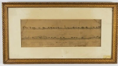
Antique 1874 Map of Market Street Lynn Massachusetts as it Appeared in 1820
£189.21
or Best Offer
£14.45 P&P
1772 De Vaugondy Original Antique Map of West & NW North America, California
£264.89
or Best Offer
£12.86 P&P
Results Pagination - Page 1
1
2
3
4
All listings
Auction
Buy It Now
Best Offer
Sort: Best match
Best match
Time: ending soonest
Time: newly listed
Price + postage: lowest first
Price + postage: highest first
Distance: nearest first
Gallery view
List view
193 results
Sort: Best match
Best match
Time: ending soonest
Time: newly listed
Price + postage: lowest first
Price + postage: highest first
Distance: nearest first
2 filters applied
Format: Sheet Map
- Selected
Printing Technique: Copper Plate
- Selected
Type
Topographical Map
(138)
Nautical Map
(21)
Physical Map
(13)
Political Map
(6)
City Map
(5)
World Atlas
(4)
County Map
(3)
Novelty Map
(2)
Geological Map
(1)
Not specified
(17)
Date Range
1600-1699
(2)
1700-1799
(21)
1800-1899
(72)
1900-1909
(65)
1910-1919
(3)
1920-1929
(7)
1930-1939
(6)
1940-1949
(12)
1950-1959
(22)
1970-1979
(1)
Unknown
(1)
Not specified
(6)
US State
New York
(38)
Massachusetts
(27)
Connecticut
(14)
Colorado
(12)
Missouri
(12)
New Jersey
(11)
California
(9)
Vermont
(7)
Pennsylvania
(6)
Rhode Island
(6)
Washington
(6)
Arkansas
(4)
Delaware
(4)
Georgia
(4)
Oregon
(4)
Virginia
(4)
Florida
(3)
Kansas
(3)
Kentucky
(3)
Maryland
(3)
Format
(1)
Sheet Map
(220)
Atlas Map
(595)
Folding Map
(168)
Atlas
(35)
Wall Map
(6)
Printing Technique
(1)
Copper Plate
(211)
Lithography
(1,436)
Manuscript/Hand drawn
(10)
Woodcut
(8)
Condition
Not specified
(221)
Price
Under £55
£55 to £115
Over £115
Delivery options
Free international postage
Free collection in person
Filter
All Filters