Essex Antique Europe Folding Maps
SPONSOREDSPONSOREDSPONSOREDSPONSORED
45 results
* Rare * Copperplate Engraved Map of Essex By John Seller Hand Coloured 1695
£90.00Click & Collector Best OfferFree postage1950 Vintage Folding Guide Map Clacton on Sea Essex England 11.5" x 6.5"
£20.00Click & Collect£2.25 postage1900s double page map from g.w. bacon - essex !
£28.00Free postage100% ORIGINAL ESSEX MAIN ROADS BRIDGES FOLDING MAP LINEN BY G PHILLIP C1906
£30.00Click & Collect£4.25 postageVintage Bacon’s New Map of EPPING FOREST, with 8 Page Guide, 1 Shilling.
£9.99Click & Collect£1.75 postageOrdnance Survey New 1" series (revised) Map COLCHESTER c 1900 sheet 224
£8.750 bids£1.55 postageEnding Today at 8:15PM BST3h 58mClick & CollectBarnett's Havering Map - Street Map and Fold-Out Map 1950s - Romford Hornchurch+
£5.00Click & Collect£3.00 postageOrdnance Survey New 1" series (revised) Map BISHOP'S STORTFORD c 1900 sheet 222
£8.750 bids£1.55 postageEnding Today at 8:23PM BST4h 6mClick & CollectBrtholomew's Street Index Plan of London - North-East Section c1930
£5.00£4.50 postageOrdnance Survey 3rd edition Map of COLCHESTER & HARWICK 1907 sheet 99
£4.850 bids£1.55 postageEnding Today at 7:59PM BST3h 42mVintage Cloth Map 1924 - Edward Stanford Ltd 73SW Battlesbridge Rawreth Wickford
£7.00Click & Collect£2.00 postageOrdnance Survey New 1" series (revised) Map COLCHESTER c 1900 sheet 224
£8.750 bids£1.55 postageEnding Today at 8:19PM BST4h 2mClick & CollectWW2 O.S. Map of SOUTHEND & DISTRICT - Sheet no. 108 - Dated 1931
£9.900 bids£3.30 postageEnding 6 May at 6:53PM BST5d 2h1950 Vintage Folding Guide Map Colchester Essex England 8.5" x 6.5"
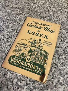
£15.00Click & Collect£2.25 postageVintage Cloth Map 1923 - Ordnance Survey 62SW - Blackmore Stondon Massey Hatch +
£10.00Click & Collect£2.00 postageVintage Geographia Cyclists Map Of Essex
£15.00Click & Collector Best OfferFree postageOS Ordnance Survey One Inch Cloth Map 30 1911 Colchester
£11.50Click & Collector Best Offer£2.30 postageVintage Cloth Map 1923 - Edward Stanford Ltd 72SW - Billericay Burstead Ramsden
£10.00Click & Collect£2.00 postageVintage Graphia Street Plan of Southend with Street Index c1960s
£12.50or Best Offer£2.60 postageESSEX HERTFORD BY WILLIAM MUDGE c1805 GENUINE 1st EDITION ORDNANCE SURVEY MAP
£125.00Click & CollectEssex Map Bacon`s County Map Essex For Cyclists & Tourists
£15.00Click & CollectVINTAGE - WRITTLE ROXWELL MARGARETTING ESSEX – 1:25,000 O/S MAP ~ 1949
£3.500 bids£1.90 postageEnding Friday at 1:29PM BST1d 21hVintage Cloth Map 1923 - Edward Stanford Ltd 72NW - Stock Buttsbury (Billericay)
£5.00Click & Collect£2.00 postagePICTORIAL MAP OF ESSEX c.1950, MINT CONDITION, by WAYFARER MAPS , WESTON, HERTS.
£48.50Click & CollectFree postage1902 - 1909 ANTIQUE ORDNANCE SURVEY MAP SHOEBURYNESS 1 INCH SHEET 109 ESSEX
£24.95Click & Collect£3.05 postageBartholomew's Road Map of England & Wales (c1910) Middlesex, Essex Suffolk, Sh 9
£14.99Click & Collect£3.25 postage1951 Bartholomew's ESSEX - Half-Inch Sheet 16 Vintage Cloth Map
£5.00Click & Collect£2.50 postageClacton on Sea & Harwich 1928 OS Ordnance Survey Popular Edition One-Inch Map 98
£8.50or Best Offer£2.30 postageWW2 O.S. Map of N.E. LONDON & EPPING FOREST - Sheet no. 107 - Dated 1931
£9.900 bids£3.30 postageEnding 6 May at 6:55PM BST5d 2hAntique Road Map Complete - 35 Miles Round To London - Geographers' Map Co. LTD
£7.50Click & Collector Best OfferFree postageAntique Road Map (on Cloth - 35 Miles Round London - Geographers' Map Co.
£5.000 bidsor Best OfferEnding Saturday at 3:52PM BST2d 23h£2.10 postageClick & CollectBartholomews Essex No.16 - October 1947(Half inch)
£3.000 bidsor Best OfferEnding Friday at 10:53AM BST1d 18h£2.50 postageBartholomew's ESSEX Half-Inch Sheet 16 - Vintage Paper Map 1962 - Superb Cond
£5.00Click & Collect£1.95 postageOrdance Survey Acient Britain South sheet Map 1964
£18.99Click & Collect£2.99 postageCOLCHESTER 1956 Ordnance Survey Vintage Large Cloth Map
£12.00Click & Collector Best Offer£2.25 postagevintage map
£4.99or Best Offer£2.70 postageVintage Bartholomew Folding Map; ESSEX (c1930s) Stanford On CLOTH Sheet 26 VGC
£13.990 bids£3.20 postageEnding 6 May at 12:19PM BST4d 20hClick & Collect1774-99 GREENVIL COLLINS 1686 MAP OF HARWICH COAST & SANDBANKS FOR SAMUELL PEPYS
£325.00Click & CollectFree postageVintage Bartholomew's Road Map,ESSEX, SUFFOLK, MIDDLESEX 4 miles to 1 inch
£12.000 bids£2.20 postageEnding Sunday at 6:56PM BST4d 2hClick & CollectAntique Map London &Environs folding colour James Wyld Queen Victoria Geographer
£950.00or Best OfferFree postageSOUTHHAMPTON ENGLAND MAP & HERITAGE EXPERIENCE
£3.590 bids£14.87 postageEnding Friday at 4:02AM BST1d 11h1917 Essex Map Ordnance Survey Office Boundary Commission
£15.00Click & Collector Best Offer£3.20 postagec1880 Massive Folding Map KENT part SURREY SUSSEX & ESSEX LONDON by G Ricmond
£385.00Click & Collect£6.00 postage1823 Folding Map of part of HERTFORDSHIRE & ESSEX by John Cary part Bedfordshire
£75.00Click & Collect£4.50 postage
You may also like
Deals for you
Grab a further 30% with code DYSONFLASH30.Shop nowPromotion organised by seller. T&Cs apply.
More to explore
- Bacon Map London in Antique Europe Maps & Atlases
- Bacon Map in Antique Europe Maps & Atlases
- Bromley Map in Antique Europe Maps & Atlases
- East Yorkshire Map
- Fox Hunting Maps
- Geographia Map in Antique Europe Maps & Atlases
- Great Yarmouth Map
- Hull Map in Antique Europe Maps & Atlases
- Jersey Map in Antique Europe Maps & Atlases
- Lambeth Map
- Linen Map in Antique Europe Maps & Atlases
- Map Cheltenham in Antique Europe Maps & Atlases
- Moule Maps
- Northern Ireland Map in Antique Europe Maps & Atlases
- Old Bristol Map
- Ordnance Survey Lake District in Antique Europe Maps & Atlases
- Philips Map in Antique Europe Maps & Atlases
- Plymouth Map in Antique Europe Maps & Atlases
- River Thames Map in Antique Europe Maps & Atlases
- Robert Morden Maps
- Saxon Map
- Saxton Map
- Scarborough Map in Antique Europe Maps & Atlases
- Vintage Michelin Maps in Antique Europe Maps & Atlases
- War Office Map in Antique Europe Maps & Atlases