1910-1919 Date Range Antique Europe Atlas Maps
372 results
1902 Map of Scotland antique vintage Britannica 10th
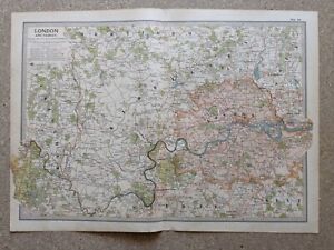
£6.50£2.50 postage1902 Map of London and Vicinity antique vintage Britannica 10th
£10.00£2.50 postage1913 South Norway & Sweden Original Antique Map by G.W. Bacon 108 Years Old
£19.99£4.50 postage1902 Map of Spain Portugal and Andorra antique vintage Britannica 10th
£6.50£2.50 postageLOUVRE et des TUILERIES, PARIS Plan FRANCE - 1910 Mounted Antique Map
£7.99£2.99 postage1902 Map of Greece Crete and Samos antique vintage Britannica 10th
£6.50£2.50 postageCHANTILLY CHATEAU, PARIS Floor Plan FRANCE - 1910 Mounted Antique Map
£7.99£2.99 postagebartholomew geographical society 1912 SURVEY ATLAS SCOTLAND maps plans
£180.00Free postage1902 Map of German Empire Eastern Part antique vintage Britannica 10th
£6.50£2.50 postage1913 Switzerland Original Antique Map by G.W. Bacon 108 Years Old
£19.99£4.50 postageGenuine Antique Victorian Map & View Of The Panama Canal
£29.99Free postage1902 Map of Austria-Hungary Western Part antique vintage Britannica 10th
£6.50£2.50 postage1902 Map of Italy Northern Part antique vintage Britannica 10th
£6.50£2.50 postage1902 Map of Oxford Essex Sussex Surrey antique vintage Britannica 10th
£6.50£2.50 postage1902 Map of Italy antique vintage Britannica 10th
£6.50£2.50 postageECOLE des BEAUX-ARTS, PARIS Plan FRANCE - 1910 Mounted Antique Map
£7.99£2.99 postageNOTRE DAME CATHEDRAL, PARIS Floor Plan FRANCE - 1910 Mounted Antique Map
£7.99£2.99 postageJARDIN des PLANTES, PARIS Floor Plan FRANCE - 1910 Mounted Antique Map
£7.99£2.99 postageVERSAILLES, PARIS Plan FRANCE - 1910 Mounted Antique Map
£11.99£2.99 postageST GERMAIN-EN-LAYE, PARIS Plan FRANCE - 1910 Mounted Antique Map
£7.99£2.99 postageMUSEE de CLUNY, PARIS Floor Plan FRANCE - 1910 Mounted Antique Map
£7.99£2.99 postage1902 Map of France Northern Part antique vintage Britannica 10th
£6.50£2.50 postage1913 Spain & Portugal Original Antique Map by G.W. Bacon 108 Years Old
£19.99£4.50 postage1913 Denmark Original Antique Map by G.W. Bacon 108 Years Old
£19.99£4.50 postage1913 West Germany Original Antique Map by G.W. Bacon 108 Years Old
£19.99£4.50 postage1913 North Norway & Sweden & Iceland Antique Map by G.W. Bacon 108 Years Old
£19.99£4.50 postageCLAMART-SCEAUX-VILLEJUIF, PARIS Plan FRANCE - 1910 Mounted Antique Map
£7.99£2.99 postagePERE LACHAISE CEMETERY, PARIS Plan FRANCE - 1910 Mounted Antique Map
£11.99£2.99 postageLOUVRE PARIS Floor Plan FRANCE - 1910 Mounted Antique Map
£11.99£2.99 postagePARIS ENVIRONS City Plan FRANCE - 1910 Mounted Antique Map
£11.99£2.99 postageENGHIEN & MONTMORENCY, PARIS Plan FRANCE - 1910 Mounted Antique Map
£7.99£2.99 postageAMIENS Town City Plan FRANCE - 1910 Mounted Antique Map
£11.99£2.99 postage1913 Mexico Original Antique Map by G.W. Bacon 108 Years Old
£19.99£4.50 postage1902 Map of France Vicinity of Paris antique vintage Britannica 10th
£6.50£2.50 postageFOREST of FONTAINEBLEAU PARIS Plan FRANCE - 1910 Mounted Antique Map
£11.99£2.99 postageHOTEL DES INVALIDES PARIS Floor Plan FRANCE - 1910 Mounted Antique Map
£11.99£2.99 postageLOUVRE PARIS Floor Plan FRANCE - 1910 Mounted Antique Map
£11.99£2.99 postageAntique map. GREAT BRITAIN. MAP OF INLAND SHIPPING ROUTES. 1911
£10.00£9.56 postageNORTH WEST GERMANY - 1913 ANTIQUE FOLDING MAP - Bacon - 35 x 54 cm
£4.99£4.00 postageAntique map. FRANCE. CITY MAP OF MARSEILLE. 1911
£10.00£9.56 postage1902 Map of Central Europe travel routes antique vintage Britannica 10th
£6.50£2.50 postage1902 Map of Denmark and Iceland antique vintage Britannica 10th
£6.50£2.50 postageEurope Physical Map 1917 Prof Meiklejohn Bartholomew Atlas
£9.99£1.75 postageOriginal 1919 CZECHOSLOVAKIA Boundary Dispute War Map Silesia Oder River Budweis
£19.66£15.34 postageOLD ANTIQUE MAP LONDON CITY PLAN THAMES c1910 by W & A K JOHNSTON COLOURED
£35.00£2.20 postageAntique Map-NETHERLANDS-TOWN PLAN-RIJSSEN-OVERIJSSEL-Kuyper-Kuijper-1865
£109.50Free postage