Antique European Maps & Atlases Dorset 1800-1899 Date Range
SPONSOREDSPONSOREDSPONSOREDSPONSOREDSPONSORED
93 results
DORSET, WEST STOUR, MILBORNE PORT, SHERBORNE, original antique map, MOGG, 1817
£35.00Click & CollectAntique/Vintage County Map of DORSET - Phillips Handy Atlas , 1887
£9.00Click & Collector Best Offer£0.85 postageCounty map of Dorsetshire England hand coloured c1860
£9.00Click & Collect£2.50 postageAntique/Vintage County Map of Dorset - John Heywood, 1868
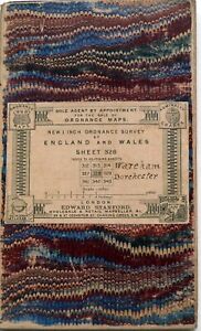
£16.99Click & Collector Best Offer£1.55 postageOrdnance Survey New 1" series DORCHESTER & WAREHAM c 1895 sheet 328
£8.750 bids£1.55 postageEnding Sunday at 6:26PM BST5d 5hClick & CollectDORSET, ASKERWELL, BRIDPORT, CHARMOUTH, original antique road map, MOGG, 1817
£30.00Click & CollectOLD MAP OF DORSETSHIRE 1836 BY THOMAS MOULE 20" x 16" PHOTOGRAPHIC PRINT
£22.00Click & Collect£4.20 postageAntique map of Dorset by Thomas Moules 1842
£25.00Click & CollectFree postageSmall Georgian County Map of Dorsetshire (c1824) Hand Coloured, Southern England
£9.990 bids£2.75 postageEnding Sunday at 7:28PM BST5d 6hClick & CollectDORSET, GUSSAGE SAINT ANDREW, TARRANT HINTON, original antique map, MOGG, 1817
£35.00Click & CollectDORSET WEYMOUTH PORTLAND SWANAGE BY JOHN CARY c1824 GENUINE ANTIQUE MAP
£14.99Click & CollectSOMERSET, YEOVIL, EAST CHINNOCK, CREWKERNE, original antique map, MOGG, 1817
£35.00Click & CollectOld Antique Victorian Picture map Dorset, England: c1830's: Moule Reprint 1800s
£5.99Click & Collect£2.50 postage3 watchingDEVON, HONITON, DORSET, STOCKLAND, CHARD, original antique map MOGG 1817
£35.00Click & Collect1880s Map Dorsetshire by J & C Walker Hand Coloured Parliamentary Divisions
£26.00Click & CollectFree postageOriginal Dorsetshire County Map Print by J Archer, for Dugdales
£44.00Click & Collect£8.99 postageCarey's Map of Dorset, 1823
£49.99Click & Collector Best Offer£4.20 postageBRIGHT'S MAP OF BOURNEMOUTH WITH INDEX 1897 - VICTORIAN SEASIDE RESORT
£275.00or Best OfferFree postageOLD ANTIQUE MAP SCILLY ISLES c1830 ENGRAVING by JOHN CARY ORIGINAL HAND COLOUR
£18.00Click & Collect£2.20 postage1805 Antique Map; John Cary large map of Dorset, Camden's Britannia
£54.99Click & Collect£3.90 postage1830 Antique map - Dorset- from Gorton's Topographical Dictionary
£12.99Click & Collect£1.95 postageDawson Original Engraved Town Plan Of Dorchester 1810 Dorset Map Roads River
£55.00Click & Collector Best OfferFree postageBRIDPORT, DORSET Original Street Plan, Dawson Original antique map 1832
£38.00Click & CollectFree postage1812 Antique Map; Dorset, John Cary, New & Correct English Atlas
£24.99Click & Collect£1.95 postageDORSETSHIRE, Darton Original Hand Coloured Miniature Antique County Map c1822
£32.00Click & CollectFree postageSmall Georgian County Map of Dorsetshire (c1820) Hand Coloured, Southern England
£9.990 bids£2.75 postageEnding Sunday at 7:28PM BST5d 6hClick & Collect3 x Old Antique Vintage Historical maps Dorset, England: 1600s & 1800's: Reprint
£12.00Click & Collect£3.00 postageLATE C19 CRUCHLEY COUNTY MAP OF DORSET ISSUED BY GALL & INGLIS
£12.00Click & Collector Best Offer£2.50 postagec1840s Dorsetshire County Map Lewis Topographical Dictionary Dorchester Wareham
£49.95Click & Collector Best OfferFree postageENGLAND WALES Map 1889 ORIGINAL London Dover Railways Counties Townships G. CRAM
£22.72or Best Offer£11.97 postagePigot & Co County Colour Map Dorset Dorsetshire 1840 Reproduction
£15.99Click & CollectOriginal antique county map DORSETSHIRE, DORSET, John Cary, 1828
£18.00Click & CollectDORSET DORSETSHIRE James Pigot Original Hand Coloured Antique County Map c1830
£65.00Click & CollectFree postageOLD ANTIQUE MAP HERTFORDSHIRE c1805 ENGRAVING by ROPER / COLE ORIGINAL COLOUR
£16.00Click & Collect£2.20 postageVictorian Colour Map of Dorsetshire (c1894) Dorset, Poole, Weymouth, Lyme Regis
£9.99Click & Collect£3.25 postageDORSET Antique Map 1883 by W & AK Johnston
£7.99Click & Collect£0.99 postageDorset map by Sidney Hall fine detail engraved with hand colour c1830
£31.30Click & CollectOLD ANTIQUE MAP DORSETSHIRE c1805 ENGRAVING by ROPER / COLE DORSET COLOURED
£16.00Click & Collect£2.20 postagec.1897 BACON'S NEW CYCLING ROAD MAP OF BOURNEMOUTH & DISTRICT
£29.99or Best Offer£3.05 postageAntique map of Dorsetshire by John Seller and Francis Grose 1809
£25.00Click & CollectFree postageDORSET, Edward Weller Original Antique Map c1870
£35.00Click & CollectFree postage1811 Ordnance Survey Folding Map mile=1 inch. Sht. 15. Cranborne env.
£49.99Click & Collect£3.90 postageSmall Georgian County Map of Dorsetshire (c1820) Hand Coloured, Dorset, England
£9.990 bids£2.75 postageEnding Sunday at 7:28PM BST5d 6hClick & CollectTHOMAS MOULE ORIGINAL HAND COLOURED ANTIQUE MAP OF DORSETSHIRE- CIRCA 1850
£60.00Click & Collector Best Offer£3.05 postage1804 (1858) Antique Map: Dorset by Cole from Railway & Pedestrian Atlas
£14.99Click & Collect£1.95 postageAntique map of Dorset by William Lewis 1819
£15.00Click & CollectFree postageDORSET, George Gray, Original Hand Coloured Antique County Map 1824
£28.00Click & CollectFree postage1882 Needles Christchurch Antique Sea Chart Coastal Map South England UK (1891)
£78.68or Best Offer£55.08 postageOLD ANTIQUE MAP DORSET by J ARCHER c1840's 19th C ENGRAVING ORIGINAL HAND COLOUR
£17.99Click & Collect£2.20 postageOriginal Antique Dorsetshire Map (c1845) Engraved Dorset County Map, Shaftesbury
£14.99Click & Collect£3.55 postage1841 Antique Map; Dorset by Thomas Moule
£19.99Click & Collect£1.95 postageDORCHESTER, DORSET, ENGLAND, Street Plan, Dawson Original antique map 1832
£48.00Click & CollectFree postageAntique map of the West of England by SUDK 1830
£30.00Click & CollectFree postage1811 Ordnance Survey Folding Map mile=1 inch. Sht. 16. Swanage env.
£49.99Click & Collect£3.90 postageOLD ANTIQUE MAP DORSETSHIRE DORSET by ODDY c1812 ENGRAVING ORIGINAL HAND COLOUR
£39.49Click & Collect£2.20 postageBLANDFORD FORUM, DORSET, ENGLAND, Street Plan, Dawson Original antique map 1832
£48.00Click & CollectFree postageLarge 51cm Victorian Antique Map DORSETSHIRE DORSET by Edward Weller
£21.99Click & Collect£3.29 postageOLD ANTIQUE MAP DORSET by CREIGHTON / WALKER c1830's ENGRAVING DORSETSHIRE
£18.99Click & Collect£2.20 postageAntique Map Of Dorset 1895. LSSR, S&D, GWR interest.
£16.990 bidsor Best OfferEnding Today at 1:28PM BST54m 38s£3.49 postageClick & CollectNew listingThomas Moule Maps Dorsetshire Reproduction Antique Map, Retro Reproduction...
£36.930 bidsor Best OfferEnding 27 May at 1:10PM BST6d£8.95 postageClick & Collect
You may also like
More to explore
- Bacon Map London in Antique Europe Maps & Atlases
- Bacon Map in Antique Europe Maps & Atlases
- Bromley Map in Antique Europe Maps & Atlases
- East Yorkshire Map
- Fox Hunting Maps
- Geographia Map in Antique Europe Maps & Atlases
- Great Yarmouth Map
- Hull Map in Antique Europe Maps & Atlases
- Jersey Map in Antique Europe Maps & Atlases
- Lambeth Map
- Linen Map in Antique Europe Maps & Atlases
- Map Cheltenham in Antique Europe Maps & Atlases
- Moule Maps
- Northern Ireland Map in Antique Europe Maps & Atlases
- Old Bristol Map
- Ordnance Survey Lake District in Antique Europe Maps & Atlases
- Philips Map in Antique Europe Maps & Atlases
- Plymouth Map in Antique Europe Maps & Atlases
- River Thames Map in Antique Europe Maps & Atlases
- Robert Morden Maps
- Saxon Map
- Saxton Map
- Scarborough Map in Antique Europe Maps & Atlases
- Vintage Michelin Maps in Antique Europe Maps & Atlases
- War Office Map in Antique Europe Maps & Atlases