
Missouri Antique North America Sheet Maps
56 results
Antique Map 1920s | Map Of The Ozark Playgrounds | Steele Undertaking | 17 X 21”
£172.89£27.22 postageVTG CIVIL WAR MAP! REBEL FORTIFICATIONS ON THE MISSISSIPPI RIVER AT NEW MADRID!
£145.67£13.24 postageMissouri Geological Survey And Water Resources Index Map Jan 1970 Box 250 Rolla
£27.21Was: £32.02£15.94 postageOriginal Vintage Map of the Missouri Pacific Railroad Company 1917
£16.01£16.89 postage1897 Map Western part of United States Original antique print USA
£1.590 bids£5.60 postageEnding Sunday at 8:30PM BST3d 4hAntique Map: United States of America Missouri Compromise Act, 1899
£4.500 bidsEnding 14 May at 7:13PM BST5d 3hFree postage1897 Map of United States & Mexico Original antique print
£1.590 bids£5.60 postageEnding Sunday at 8:14PM BST3d 4h1897 Map East part of United States Original antique print
£1.590 bids£5.60 postageEnding Sunday at 8:19PM BST3d 4hMISSOURI Ruth Taylor VINTAGE ORIGINAL Cartoon Map 1935 6 Color Litho EX COND
£12.00£17.17 postage1852 Historic Map - Location of Indian Tribes within the United States
Compiled and Drawn by Captain S. Eastman£160.08£22.48 postage1884 ANTIQUE MAP Indian Removal CHEROKEE NATION 32" Arkansas Kansas Missouri
£104.05£16.11 postageoriginal 1901 USGS map of Springfield, MO
£48.02£24.92 postageMap of Missouri with Railroads, Counties, Towns Color Plate circa 1900
£10.40£13.35 postage1936 MISSOURI STATE Cultural Thematic Map Chromo Litography C13-2
£23.93£16.92 postageOriginal Vintage Map Showing MIssouri-Kansas-Texas Lines, 1926
£16.01£18.93 postageOriginal Vintage Map of the Missouri Pacific Railway St. Louis, Iron Mt. - 1910
£16.01£16.89 postageoriginal 1904 USGS map of Nevada, El Dorado Springs, MO
£68.04£13.50 postage1909 Antique Color Map Cedar County Missouri Filley Stockton Balm 29 X 25 #0388
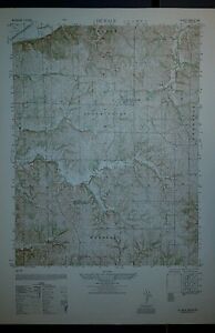
£31.94£15.74 postage1950 Army map Smithville Missouri Sheet 7062 I
£20.00£15.68 postageMap War Secession West Operations 1871 Victorian Woodcut Print History DWAA12
£10.81Was: £24.00£16.09 postage1940's Army map Cuba Missouri Sheet 7760 III SW
£20.00£15.68 postageoriginal 1906 USGS map of Bolivar, Buffalo, Urbana, Hermitage, Wheatland, MO
£52.03£13.02 postage1940's Army map Leasburg Missouri Sheet 7760 III SE
£20.00£15.68 postageoriginal 1900 USGS map of Tuscumbia MO
£52.03£13.02 postageVintage 1947 State Map Print Suitable For Framing 2 Sided - Missouri / Montana
£15.17£16.70 postage1903 Antique Map Missouri Shelby County Shelbyville Bethel Hunnewell 28X27 #9965
£19.93£15.38 postage1879 Map West Central States Group Victorian Atlas Geography 1st Edition DWAA9
£28.81Was: £64.03£18.65 postage1940's Army map De Kalb Missouri Sheet 7063 III SW w/ Aerial Photo on Reverse
£28.01£15.92 postage1940's Army map Edgerton Missouri Sheet 7063 II SW w/ Aerial Photo on Reverse
£28.01£15.92 postage1940's Army map Dearborn Missouri Sheet 7063 III SE w/ Aerial Photo on Reverse
£28.01£15.92 postage1940's Army map Gower Missouri Sheet 7063 II SE w/ Aerial Photo on Reverse
£28.01£15.92 postage1903 Antique Map Shelby County Missouri Shelbyville Bethel Lakenan 28X27 #4280
£23.93£15.50 postage1940's Army map Rushville Missouri Sheet 6963 II SE w/ Aerial Photo
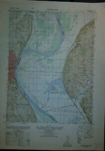
£32.01£16.04 postage1940's Army map Tracy Missouri Sheet 7062 IV NE w/ Aerial Photo on Reverse
£28.01£15.92 postageoriginal 1905 USGS map of Clinton, MO pre Truman Reservoir
£48.02£12.91 postage1906 Antique Map Putnam County Missouri Unionville Lucerne Livonia 41X19 #4332
£23.93£15.50 postageAntique 1906 Color Map Missouri Saint Louis 11" X 16" #4137
£11.93£16.70 postage1913 Antique Map Missiouri Nodaway Maryville Clearmont Elmo Hopkins 37X34 #4702
£23.93£15.50 postage1914 Antique Map Missouri Grundy County Spickard Trenton Edinburg 27 X 25" #8868
£31.94£15.74 postage1906 Antique Map Putnam County Missouri Unionville Howland Livonia 41 X 1 #8564
£31.94£15.74 postage1940's Army map Ferrelview Kansas City Missouri Sheet 7062 I SW w/ Aerial Photo
£32.01£16.04 postage1914 Antique Map Missouri Harrison County Bethany Blythedale 30 X 34" #8867
£31.94£15.74 postage1914 Antique Map Missouri Dekalb County Maysville Fairport Amity 27 X 23" #8869
£31.94£15.74 postageMissouri - Berrymam Quadrangle (1943 survey) Original...
£27.21Was: £32.02£27.53 postageParts of Illinois, Missouri and Indiana Original 1884 Map
£92.05£28.01 postageoriginal 1905 USGS map of Butler, Rich Hill, Appleton, Creighton,MO Island Mound
£68.04£25.50 postageoriginal 1894 USGS map of Independence, Blue Springs Excelsior Liberty MO
£80.04£13.86 postage1900 USGS map of Fort Scott, KS Liberal, MO
£44.02£24.80 postageoriginal 1905 USGS map of Greenfield, MO & Mt. Vernon, Ash Grove Walnut Grove
£44.02£24.80 postageoriginal 1900 USGS map of Versailles, Aurora Springs, Linn Creek, MO
£36.02£24.56 postageoriginal 1901 USGS map of Carthage, Sarcoxie, Golden City, Lamar, Webb City, MO
£60.03£25.27 postage1877 Coast & Geodetic Survey Triangulation Map #22 Missouri & Illinois
£36.02£15.74 postageImproving Missouri River in Front of Sioux City, Iowa, with Pile Dikes - 1895
£24.01£25.96 postageImproving Upper Missouri River, Dikes Built at Mandan North Dakota, 1896
£24.01£20.20 postage1877 Coast & Geodetic Survey Triangulation Map #22 Missouri & Illinois
£36.02£15.74 postage


Deals for you
Grab a further 10% with code TOOLSAVE10Shop nowPromotion organised by seller. T&Cs apply.


