
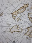
1693 Orkney Islands Sea Chart Greenvile Collins Scotland Scottish Antique Map
£250.00£250.00
Thu, 04 Sep, 14:52Thu, 04 Sep, 14:52
Picture 1 of 17


Gallery
Picture 1 of 17


1693 Orkney Islands Sea Chart Greenvile Collins Scotland Scottish Antique Map
£250.00
or Best Offer
From £11.80 per month for 24 months with *
Condition:
“The map has received a little professional attention and is now in a very good condition. it is ”... Read moreAbout condition
Oops! Looks like we're having trouble connecting to our server.
Refresh your browser window to try again.
Postage:
£25.00 International Tracked Postage.
Located in: Fairlight, United Kingdom
Delivery:
Estimated between Mon, 10 Nov and Wed, 26 Nov to 94104
Returns:
30 days return. Buyer pays for return postage. If you use an eBay delivery label, it will be deducted from your refund amount.
Payments:
Shop with confidence
Seller assumes all responsibility for this listing.
eBay item number:127093260147
Item specifics
- Seller notes
- Date Range
- 1700-1799
- Antique
- Yes
- Type
- Nautical Map
- Chart engraved by
- Herman Moll
- Format
- Sheet Map
- Cartographer/Publisher
- Captain Greenvile Collins
- Original/Reproduction
- Antique Original
- Colouring
- Handcoloured
- City
- Kirkwall
- Country/Region
- Scotland
- County
- Orkney
- Antique/ Modern
- Antique
Item description from the seller
Seller business information
Seller Feedback
No Feedback yet
More to explore:
- Orkney Antique Europe Atlas Maps,
- Orkney Antique Europe Sheet Maps,
- Orkney Antique Europe Political Maps,
- Orkney Antique Europe County Maps,
- Antique European Maps & Atlases Orkney,
- Orkney Antique Original Antique Europe Sheet Maps,
- Antique European Maps & Atlases Orkney 1900-1909 Date Range,
- Chart Marine & Maritime Antiques,
- France Chart Marine & Maritime Antiques,
- Antique Original Political Map Antique Sheet Maps