Picture 1 of 2

Gallery
Picture 1 of 2


Have one to sell?
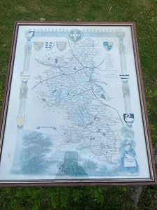
Map of Buckinghamshir
£26.40
or Best Offer
Condition:
- Buy it nowMap of Buckinghamshire 1848 antique engraving Thomas Moule Barclay's Dictionary
Oops! Looks like we're having trouble connecting to our server.
Refresh your browser window to try again.
Postage:
Located in: GREAT MISSENDEN, United Kingdom
Delivery:
Varies
Returns:
No returns accepted.
Payments:
Get more time to pay. See payment informationfor PayPal Credit - opens in a new window or tab
Shop with confidence
Seller assumes all responsibility for this listing.
eBay item number:127155733770
Item specifics
- Antique
- Yes
- Date Range
- 1800-1899
- Type
- Topographical Map
- Format
- Atlas Map
- Year
- 1848
- Era
- 1800s
- Original/Reproduction
- Antique Original
- Country/Region
- England
- County
- Buckinghamshire
Item description from the seller
About this seller
sh289982
1 item sold
Registered as a private sellerThereby, consumer rights stemming from EU consumer protection law do not apply. eBay buyer protection still applies to most purchases.
Seller Feedback
No Feedback yet
More to explore:
- Buckinghamshire Antique Europe County Maps,
- Buckinghamshire Antique Europe Atlas Maps,
- Antique European Maps & Atlases Buckinghamshire,
- Buckinghamshire Antique Europe Sheet Maps,
- Buckinghamshire Antique Europe Topographical Maps,
- Buckinghamshire Ordnance Survey Map Antique Europe Sheet Maps,
- Thomas Kitchin Antique County Maps,
- Thomas Kelly Antique Maps, Atlases & Globes,
- Thomas Kitchin Antique Maps, Atlases & Globes,
- Thomas Jefferys Antique Maps, Atlases & Globes