Picture 1 of 4


Picture 1 of 4


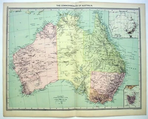
Australia - Original Map c1906 by G Philip & Son. Antique

US $24.00
Approximately£17.98
Condition:
“Some age toning, minor wear and one center fold, otherwise this attractive map is in good condition ”... Read moreAbout condition
Postage:
Free USPS Ground Advantage®.
Located in: Sayville, New York, United States
Delivery:
Estimated between Fri, 27 Sep and Mon, 30 Sep to 43230
Returns:
30 days return. Seller pays for return postage.
Payments:
Shop with confidence
Seller assumes all responsibility for this listing.
eBay item number:145572290787
Item specifics
- Seller notes
- Date Range
- 1900-1909
- Type
- Political Map
- Format
- Atlas Map
- Printing Technique
- Lithography
- Year
- 1906
- Original/Reproduction
- Antique Original
- State/Territory
- Australian Capital Territory, Jervis Bay Territory, New South Wales, Northern Territory, Queensland, South Australia, Tasmania, Victoria, Western Australia
- Cartographer/Publisher
- George Philip & Son
- Country/Region
- Australia
Item description from the seller

Registered as a private seller
Thereby, consumer rights stemming from EU consumer protection law do not apply. eBay buyer protection still applies to most purchases.
More to explore:
- Western Australia Antique Original Antique Australia/Oceania Maps & Atlases,
- South Australia Antique Original Antique Australia/Oceania Maps & Atlases,
- Antique Original Antique Australia/Oceania Sheet Maps,
- Antique Original Antique Australia/Oceania Wall Maps,
- Antique Original Antique Australia/Oceania Topographical Maps,
- Antique Original Antique Australia/Oceania Maps & Atlases,
- Antique Original Antique Australia/Oceania Political Maps,
- Vintage Original Antique Australia/Oceania Atlas Maps,
- Western Australia Antique Australia/Oceania Atlas Maps,
- Western Australia Antique Australia/Oceania Political Maps