Picture 1 of 4


Gallery
Picture 1 of 4


Have one to sell?
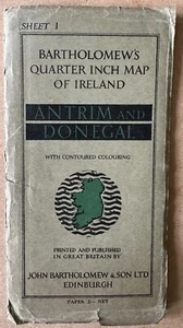
VINTAGE MAP Antrim & Donegal, Ireland. 1952 Bartholomew's Quarter Inch to Mile
£8.52
or Best Offer
Condition:
- Buy it nowVINTAGE MAP Antrim & Donegal, Ireland. 1952 Bartholomew's Quarter Inch to Mile
Oops! Looks like we're having trouble connecting to our server.
Refresh your browser window to try again.
Postage:
Located in: Kilmacolm, United Kingdom
Delivery:
Varies
Returns:
No returns accepted.
Payments:
Get more time to pay. See payment informationfor PayPal Credit - opens in a new window or tab
Shop with confidence
Seller assumes all responsibility for this listing.
eBay item number:156489005053
Item specifics
- Date Range
- 1950-1959
- Antique
- Yes
- Type
- County Map
- Format
- Folding Map
- Year
- 1952
- Cartographer/Publisher
- Bartholomew
- Original/Reproduction
- Vintage Original
- Country/Region
- Ireland
- County
- Antrim, Armagh, Donegal, Down, Fermanagh, Londonderry, Tyrone
Item description from the seller
About this seller
16mainstreet
100% positive Feedback•851 items sold
Registered as a private sellerThereby, consumer rights stemming from EU consumer protection law do not apply. eBay buyer protection still applies to most purchases.
Seller Feedback (507)
- e***e (1226)- Feedback left by buyer.Past 6 monthsVerified purchaseFirst class service, quick dispatch and delivery,5-star plus seller, very highly recommended, would buy from this seller again, item very well packaged, thank you ever so much.
- 0***_ (799)- Feedback left by buyer.Past monthVerified purchaseExcellent, exactly as described, well packed and very fast delivery, thank you!!
- c***c (33)- Feedback left by buyer.Past 6 monthsVerified purchaseGreat to deal with. Replies quickly. Item arrived in no time at all. Great value. Recommended.NI PUNK Rudi - 'When I Was Dead' +2. 7" w/insert 1981. Jamming Records. Create 1 (#156488997678)
More to explore:
- John Bartholomew Vintage Original Antique Sheet Maps,
- John Bartholomew Vintage Original Antique Folding Maps,
- John Bartholomew Vintage Original Antique County Maps,
- Donegal Antique Europe Sheet Maps,
- Antique European Maps & Atlases Donegal,
- Antique European Maps & Atlases Antrim,
- John Bartholomew Antique Folding Maps,
- Antrim Ordnance Survey Map Antique Europe Sheet Maps,
- John Bartholomew Antique Maps, Atlases & Globes,
- John Bartholomew Antique World Sheet Maps