Picture 1 of 10


Gallery
Picture 1 of 10


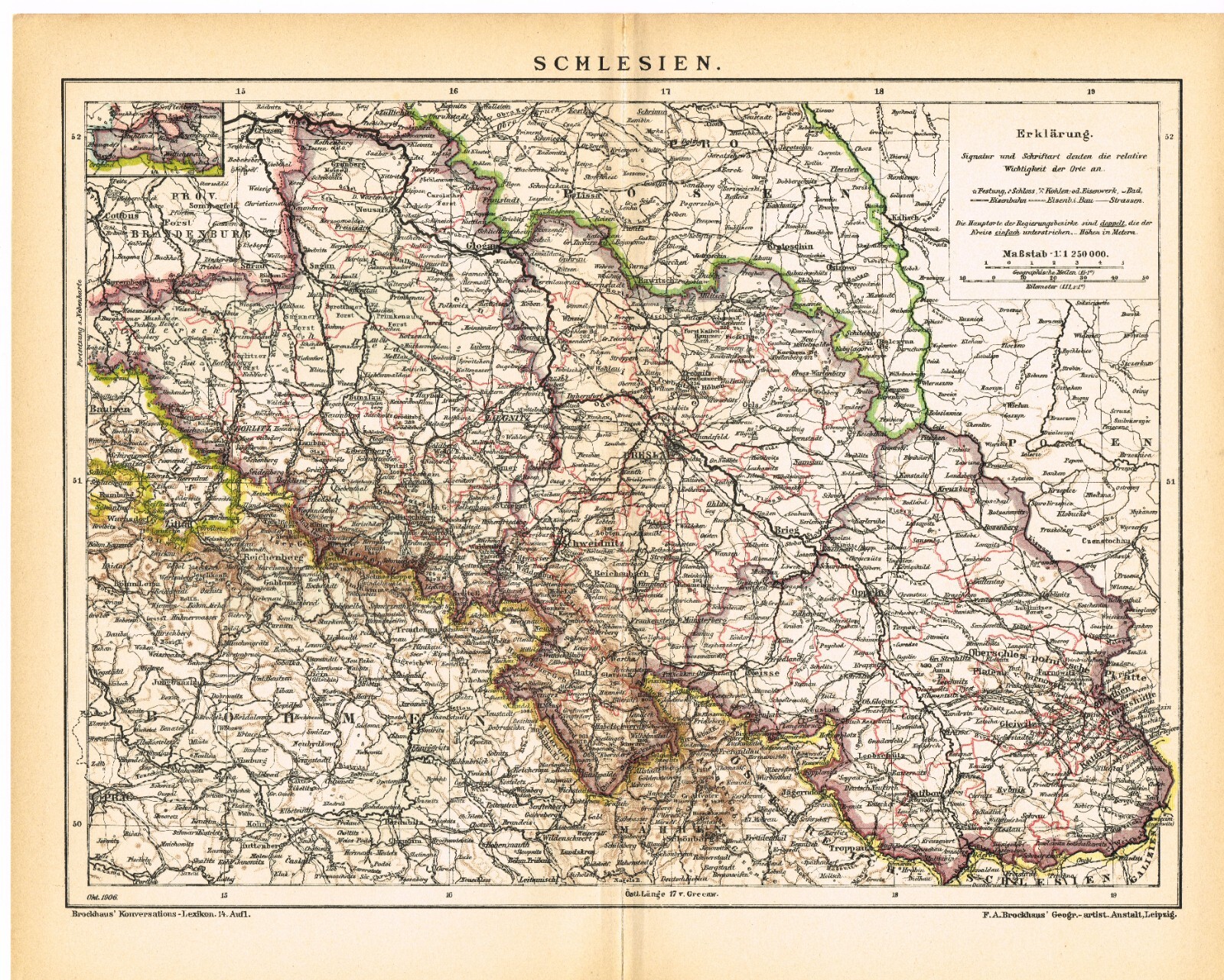

SILESIA Śląsk POLAND date 1906 Original Antique Map Austria Czechia Ukraine
US $18.00
Approximately£13.69
Condition:
“In very good condition.”
- Buy it nowSILESIA Śląsk POLAND date 1906 Original Antique Map Austria Czechia Ukraine
Oops! Looks like we're having trouble connecting to our server.
Refresh your browser window to try again.
Postage:
US $4.50 (approx £3.42) Economy Shipping.
Located in: Manville, New Jersey, United States
Delivery:
Estimated between Wed, 5 Nov and Mon, 10 Nov to 94104
Returns:
14 days return. Seller pays for return postage.
Payments:
Shop with confidence
Seller assumes all responsibility for this listing.
eBay item number:156730389193
Item specifics
- Seller notes
- “In very good condition.”
- Date Range
- 1850-1950
- Type
- World Atlas
- Format
- Sheet Map
- Printing Technique
- Lithography
- Year
- 1906
- Original/Reproduction
- Antique Original
- City
- Wrocław
- Country/Region
- Austria, Czech Republic, Poland, Ukraine
Item description from the seller
About this seller
Princeton Maps&Prints
99.6% positive Feedback•1.7K items sold
Registered as a private sellerThereby, consumer rights stemming from EU consumer protection law do not apply. eBay buyer protection still applies to most purchases.
Seller Feedback (632)
- *****- Feedback left by buyer.Past 6 monthsVerified purchaseItem better than described. There is an extra leaf from the book this was extracted from with info about the places on the map, a wonderful surprise! Item was packaged carefully in a sturdy cardboard mailer, but leave it to the mail carrier to bend it in order to fit in my narrow mailbox. Fortunately, no harm to the map. Item arrived quickly with tracking updates. All in all, great item from a pro seller. Thanks very much!
- *****- Feedback left by buyer.Past 6 monthsVerified purchaseThe only issue with this transaction was that the item that I ordered, an old lithograph removed from a book, was not marked "DO NOT BEND". Unfortunately my postman folded the shipping envelope in half so he could get it into my small mailbox. Amazingly the lithograph suffered no apparent damage once I got it flattened out. I put it under a heavy book overnight and it's perfectly flat with no visible crease. No harm, no foul. Perfect transaction otherwise.
- *****- Feedback left by buyer.Past monthVerified purchaseShipping: Timely and inexpensive. Packaging: Well packed and sealed. As described: Oh Yes. So much better than described. Value for money. Very much so. I'll be looking for your items again. Thank you.
This is a private listing and your identity will not be disclosed to anyone except the seller.
More to explore:
- Antique Original 1970-1979 Date Range Antique Sheet Maps,
- Antique Original 1700-1799 Date Range Antique County Maps,
- Antique Original 1800-1899 Date Range Antique River Maps,
- Antique Original 1940-1949 Date Range Antique Atlas Maps,
- Antique Original 1910-1919 Date Range Antique Sheet Maps,
- Antique Original 1910-1919 Date Range Antique Folding Maps,
- Antique Original 1960-1969 Date Range Antique Folding Maps,
- Antique Original 1800-1899 Date Range Antique Wall Maps,
- Antique Original 1900-1909 Date Range Antique Folding Maps,
- Antique Original 1700-1799 Date Range Antique Folding Maps