Picture 1 of 5


Gallery
Picture 1 of 5


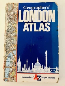
A. to Z. London Atlas (Street Atlases) Geographers' A-Z Map Hardback Book 1995
£16.09
Condition:
Good
A book that has been read, but is in good condition. Minimal damage to the book cover eg. scuff marks, but no holes or tears. If this is a hard cover, the dust jacket may be missing. Binding has minimal wear. The majority of pages are undamaged with some creasing or tearing, and pencil underlining of text, but this is minimal. No highlighting of text, no writing in the margins, and no missing pages. See the seller’s listing for full details and description of any imperfections.
- Buy it nowA. to Z. London Atlas (Street Atlases) Geographers' A-Z Map Hardback Book 1995
Oops! Looks like we're having trouble connecting to our server.
Refresh your browser window to try again.
Postage:
Located in: New Milton, United Kingdom
Delivery:
Varies
Returns:
No returns accepted.
Payments:
Get more time to pay. See payment informationfor PayPal Credit - opens in a new window or tab
Shop with confidence
Seller assumes all responsibility for this listing.
eBay item number:156936496970
Item specifics
- Condition
- Artist
- Geographers' A-Z Map Company
- Brand
- N/A
- Date of Publication
- 19980100
- EAN
- 9780850390001
- ISBN
- 0850390001
- Release Title
- A. to Z. London Atlas (London Street Atlases)
- Book Title
- A. to Z. London Atlas (London Street Atlases)
- City
- London
- Colour
- N/A
- Publication Year
- 1998
- Type
- Road Atlas
- Format
- Hardcover
- Language
- English
- Publication Name
- A. to Z. London Atlas
- Item Height
- 220 mm
- Map Scale
- 1:1 m-3
- Publisher
- HarperCollins
- Subject
- Transportation
- Item Width
- 140 mm
- Number of Pages
- 144 Pages
About this product
Product Information
This atlas of London contains coloured street maps at 3.1 to 1 miles (1:20,438). Details include motorways, A and B roads, postal districts, built-up areas and green areas. The area covered extends to Watford, Loughton, Romford, Dartford, Orpington, Purley, Epsom, Walton-upon-Thames, Heathrow Airport and Uxbridge. The cover for this edition has been redesigned and the key map is now shown in full colour. A number of subsidiary addresses have been included on the maps, but where there has been insufficient space, the entry is shown in the index in italics with the adjacent access road or street.
Product Identifiers
Publisher
HarperCollins
ISBN-13
9780850390001
eBay Product ID (ePID)
91844102
Product Key Features
Number of Pages
144 Pages
Publication Name
A. to Z. London Atlas
Language
English
Subject
Transportation
Publication Year
1998
Map Scale
1:1 m-3
Type
Road Atlas
Format
Hardcover
Dimensions
Item Height
220 mm
Item Width
140 mm
Additional Product Features
Country/Region of Manufacture
United Kingdom
Series Title
London Street Atlases
Item description from the seller
About this seller
tools-tackle-home
97.6% positive Feedback•2.6K items sold
Registered as a private sellerThereby, consumer rights stemming from EU consumer protection law do not apply. eBay buyer protection still applies to most purchases.
Seller Feedback (1,025)
- 5***6 (2659)- Feedback left by buyer.Past 6 monthsVerified purchaseExcellent product as described. Well packaged. Good value. Quick delivery. Recommended.
- d***r (1000)- Feedback left by buyer.Past 6 monthsVerified purchaseA good efficient seller, postage good, as described, reasonable value,16 DRAKES PRIDE VINTAGE BOWLS STICKERS W. H.SMITHS EDWARDIAN MAN RARE BOWLING (#156219121427)
- r***r (1599)- Feedback left by buyer.Past 6 monthsVerified purchaseExactly as described, brand new top quality red beam torch, very good price, great comms! Super fast delivery! Vendor top notch, recommended to all!CARP TECH Fishing Tackle RED LED Tuftie Bird Scaring Torch Zoomable 3 Modes (#156636831009)
Product ratings and reviews
Most relevant reviews
- 06 Mar, 2024
Very good
Verified purchase: YesCondition: Pre-ownedSold by: baham_books
- 25 May, 2016
Good for finding streets and seeing the vicinity without technology
Verified purchase: YesCondition: Pre-ownedSold by: worldofbooks08
More to explore:
- National Geographic Maps & Atlases,
- National Geographic Folding Map Maps & Atlases,
- London Maps & Atlases,
- National Geographic Maps & Atlases in English,
- London Folding Map Maps & Atlases,
- Ordnance Survey London Maps & Atlases,
- London Maps & Atlases 1950-1999 Publication Year,
- Maps & Atlases,
- Hardback Books,
- Italian Maps & Atlases
tools-tackle-home
97.6% positive Feedback•2.6K items sold
Registered as a private sellerThereby, consumer rights stemming from EU consumer protection law do not apply. eBay buyer protection still applies to most purchases.
Seller Feedback (1,025)
- 5***6 (2659)- Feedback left by buyer.Past 6 monthsVerified purchaseExcellent product as described. Well packaged. Good value. Quick delivery. Recommended.
- d***r (1000)- Feedback left by buyer.Past 6 monthsVerified purchaseA good efficient seller, postage good, as described, reasonable value,16 DRAKES PRIDE VINTAGE BOWLS STICKERS W. H.SMITHS EDWARDIAN MAN RARE BOWLING (#156219121427)
- r***r (1599)- Feedback left by buyer.Past 6 monthsVerified purchaseExactly as described, brand new top quality red beam torch, very good price, great comms! Super fast delivery! Vendor top notch, recommended to all!CARP TECH Fishing Tackle RED LED Tuftie Bird Scaring Torch Zoomable 3 Modes (#156636831009)