
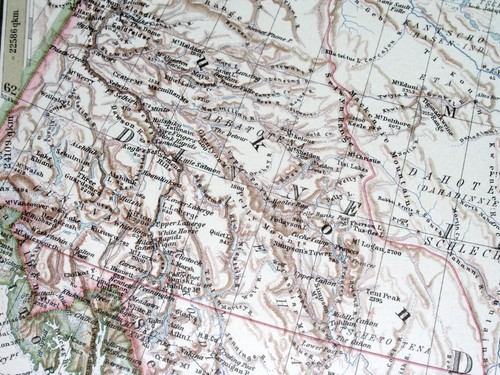
1925 VINTAGE MAP OF WESTERN CANADA BRITISH COLUMBIA YUKON ALBERTA SASKATCHEWAN
US $29.99US $29.99
Mon, 04 Aug, 23:03Mon, 04 Aug, 23:03
Picture 1 of 13


Gallery
Picture 1 of 13


Have one to sell?
1925 VINTAGE MAP OF WESTERN CANADA BRITISH COLUMBIA YUKON ALBERTA SASKATCHEWAN
US $29.99
Approximately£22.29
or Best Offer
Condition:
“GOOD.”
Oops! Looks like we're having trouble connecting to our server.
Refresh your browser window to try again.
Postage:
Free Standard Shipping from Canada.
Located in: Montreal, Quebec, Canada
Delivery:
Estimated between Tue, 12 Aug and Mon, 18 Aug to 94104
Returns:
60 days return. Seller pays for return postage.
Payments:
Shop with confidence
Seller assumes all responsibility for this listing.
eBay item number:157194926613
Item specifics
- Seller notes
- “GOOD.”
- Publication Year
- 1925
- Date Range
- 1920-1929
- Type
- Map
- Canadian Province
- Alberta, British Columbia, Manitoba, Northwest Territories, Nunavut, Saskatchewan, Yukon
- Year
- 1925
- City
- Vancouver
- Country/Region
- Canada
- Topic
- Maps
- SHEET SIZE
- 18 1/2" x 15 1/4" (47 x 38,5 cm)
- Maker
- STIELER
Item description from the seller
Seller business information
Seller Feedback
No Feedback yet
More to explore:
- Antique North American Maps & Atlases British Columbia,
- British Columbia Antique North America Atlas Maps,
- Antique North American Maps & Atlases Saskatchewan,
- Antique North American Maps & Atlases Alberta,
- British Columbia Antique Original Antique North America Maps & Atlases,
- District of Columbia Antique North American Maps & Atlases,
- Vintage Original Nautical Map Antique Sheet Maps,
- Vintage Original Topographical Map Antique Folding Maps,
- Vintage Original City Map Antique Folding Maps,
- Vintage Original County Map Antique Europe Sheet Maps