Picture 1 of 4


Gallery
Picture 1 of 4


Have one to sell?
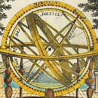
Map Europe Asia Tartary Indian Islands & Southern Land by Heinrich Scherer c1710

£149.00
From £13.26 per month for 12 months with *
Condition:
“Please see details below”
- Buy it nowMap Europe Asia Tartary Indian Islands & Southern Land by Heinrich Scherer c1710
Oops! Looks like we're having trouble connecting to our server.
Refresh your browser window to try again.
Postage:
£12.95 Royal Mail International Standard.
Located in: Buckinghamshire, United Kingdom
Delivery:
Estimated between Fri, 8 Aug and Thu, 21 Aug to 94104
Returns:
No returns accepted.
Payments:
*From £13.26 per month for 12 months.
Shop with confidence
Seller assumes all responsibility for this listing.
eBay item number:157201539253
Item specifics
- Seller notes
- “Please see details below”
- Date Range
- 1800-1899
- Type
- Engraved
- Format
- Atlas Map
- Printing Technique
- Copper Plate
- Year
- 1700
- Era
- 1700s
- Cartographer/Publisher
- Samuel Neele / Thomas Tegg
- Original/Reproduction
- Antique Original
- City
- Asia
- Country/Region
- Asia
Item description from the seller
Seller business information
CRN: 11235906
About this seller
raremapsandprints
100% positive Feedback•3.9K items sold
Registered as a business seller
Popular categories from this shop
Seller Feedback (1,848)
- r***r (63)- Feedback left by buyer.Past monthVerified purchaseThank you so much for the print of the Crocus fairy by Cicely Mary Barker. The postage is good. The packaging is good. The item is as described and good value for money.
- i***a (46)- Feedback left by buyer.Past 6 monthsVerified purchaseSwift delivery, well packed, good value and just as described
- u***y (627)- Feedback left by buyer.Past 6 monthsVerified purchaseSuper, just as described and packaged securely. Arrived quickly too!
More to explore:
- Southern Hemisphere Antique World Maps & Atlases,
- Topographical Map Antique Asia Atlas Maps,
- Topographical Map Antique Asia Sheet Maps,
- Nautical Map Antique Asia Sheet Maps,
- Thematic Map Antique Asia Atlas Maps,
- Antique Asia Sheet Maps,
- Antique Asia Thematic Maps,
- Antique Asia Nautical Maps,
- Lithography Political Map Antique Asia Atlas Maps,
- Lithography Antique Asia Folding Maps
Popular categories from this shop
Seller Feedback (1,848)
- r***r (63)- Feedback left by buyer.Past monthVerified purchaseThank you so much for the print of the Crocus fairy by Cicely Mary Barker. The postage is good. The packaging is good. The item is as described and good value for money.
- i***a (46)- Feedback left by buyer.Past 6 monthsVerified purchaseSwift delivery, well packed, good value and just as described
- u***y (627)- Feedback left by buyer.Past 6 monthsVerified purchaseSuper, just as described and packaged securely. Arrived quickly too!