Picture 1 of 3


Gallery
Picture 1 of 3


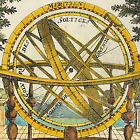
map Leicestershire John Aikin England Delineated 1803 Original with text

raremapsandprints
(1638)
Business
£34.00
Condition:
“Good Condition - Please see description below”
- Buy it nowmap Leicestershire John Aikin England Delineated 1803 Original with text
Oops! Looks like we're having trouble connecting to our server.
Refresh your browser window to try again.
Returns:
No returns accepted.
Payments:
Get more time to pay. See payment informationfor PayPal Credit - opens in a new window or tab
Shop with confidence
About this item
Seller assumes all responsibility for this listing.
eBay item number:157424942529
Item specifics
- Seller notes
- “Good Condition - Please see description below”
- Antique
- Yes
- Printing Technique
- Copper Plate
- County
- Leicestershire
- City
- Leicester
- Date Range
- 1800-1899
- Original/Reproduction
- Antique Original
- Country/Region
- England
- Era
- 1800s
- Format
- Atlas Map
- Maker
- John Aikin
- Cartographer/Publisher
- John Aikin
- Antique/ Modern
- Antique
- Type
- County Map
- Year
- 1803
Item description from the seller
Seller business information
CRN: 11235906
Extended Producer Responsibility (EPR) numbers:
A seller has an EPR number if they've registered with the government as a producer of a certain type of product and taken responsibility for managing the waste that product creates.
About this seller
raremapsandprints
100% positive Feedback•4.0K items sold
Registered as a business seller
Popular categories from this shop
Seller Feedback (1,886)
- 3***r (890)- Feedback left by buyer.Past 6 monthsVerified purchaseShipping: Perfect. USPS Priority. Packaging: In a good, sturdy tube. Came all the way with barely a dent. As described: YES. I surely got the better end of the deal. Value: For me, priceless. Thank you. I'll be looking for your items again. AND AND AND I avoided any tariff !!
- r***1 (163)- Feedback left by buyer.Past 6 monthsVerified purchaseExactly as described. Great communications, and fast shipping. If you are from the states, don’t let the tariff stuff dissuade you. Seller made it a seamless transaction. I’ll be shopping there again!Road Map London to Montgomery by Bowles original early 1782 (#167530988249)
- k***t (118)- Feedback left by buyer.Past monthVerified purchaseExcellent communication and packaging. The print was as described and it was a good value. Thank you!
More to explore:
- John Cary Leicestershire Antique Europe Maps & Atlases,
- John Speed Leicestershire Antique Europe Maps & Atlases,
- Leicestershire Antique Original Antique Europe County Maps,
- Leicestershire Antique Original Antique Europe Atlas Maps,
- Leicestershire Antique Original Antique European Maps & Atlases,
- Leicestershire Antique Europe Sheet Maps,
- Leicestershire Ordnance Survey Map Antique Europe Sheet Maps,
- Antique European Maps & Atlases Leicestershire Contemporary,
- John Bartholomew Antique Original Antique Atlas Maps,
- John Bartholomew Antique Original Antique City Maps
Popular categories from this shop
Seller Feedback (1,886)
- 3***r (890)- Feedback left by buyer.Past 6 monthsVerified purchaseShipping: Perfect. USPS Priority. Packaging: In a good, sturdy tube. Came all the way with barely a dent. As described: YES. I surely got the better end of the deal. Value: For me, priceless. Thank you. I'll be looking for your items again. AND AND AND I avoided any tariff !!
- r***1 (163)- Feedback left by buyer.Past 6 monthsVerified purchaseExactly as described. Great communications, and fast shipping. If you are from the states, don’t let the tariff stuff dissuade you. Seller made it a seamless transaction. I’ll be shopping there again!Road Map London to Montgomery by Bowles original early 1782 (#167530988249)
- k***t (118)- Feedback left by buyer.Past monthVerified purchaseExcellent communication and packaging. The print was as described and it was a good value. Thank you!