Picture 1 of 7


Gallery
Picture 1 of 7


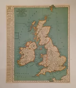
VTG Pre WWII 1938 Map British Isles Of Churchill's Disaster Of The 1st Magnitude
US $19.99
Approximately£15.02
or Best Offer
Condition:
- Buy it nowVTG Pre WWII 1938 Map British Isles Of Churchill's Disaster Of The 1st Magnitude
Oops! Looks like we're having trouble connecting to our server.
Refresh your browser window to try again.
Postage:
US $2.59 (approx £1.95) USPS First Class Large Envelope.
Located in: Columbia, Pennsylvania, United States
Delivery:
Estimated between Thu, 15 May and Wed, 21 May
Returns:
No returns accepted.
Payments:
Shop with confidence
Seller assumes all responsibility for this listing.
eBay item number:176716266896
Item specifics
- Date Range
- 1930-1939
- Type
- Political Map
- Format
- Atlas Map
- Year
- 1939
- Original/Reproduction
- Vintage Original
- Cartographer/Publisher
- Rand McNally & Co.
- Country/Region
- Great Britain
Item description from the seller
About this seller
The Wandering Jew Antiques
99.5% positive Feedback•446 items sold
Registered as a private sellerThereby, consumer rights stemming from EU consumer protection law do not apply. eBay buyer protection still applies to most purchases.
Seller Feedback (167)
- 8***s (467)- Feedback left by buyer.Past monthVerified purchasePerfect seller! Items exactly as described! Arrived quickly! Packaged very well! Cost less than what the kid’s meals would have cost me to collect all the figures!
- 6***7 (89)- Feedback left by buyer.Past 6 monthsVerified purchaseVery well packaged, post office still managed to put a small dent in the frame, but otherwise the map and frame is exactly as described - great transaction and recommended seller!
- f***i (1384)- Feedback left by buyer.Past monthVerified purchaseFast shipping, great communication, item arrived well packaged and in perfect condition. A++ seller!
More to explore:
- Antique European Maps & Atlases Isle of Wight,
- Isle of Wight Antique Europe Sheet Maps,
- Isle of Wight Antique Europe County Maps,
- Isle of Wight Antique Europe Atlas Maps,
- Isle of Wight Ordnance Survey Map Antique Europe Sheet Maps,
- Isle of Wight Antique Europe Ordnance Survey Maps,
- Isle of Wight Antique Original Antique Europe Maps & Atlases,
- British Royal Navy WWII Marine & Maritime Antiques,
- Isle of Wight 1800-1899 Date Range Antique Europe Maps & Atlases,
- British Royal Navy Compass WWII Marine & Maritime Antiques