Picture 1 of 12


Gallery
Picture 1 of 12


Have one to sell?
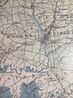
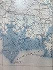
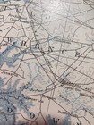
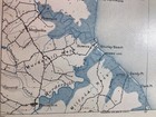
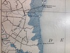
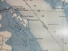
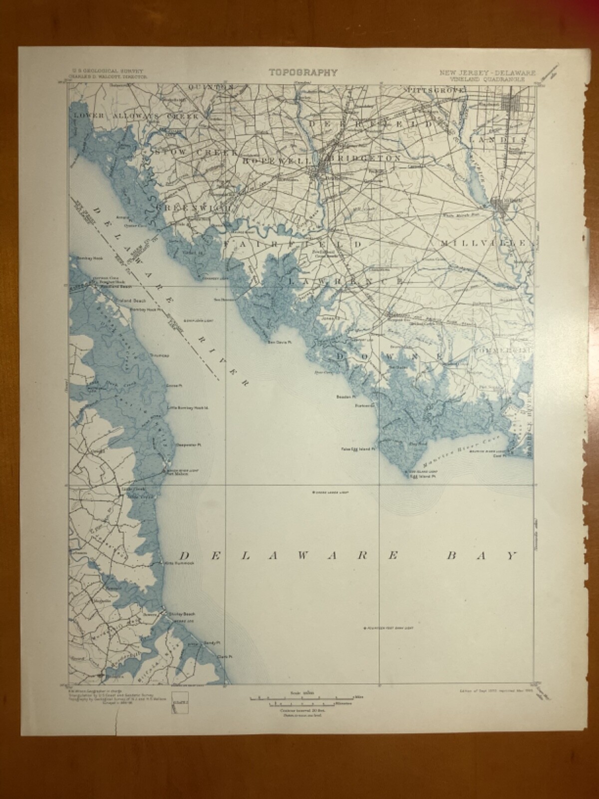
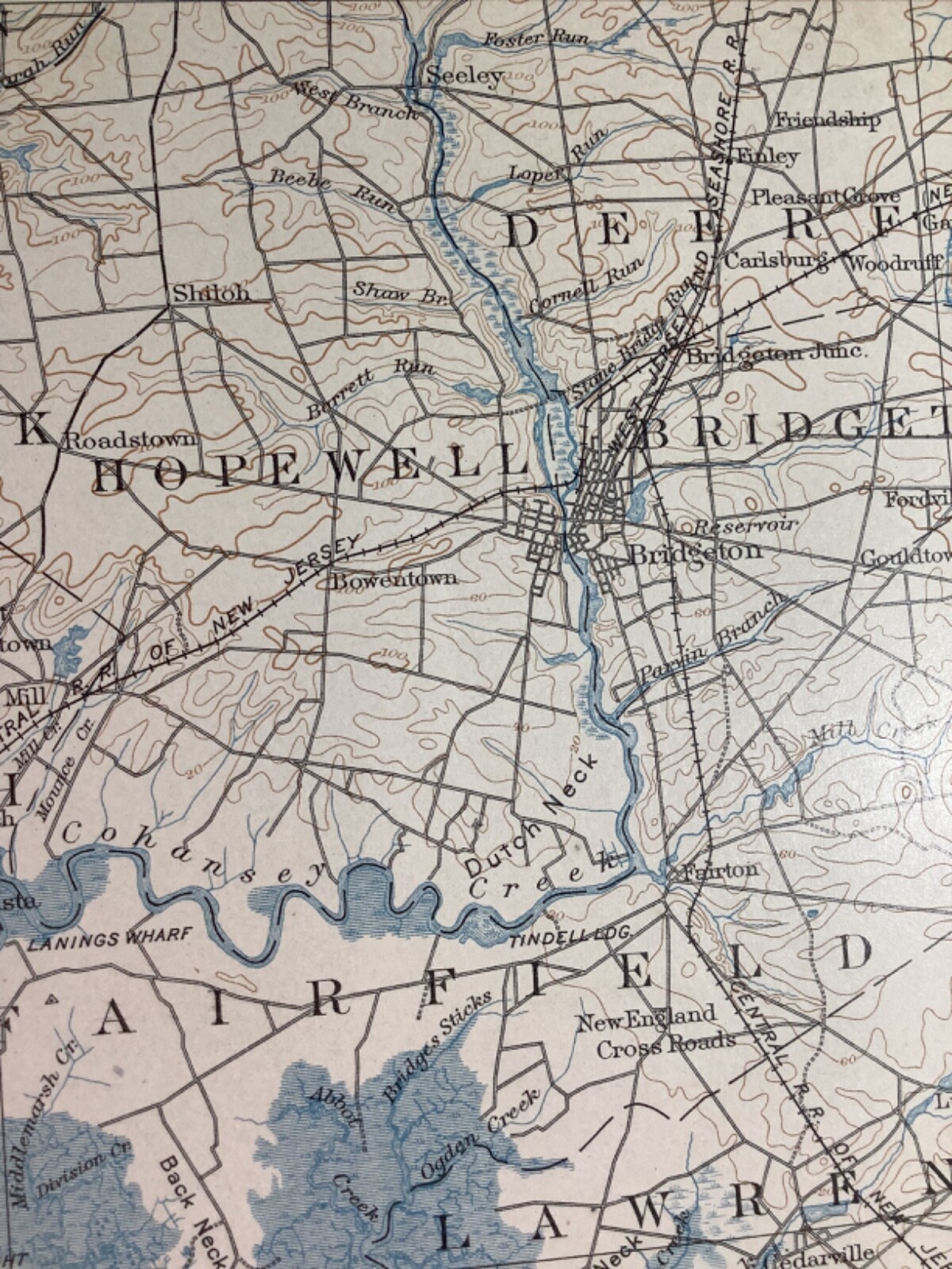
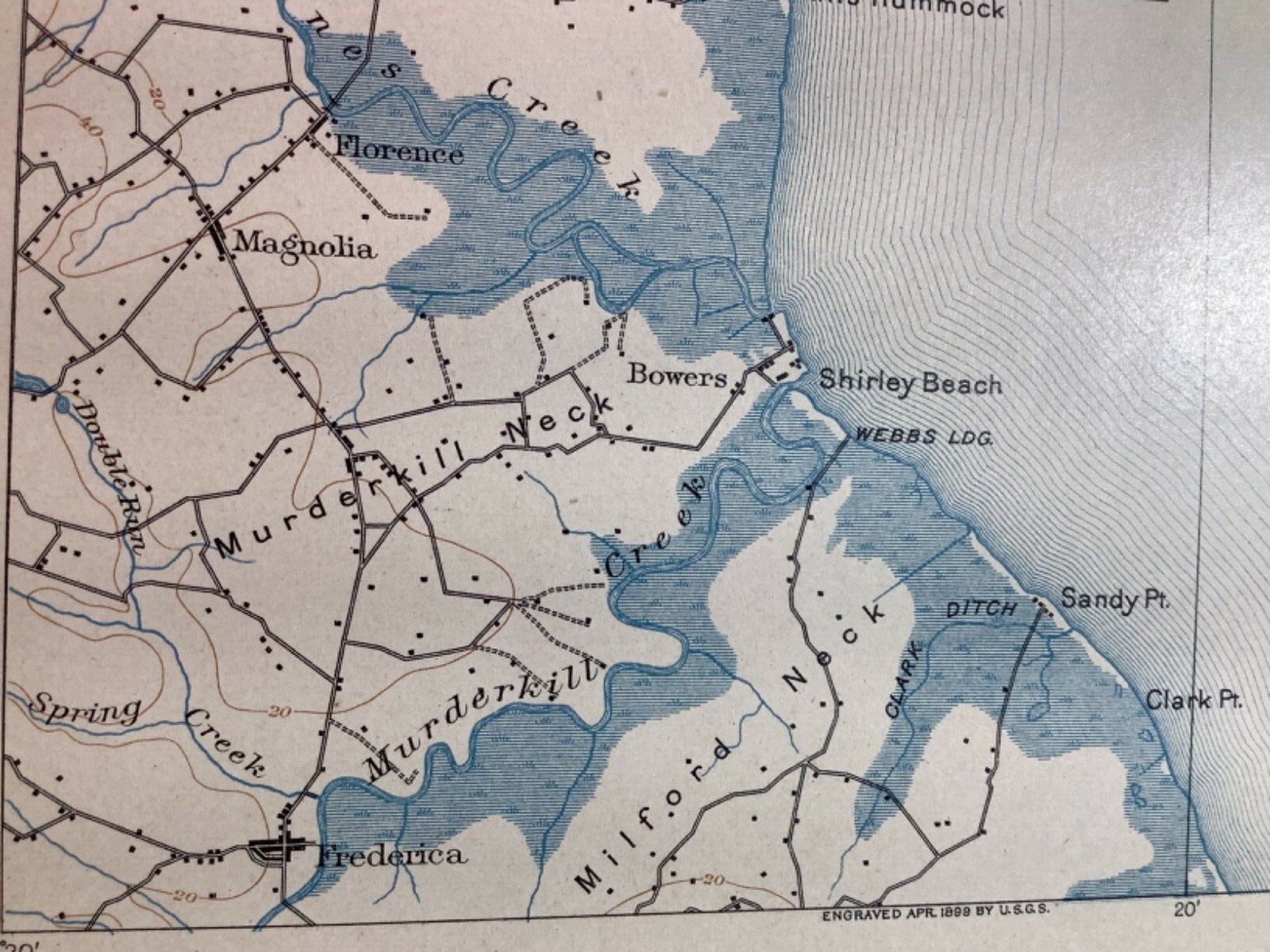
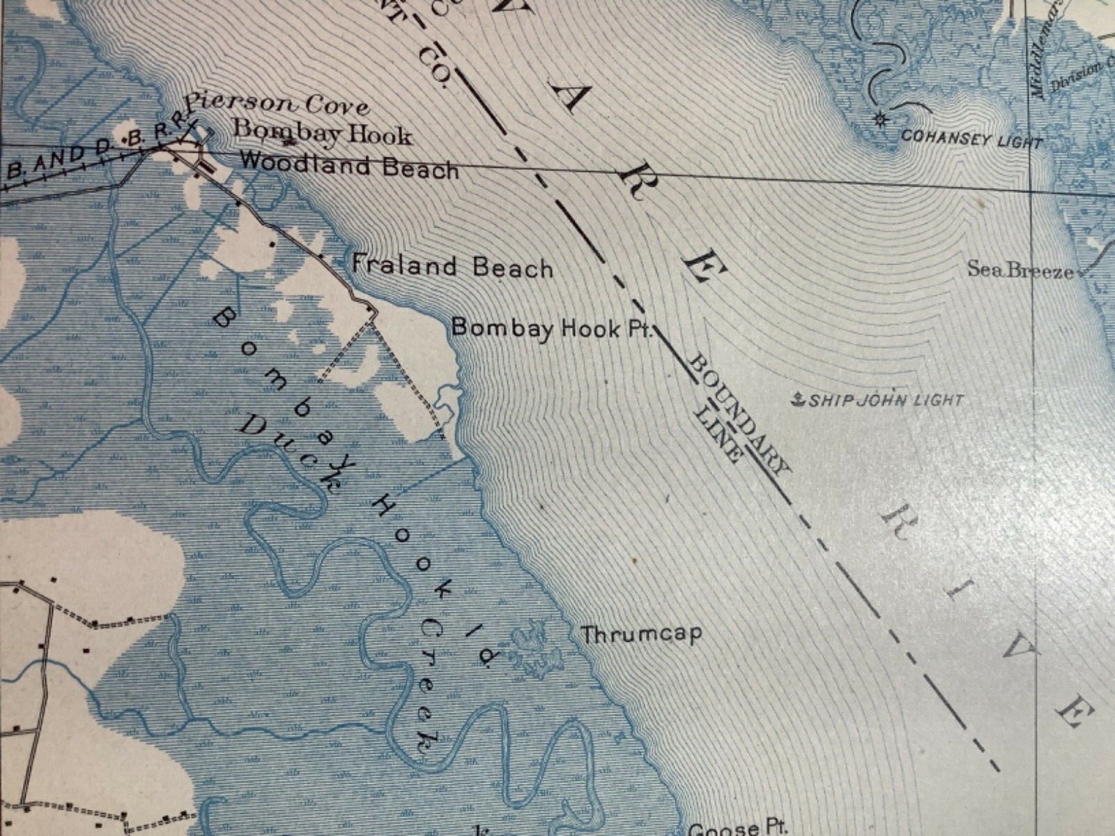
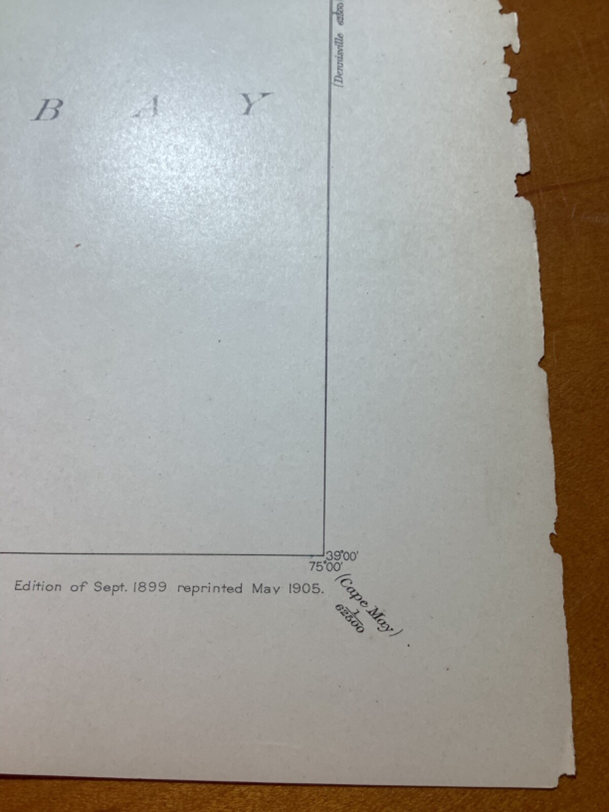
1905 USGS map of Vineland, Bridgeton,Gree
US $100.00
Approximately£73.89
Condition:
“This map of Vineland Quadrangle is perfect on it’s printed face and has wear on it’s right edge and ”... Read moreAbout condition
- Buy it now1905 USGS map of Vineland, Bridgeton,Greenwich, NJ land & sea east of Dover, DE
Oops! Looks like we're having trouble connecting to our server.
Refresh your browser window to try again.
Postage:
US $15.00 (approx £11.08) USPS Priority Mail®.
Located in: Meeker, Colorado, United States
Delivery:
Estimated between Mon, 28 Jul and Mon, 4 Aug to 94104
Returns:
No returns accepted.
Payments:
Shop with confidence
Seller assumes all responsibility for this listing.
eBay item number:185193021908
Item specifics
- Seller notes
- Date Range
- 1900-1909
- Type
- Topographical Map
- US State
- New Jersey
- Printing Technique
- Copper Plate
- Format
- Sheet Map
- Year
- 1905
- Original/Reproduction
- Antique Original
- Country/Region
- United States of America
Item description from the seller
About this seller
itemsfor$
100% positive Feedback•409 items sold
Registered as a private sellerThereby, consumer rights stemming from EU consumer protection law do not apply. eBay buyer protection still applies to most purchases.
Seller Feedback (155)
- m***a (327)- Feedback left by buyer.Past 6 monthsVerified purchaseArrived as deacribed, Excellent communication from Seller A+ Experience. Thank you!KERSHAW "BLUR" 1670BLKST - Black Tanto Partially Serrated - Jul 06 (#186920504387)
- 3***3 (1136)- Feedback left by buyer.Past yearVerified purchaseItem as described, great communication, lightning fast delivery, highly recommended seller ⭐️⭐️⭐️⭐️⭐️Vintage NOS ~The Phil Zone~STAR MAP 4”x4”Vinyl Grateful Dead Sticker. Phil Lesh. (#186703606170)
- *****- Feedback left by buyer.Past monthVerified purchaseGreat seller. Was very well packaged. Thanks!
This is a private listing and your identity will not be disclosed to anyone except the seller.
More to explore:
- Dover Antique Europe Atlas Maps,
- Dover Antique Europe County Maps,
- Antique European Maps & Atlases Dover,
- Dover Antique Europe Sheet Maps,
- Dover Kent Antique Europe County Maps,
- Antique European Maps & Atlases Dover 1800-1899 Date Range,
- Dover Kent Antique Europe Maps & Atlases 1800-1899 Date Range,
- Dover Kent Antique Europe Maps & Atlases 1700-1799 Date Range,
- City Map Antique Sheet Maps,
- Railroad Map Antique Wall Maps