Picture 1 of 12


Gallery
Picture 1 of 12


Have one to sell?
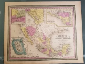
Antique Map of Texas, Mexico, and Guatamala - 1850 - Hand Water colored - Austin
US $485.00
Approximately£364.69
or Best Offer
Condition:
- Buy it nowAntique Map of Texas, Mexico, and Guatamala - 1850 - Hand Water colored - Austin
Oops! Looks like we're having trouble connecting to our server.
Refresh your browser window to try again.
Postage:
US $7.10 (approx £5.34) USPS Ground Advantage®.
Located in: North Branford, Connecticut, United States
Delivery:
Estimated between Mon, 11 Aug and Mon, 18 Aug to 94104
Returns:
14 days return. Buyer pays for return postage. If you use an eBay delivery label, it will be deducted from your refund amount.
Payments:
Shop with confidence
Seller assumes all responsibility for this listing.
eBay item number:195498200258
Item specifics
- Type
- Political Map
- US State
- Texas
- Format
- Atlas Map
- Printing Technique
- Lithography
- Mexican State
- Chiapas, Chihuahua, Coahuila, Durango, Guanajuato, Jalisco, Michoacán, Nuevo León, Oaxaca, Puebla, Querétaro, San Luis Potosí, Sinaloa, Sonora, Tabasco, Tamaulipas, Veracruz, Zacatecas
- Year
- 1850
- Cartographer/Publisher
- Samuel Augustus Mitchell
- City
- Mexico City
- Country/Region
- Mexico
Item description from the seller
About this seller
The Corner Art Shop
100% positive Feedback•57 items sold
Registered as a private sellerThereby, consumer rights stemming from EU consumer protection law do not apply. eBay buyer protection still applies to most purchases.
Seller Feedback (20)
- c***r (3396)- Feedback left by buyer.More than a year agoVerified purchasePerfect Transaction! Fast Delivery and Well Packed! Highly Recommend this eBayer! AAA+++New Haven Harbor Vintage Map from 1946 - 80 Years Old! Fascinating! (#195606459798)
- t***2 (118)- Feedback left by buyer.More than a year agoVerified purchaseGreat communication and fast shipping!Antique Map of Uvalde, Texas, 1908 - Topographic Map - w/ Section on Line A-B (#194768519873)
- 0***j (759)- Feedback left by buyer.More than a year agoVerified purchaseWell packaged, everything as described!! Fast shippingTEN Antique Texas Maps, All Originals, dated from 1911-1954, Various! Colorful! (#194751508421)
More to explore:
- Antique North American Maps & Atlases Texas,
- Texas Antique North America Wall Maps,
- Texas Antique North America Railroad Maps,
- Texas Antique North America City Maps,
- Texas Antique Original Antique North American Maps & Atlases,
- Manuscript/Hand drawn Antique Maps, Atlases & Globes,
- Antique Original County Map Antique Folding Maps,
- Antique Chairs 1850-1899,
- 1850-1899 Ethnographic Antiques,
- 1850-1899 Antique Treen