
Picture 1 of 14


Picture 1 of 14


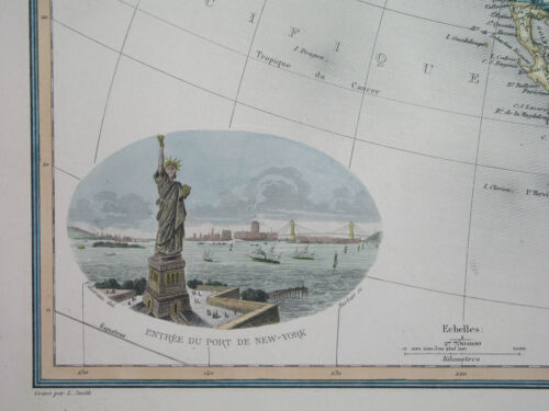
1898 rare ORIGINAL MAP UNITED STATES MEXICO TEXAS CALIFORNIA FLORIDA CANADA CUBA

Condition:
“SOME STAINS, SOME SCATTERED SPOTTING AND FOXING //// I INVITE YOU TO MY SHOP //////”
Ended: 18 Apr, 2024 22:41:07 BST
Postage:
Located in: Zary, Poland
Delivery:
Estimated between Thu, 30 May and Fri, 7 Jun to 43230
Returns:
Payments:
Shop with confidence
Seller assumes all responsibility for this listing.
eBay item number:196335728236
Item specifics
- Seller notes
- “SOME STAINS, SOME SCATTERED SPOTTING AND FOXING //// I INVITE YOU TO MY SHOP //////”
- Printing Technique
- Copper Plate
- US State
- AK, HI, AL, FL, GA, MS, NC, SC, AR, IA, KS, LA, MO, NE, AZ, CA, CO, NM, NV, UT, Alabama, Alaska, Arizona, Arkansas, California, Colorado, Connecticut, Florida, Georgia, Illinois, Indiana, Iowa, Louisiana, Massachusetts, Michigan, Mississippi, New Mexico, New York, Oklahoma, Oregon, Pennsylvania, South Carolina, Texas, Virginia, Washington, West Virginia
- Cartographer/Publisher
- Lacoste / Migeon / Vuillemin
- City
- Dallas Houston Los Angeles Washington Toronto Atlanta Tampa
- Date Range
- 1700-1799
- Continent
- North America
- Type
- Political Map
- Mexican State
- Aguascalientes, Baja California, Baja California Sur, Campeche, Chiapas, Chihuahua, Coahuila, Colima, Durango, Guanajuato, Guerrero, Hidalgo, Jalisco, Michoacán, Morelos, Nuevo León, Oaxaca, Puebla, Querétaro, Quintana Roo, San Luis Potosí, Sinaloa, Sonora, Tabasco, Tamaulipas, Tlaxcala, Veracruz, Yucatán, Zacatecas
- Format
- Atlas Map
- Canadian Province
- Alberta, British Columbia, Manitoba, New Brunswick, Newfoundland & Labrador, Northwest Territories, Nova Scotia, Nunavut, Ontario, Prince Edward Island, Quebec, Saskatchewan
- Year
- 1898
- Original/Reproduction
- Antique Original
- Topic
- Maps
- Country/Region
- United States
Item description from the seller
Business seller information
Antykwariat "Lusatia"
Ul. Witosa 17/2
68-200 Żary
Poland
I certify that all my selling activities will comply with all EU laws and regulations.
Seller assumes all responsibility for this listing.
eBay item number:196335728236
Post to me
Item location:
Zary, Poland
Posts to:
Worldwide
Excludes:
Russian Federation, Ukraine
| Postage and packaging | To | Service | Delivery*See Delivery notes |
|---|---|---|---|
| US $16.00 (approx £12.59) | United States | Economy Shipping from outside US | Estimated between Thu, 30 May and Fri, 7 Jun to 43230 |
| Taxes |
|---|
| Taxes may be applicable at checkout. Learn moreLearn more about paying tax on eBay purchases. |
Returns policy
| After receiving the item, cancel the purchase within | Refund will be given as | Return postage |
|---|---|---|
| 60 days | Money back, Replacement | Buyer pays for return postage |
Refer to eBay return policyopens in a new tab or window for more details. You're covered by the eBay Money Back Guaranteeopens in a new tab or window if you receive an item that is not as described in the listing.
The buyer is responsible for return postage costs.
| Return policy details |
|---|
| Returns accepted |
Payment details
Payment methods

More to explore:
- Florida Antique Original Antique North America Maps & Atlases,
- Texas Antique Original Antique North American Maps & Atlases,
- California Antique Original Antique North American Maps & Atlases,
- California Vintage Original Antique North American Maps & Atlases,
- New Mexico Antique Original Antique North America Maps & Atlases,
- Antique North American Maps & Atlases Texas,
- Houston Texas Antique North American Maps & Atlases,
- New Mexico Antique North America Maps & Atlases,
- Los Angeles California American Antique Maps & Atlases,
- Florida Antique North America Maps & Atlases 1800-1899 Date Range