Picture 1 of 20


Gallery
Picture 1 of 20


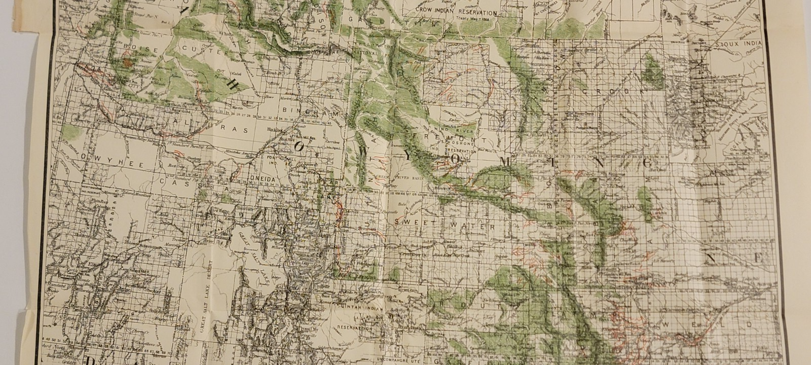
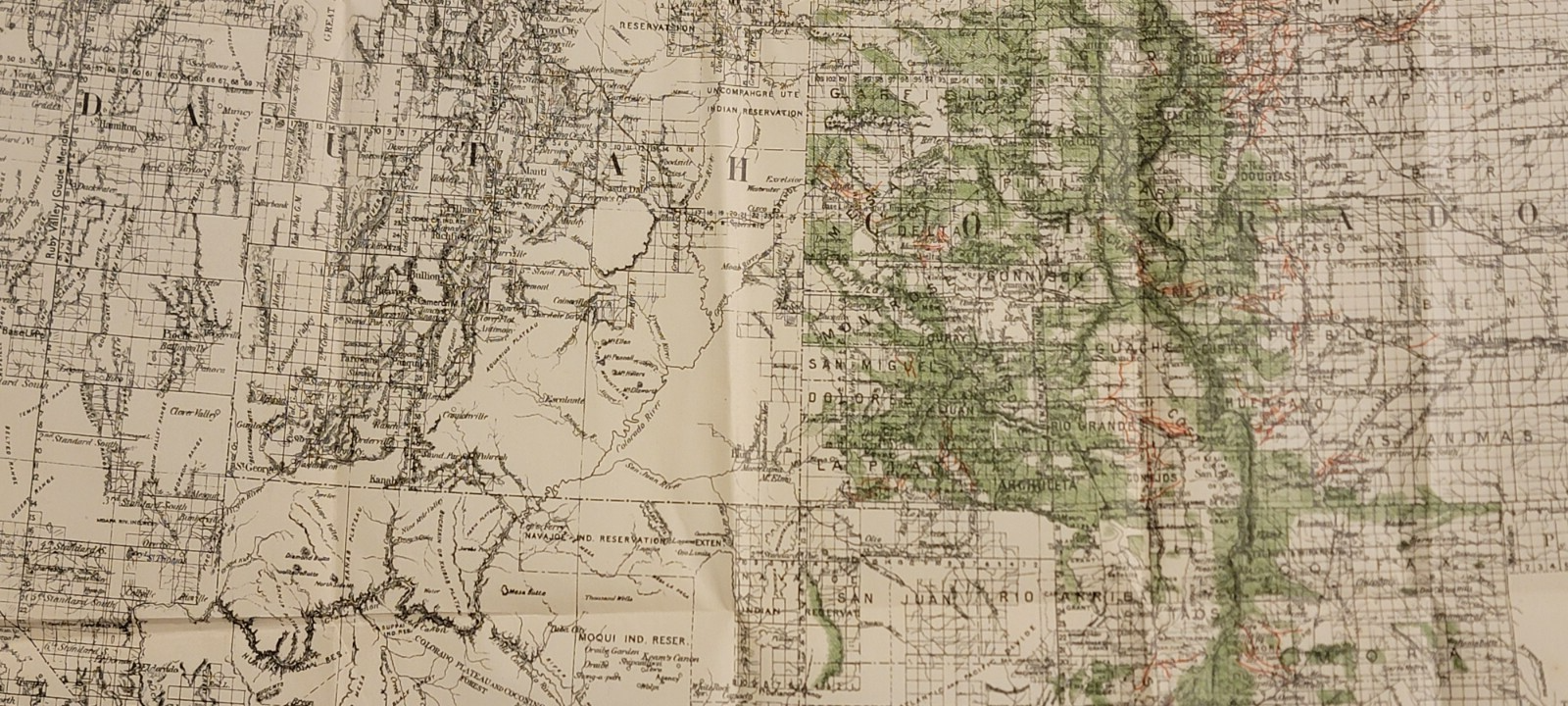


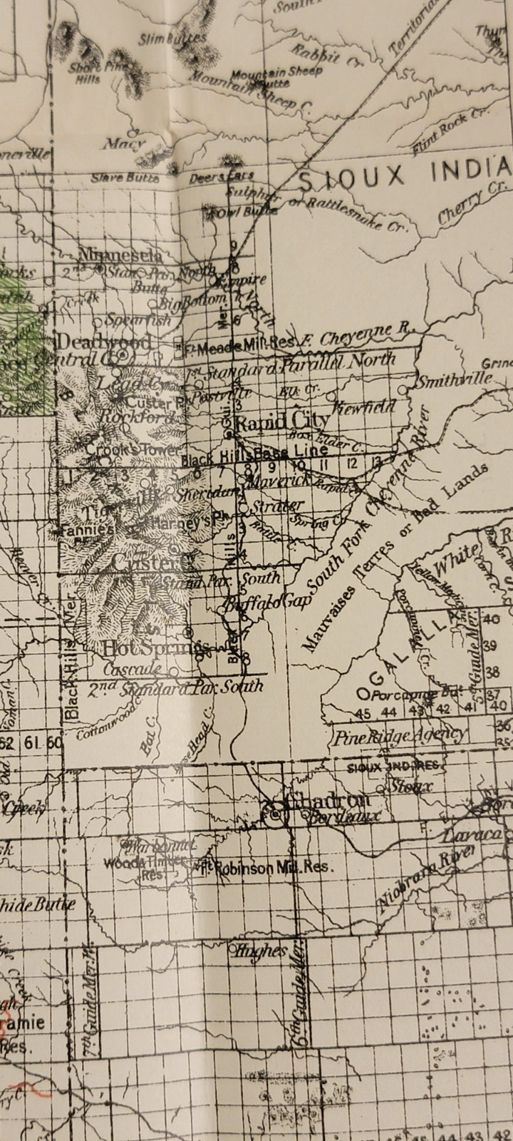


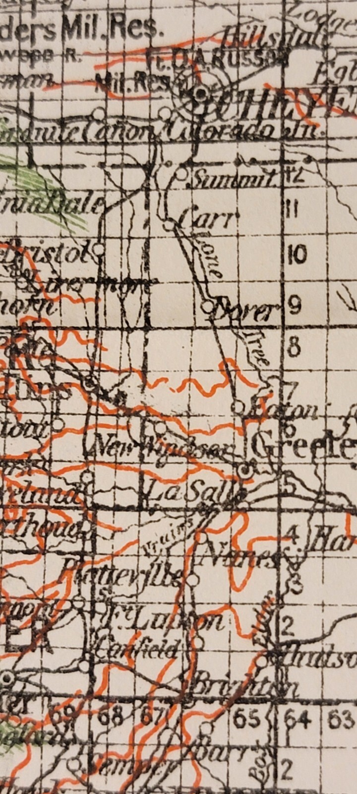


Detailed 1885 colored map Rocky Mountain Region forests, ditches Ensign
US $150.00
Approximately£110.53
Condition:
- Buy it nowDetailed 1885 colored map Rocky Mountain Region forests, ditches Ensign
Oops! Looks like we're having trouble connecting to our server.
Refresh your browser window to try again.
Postage:
Free USPS Ground Advantage®.
Located in: Lafayette, Colorado, United States
Delivery:
Estimated between Wed, 18 Jun and Tue, 24 Jun to 94104
Returns:
No returns accepted.
Payments:
Shop with confidence
Seller assumes all responsibility for this listing.
eBay item number:197237286010
Item specifics
- Date Range
- 1800-1899
- Type
- Map
- Format
- Folding Map
- Printing Technique
- Lithography
- US State
- Arizona, Colorado, Idaho, Montana, Nebraska, Nevada, New Mexico, Texas, Utah, Rocky Mt. states
- Year
- 1885
- Original/Reproduction
- Original
- Country/Region
- United States of America
Item description from the seller
About this seller
dprussi7
100% positive Feedback•154 items sold
Registered as a private sellerThereby, consumer rights stemming from EU consumer protection law do not apply. eBay buyer protection still applies to most purchases.
Seller Feedback (68)
- 4***3 (2440)- Feedback left by buyer.Past 6 monthsVerified purchaseItem as described 👍, fast shipping 👍 very well packaged 👌 and nice contact 😁 - thank you very much 🌟🌟🌟🌟🌟Vintage Apple Computer lanyard pen Logo “The Power to Be Your Best" 1980s/1990s (#196904356009)
- y***_ (86)- Feedback left by buyer.Past 6 monthsVerified purchaseItem arrived as described and carefully packaged. Would do business with seller again.Antique detailed copperplate hand colored map Florida Johnson's Cyclopaedia 1897 (#196887383573)
- f***5 (5)- Feedback left by buyer.Past monthVerified purchaseAs described and quickly despatched. Packaged well. Thank you.
More to explore:
- Ensign Marine & Maritime Antiques,
- South Polar Region Antique World Maps & Atlases,
- North Polar Region Antique World Sheet Maps,
- North Polar Region Antique World Maps & Atlases,
- North Polar Region Lithography Antique World Maps & Atlases,
- Black Forest Bear,
- City Map Antique Folding Maps,
- County Map Antique Sheet Maps,
- Topographical Map Antique Folding Maps,
- Geological Map Antique Sheet Maps