Picture 1 of 17


Gallery
Picture 1 of 17


Have one to sell?
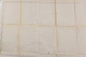
1859 U.S. Coast Survey nautical chart map Florida Reefs to Boca Grande Key
US $125.00
Approximately£94.43
Condition:
- Buy it now1859 U.S. Coast Survey nautical chart map Florida Reefs to Boca Grande Key
Oops! Looks like we're having trouble connecting to our server.
Refresh your browser window to try again.
Postage:
Free USPS Ground Advantage®.
Located in: Lafayette, Colorado, United States
Delivery:
Estimated between Mon, 4 Aug and Sat, 9 Aug to 94104
Returns:
No returns accepted.
Payments:
Shop with confidence
Seller assumes all responsibility for this listing.
eBay item number:197277219420
Item specifics
- Date Range
- 1850-1899
- Type
- Nautical chart
- Format
- Folding Map
- Printing Technique
- Lithography
- US State
- Florida
- Year
- 1859
- Original/Reproduction
- Antique Original
- Cartographer/Publisher
- A. D. Bache
- City
- Key West
- Country/Region
- United States of America
Item description from the seller
About this seller
dprussi7
100% positive Feedback•164 items sold
Registered as a private sellerThereby, consumer rights stemming from EU consumer protection law do not apply. eBay buyer protection still applies to most purchases.
Seller Feedback (72)
- v***v (99)- Feedback left by buyer.Past 6 monthsVerified purchaseFast Shipping and well packed. Very nice item at a good price. Thank you.
- 4***3 (2447)- Feedback left by buyer.Past yearVerified purchaseItem as described 👍, fast shipping 👍 very well packaged 👌 and nice contact 😁 - thank you very much 🌟🌟🌟🌟🌟Vintage Apple Computer lanyard pen Logo “The Power to Be Your Best" 1980s/1990s (#196904356009)
- f***5 (5)- Feedback left by buyer.Past 6 monthsVerified purchaseAs described and quickly despatched. Packaged well. Thank you.
More to explore:
- Antique Nautical Maps,
- Ordnance Survey Map Antique Folding Maps,
- Ordnance Survey Map Antique Atlas Maps,
- Ordnance Survey Map Antique Sheet Maps,
- Antique Ordnance Survey Maps,
- Nautical Map Antique Folding Maps,
- Ordnance Survey Map Antique Europe Sheet Maps,
- Nautical Map Antique Europe Folding Maps,
- Antique World Nautical Maps,
- Antique Europe Ordnance Survey Maps