Picture 1 of 7


Gallery
Picture 1 of 7


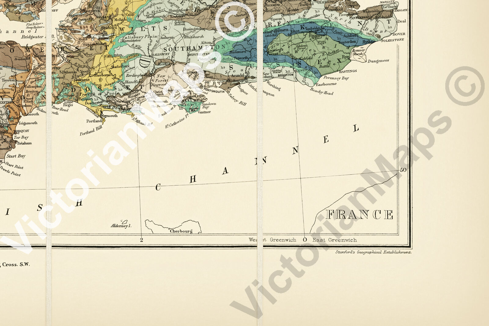

UK British Isles Great Britain geological map Best & Stanford 1893 print poster

VictorianMaps
(644)
Business
£23.70
Condition:
5 available1 sold
- Buy it nowUK British Isles Great Britain geological map Best & Stanford 1893 print poster
Oops! Looks like we're having trouble connecting to our server.
Refresh your browser window to try again.
Returns:
30 days return. Buyer pays for return postage. If you use an eBay delivery label, it will be deducted from your refund amount.
Payments:
Get more time to pay. See payment informationfor PayPal Credit - opens in a new window or tab
Shop with confidence
About this item
Seller assumes all responsibility for this listing.
eBay item number:224748769788
Item specifics
- Cartographer/Publisher
- Edward Best / Edward Stanford
- Printing Technique
- Giclee
- Original/Reproduction
- Reproduction
- Format
- Wall Map / Poster
- Country/Region of Manufacture
- United Kingdom
- Style
- Vintage / Victorian / Antique
- Presentation
- Unframed
- Type
- Geological Map of British Isles
- Original/ Repro
- Reproduction
- Listed by:
- Listed by Self-Representing Artist
- Year
- 1893
- Print surface
- Art paper
- Medium
- Giclee
- Region
- United Kingdom of Great Britain & Ireland
- Exact subject
- Geology map of British Isles
- Date Range
- 1800-1899
- City
- London
- Country/Region
- Great Britain / Ireland, England, Ireland, Scotland, Wales
- Era
- 1800s
Item description from the seller
Seller business information
About this seller

VictorianMaps
100% positive Feedback•2.2K items sold
Registered as a business seller
Popular categories from this shop
Seller Feedback (770)
- 1***9 (78)- Feedback left by buyer.Past monthVerified purchaseExcellent item as described, beautifully packed, arrived swiftly
- 7***r (1114)- Feedback left by buyer.Past 6 monthsVerified purchaseExcellent print of the city of London with old London Bridge, excellent seller, professionally tubed and wrapped, fast delivery, high recommended seller, many thanksRiver Thames Old London Bridge antique map panoramic view Merian 1638 art poster (#225080562685)
- l***l (1851)- Feedback left by buyer.Past 6 monthsVerified purchaseHigh quality print with bright and accurate colours Quick and very secure delivery Excellent comms Arranged rebate for overcharged delivery All excellent thank you highly recommended sellerPyramid of Capitalist System antique communist caricature 1911 art print poster (#226635451388)
More to explore:
- Antique Geological Maps,
- Geological Map Antique Atlas Maps,
- Geological Map Antique Sheet Maps,
- Geological Map Antique Folding Maps,
- Lithography Antique Geological Maps,
- Yorkshire Geological Map Antique Europe Sheet Maps,
- Geological Map Antique Europe Atlas Maps,
- Atlas Geological Map Antique World Maps & Atlases,
- Vintage Original Antique Geological Maps,
- Yorkshire Antique Europe Geological Maps
Popular categories from this shop
Seller Feedback (770)
- 1***9 (78)- Feedback left by buyer.Past monthVerified purchaseExcellent item as described, beautifully packed, arrived swiftly
- 7***r (1114)- Feedback left by buyer.Past 6 monthsVerified purchaseExcellent print of the city of London with old London Bridge, excellent seller, professionally tubed and wrapped, fast delivery, high recommended seller, many thanksRiver Thames Old London Bridge antique map panoramic view Merian 1638 art poster (#225080562685)
- l***l (1851)- Feedback left by buyer.Past 6 monthsVerified purchaseHigh quality print with bright and accurate colours Quick and very secure delivery Excellent comms Arranged rebate for overcharged delivery All excellent thank you highly recommended sellerPyramid of Capitalist System antique communist caricature 1911 art print poster (#226635451388)