Picture 1 of 7


Gallery
Picture 1 of 7


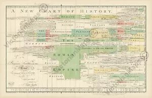
A New Chart of History antique map plan J Priestley 1769 - 1805 art print poster

£23.70
Condition:
6 available1 sold
- Buy it nowA New Chart of History antique map plan J Priestley 1769 - 1805 art print poster
Oops! Looks like we're having trouble connecting to our server.
Refresh your browser window to try again.
Postage:
£22.40 Royal Mail International Tracked & Signed.
Located in: Haslemere, United Kingdom
Delivery:
Estimated between Sat, 21 Jun and Sat, 28 Jun to 94104
Returns:
30 days return. Buyer pays for return postage. If you use an eBay delivery label, it will be deducted from your refund amount.
Payments:
Get more time to pay. See payment informationfor PayPal Credit - opens in a new window or tab
Shop with confidence
Seller assumes all responsibility for this listing.
eBay item number:226169757020
Item specifics
- occasion
- gift, present, souvenir, birthday, Christmas, decoration
- Print surface
- Art paper
- Cartographer/Publisher
- J. Priestley / J. Johnson
- Period
- A New Chart of World History dedicated to Benjamin Franklin
- City
- London
- County
- London
- Date Range
- 1800-1899
- Type
- Thematic Map
- Listed By
- Self-representing artist
- Format
- Wall Map / Poster
- Year
- 1805
- Era
- 1800s
- Medium
- Giclee
- Original/Reproduction
- Reproduction
- Theme
- historical chart / World history civilization empires nations
- Country/Region
- Austria, Constantinople, England, Europe, Finland, France, Germany, Greece, Italy, Malta, Norway, Poland, Prussia, Romania, Russia, Scotland, Spain, Sweden, Turkey, United Kingdom, Wales, Great Britain
- Exact subject
- Old antique decorative folding plan map A New Chart of History
Item description from the seller
Seller business information
About this seller

VictorianMaps
100% positive Feedback•2.1K items sold
Registered as a business seller
Popular categories from this shop
Seller Feedback (715)
- 7***r (786)- Feedback left by buyer.Past monthVerified purchaseExcellent print of the city of London with old London Bridge, excellent seller, professionally tubed and wrapped, fast delivery, high recommended seller, many thanks
- e***c (290)- Feedback left by buyer.Past 6 monthsVerified purchaseSuperb quality print with lovely detail. Arrived in great condition... Well packaged. Great value for quite a large print. Great seller.First Rate Ship of War rigging & section sailing chart 1728 art print poster (#224066244662)
- 9***i (30)- Feedback left by buyer.Past 6 monthsVerified purchaseThe whole experience was a very professional one, I'm over the moon with my purchase, ordering was easy, delivery was quick and very professionally packaged, I couldn't be happier. I will be on the look out for more maps on their site in future. Many thanks. Susanantique guide map early plan of London Westminster Bowles 1800 art print poster (#223244031850)
More to explore:
- Chart Marine & Maritime Antiques,
- 2000-Now Antique Asian Maps (new),
- 2000-Now Antique European Maps (new),
- 1800-1899 Antique European Maps (new),
- 1800-1899 Antique African Maps (new),
- 1800-1899 Antique World Maps (new),
- 2000-Now Antique World Maps (new),
- 1800-1899 Antique Asian Maps (new),
- New York New York Antique Original Antique North America Maps & Atlases,
- New York Antique North America Sheet Maps
Popular categories from this shop
Seller Feedback (715)
- 7***r (786)- Feedback left by buyer.Past monthVerified purchaseExcellent print of the city of London with old London Bridge, excellent seller, professionally tubed and wrapped, fast delivery, high recommended seller, many thanks
- e***c (290)- Feedback left by buyer.Past 6 monthsVerified purchaseSuperb quality print with lovely detail. Arrived in great condition... Well packaged. Great value for quite a large print. Great seller.First Rate Ship of War rigging & section sailing chart 1728 art print poster (#224066244662)
- 9***i (30)- Feedback left by buyer.Past 6 monthsVerified purchaseThe whole experience was a very professional one, I'm over the moon with my purchase, ordering was easy, delivery was quick and very professionally packaged, I couldn't be happier. I will be on the look out for more maps on their site in future. Many thanks. Susanantique guide map early plan of London Westminster Bowles 1800 art print poster (#223244031850)