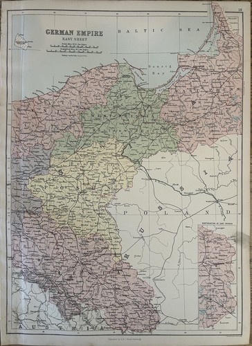
1882 Prussia, Silesia, Posen, East German Empire Original Antique Map
£19.99£19.99
Mon, 19 May, 20:19Mon, 19 May, 20:19
Picture 1 of 3


Gallery
Picture 1 of 3
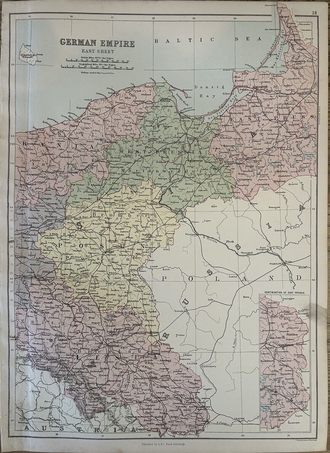


1882 Prussia, Silesia, Posen, East German Empire Original Antique Map
£19.99
or Best Offer
Condition:
“The map is in good condition for its age.”
Oops! Looks like we're having trouble connecting to our server.
Refresh your browser window to try again.
Postage:
£12.00 Parcelforce Global Express.
Located in: Manchester, United Kingdom
Delivery:
Estimated between Tue, 3 Jun and Fri, 6 Jun to 94104
Returns:
60 days return. Seller pays for return postage.
Payments:
Get more time to pay. See payment informationfor PayPal Credit - opens in a new window or tab
Shop with confidence
Seller assumes all responsibility for this listing.
eBay item number:256648186126
Item specifics
- Seller notes
- “The map is in good condition for its age.”
- Date Range
- 1800-1899
- Antique
- Yes
- Type
- Political Map
- Format
- Atlas Map
- Year
- 1882
- Era
- 1800s
- Cartographer/Publisher
- John Bartholomew
- Original/Reproduction
- Antique Original
- Country/Region
- Germany, Poland, Prussia
Item description from the seller
Seller business information
Seller Feedback
No Feedback yet
More to explore:
- Antique Original Geological Map Antique Sheet Maps,
- Antique Original Political Map Antique Sheet Maps,
- Antique Original Nautical Map Antique Sheet Maps,
- Antique Original City Map Antique Wall Maps,
- Antique Original County Map Antique Folding Maps,
- Antique Original County Map Antique Wall Maps,
- Antique Original Antique County Maps,
- Antique Original Antique Nautical Maps,
- Antique Original Antique Folding Maps,
- Antique Original Antique Wall Maps