Picture 1 of 9


Gallery
Picture 1 of 9


Have one to sell?
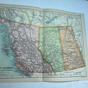
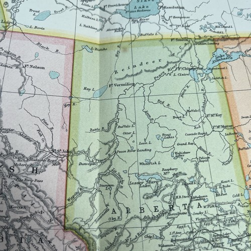
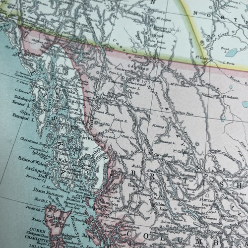
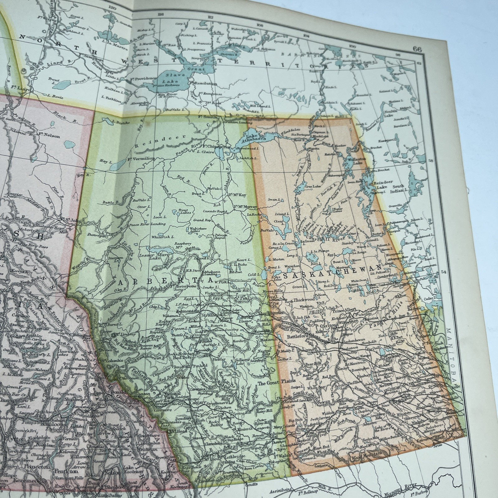
1910: Antique Map Of British Columbia Alberta Saskatchewan CS #66 Antiquarian
£21.18
or Best Offer
Condition:
- Buy it now1910: Antique Map Of British Columbia Alberta Saskatchewan CS #66 Antiquarian
Oops! Looks like we're having trouble connecting to our server.
Refresh your browser window to try again.
Postage:
Located in: Leicester, United Kingdom
Delivery:
Varies
Returns:
No returns accepted.
Payments:
Get more time to pay. See payment informationfor PayPal Credit - opens in a new window or tab
Shop with confidence
Seller assumes all responsibility for this listing.
eBay item number:277202491012
Item specifics
- Date Range
- 1910-1919
- Antique
- Yes
- Type
- Political Map
- Format
- Folding Map
- Printing Technique
- Lithography
- Year
- 1910
- Canadian Province
- Saskatchewan, Alberta
- Era
- 1910s
- Original/Reproduction
- Antique Original
- Cartographer/Publisher
- John Bartholomew
Item description from the seller
About this seller
hiddentreasure-uk
99.1% positive Feedback•5.4K items sold
Registered as a private sellerThereby, consumer rights stemming from EU consumer protection law do not apply. eBay buyer protection still applies to most purchases.
Seller Feedback (2,009)
- c***e (474)- Feedback left by buyer.Past 6 monthsVerified purchaseA lovely spoon in perfect condition. It is even better than as described and offers great value. The item was packaged carefully and posted promptly. Helpful communication from the seller combined to make this a perfect transaction - many thanks. Highly recommended A++++++++++++
- *****- Feedback left by buyer.Past 6 monthsVerified purchaseItem good as described. Well packaged. Communication good over problem of Royal Mail tardiness ( not seller's fault at all). Overall I can recommend Royal Mail notwithstanding.
- o***u (1045)- Feedback left by buyer.Past 6 monthsVerified purchaseBeautiful pictures & lovely frames. Very well packaged and arrived safely and exactly as expected. A1 seller
More to explore:
- Antique North American Maps & Atlases Saskatchewan,
- Antique North American Maps & Atlases British Columbia,
- British Columbia Antique North America Atlas Maps,
- British Columbia Antique Original Antique North America Maps & Atlases,
- Antique North American Maps & Atlases Alberta,
- 1910-1919 Antique Ordnance Survey Maps,
- District of Columbia Antique North American Maps & Atlases,
- 1910-1919 Date Range Antique Sheet Maps,
- Antique Original 1910-1919 Date Range Antique Atlas Maps,
- 1910-1919 Date Range Ordnance Survey Map Antique Folding Maps