Picture 1 of 4


Gallery
Picture 1 of 4


Have one to sell?
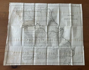
Lg 1849 US Public Survey Map Of Missouri

Condition:
Oops! Looks like we're having trouble connecting to our server.
Refresh your browser window to try again.
Postage:
Located in: Kalamazoo, Michigan, United States
Delivery:
Varies
Returns:
No returns accepted.
Payments:
Shop with confidence
Seller assumes all responsibility for this listing.
eBay item number:277294225889
Item specifics
- Date Range
- 1800-1899
- Type
- Government Survey Map
- Printing Technique
- Lithography
- US State
- Missouri
- Format
- Folding Map
- Year
- 1849
- Cartographer/Publisher
- U.S. Government
- Original/Reproduction
- Antique Original
Item description from the seller
About this seller
zootiques
100% positive Feedback•1.5K items sold
Registered as a private sellerThereby, consumer rights stemming from EU consumer protection law do not apply. eBay buyer protection still applies to most purchases.
Seller Feedback (946)
- 7***7 (156)- Feedback left by buyer.Past 6 monthsVerified purchaseJoe is always great to work with. He answers any and all questions quickly, items come fast and as advertised. Great seller!
- p***k (2837)- Feedback left by buyer.Past monthVerified purchaseSmooth ebay transaction; safely wrapped; speedy delivery. ★★★★★
- u***d (620)- Feedback left by buyer.Past monthVerified purchaseAs described! Safe shipping ! Thanks
More to explore:
- Missouri Antique North America Railroad Maps,
- Missouri Antique North America Sheet Maps,
- Missouri Antique North America City Maps,
- Missouri Antique North America River Maps,
- Missouri Antique North America County Maps,
- Ordnance Survey Map Antique Folding Maps,
- Antique Ordnance Survey Maps,
- Ordnance Survey Map Antique Europe Sheet Maps,
- Ordnance Survey Map Antique Europe Wall Maps,
- Londonderry Ordnance Survey Map Antique Europe Sheet Maps
zootiques
100% positive Feedback•1.5K items sold
Registered as a private sellerThereby, consumer rights stemming from EU consumer protection law do not apply. eBay buyer protection still applies to most purchases.
Seller Feedback (946)
- 7***7 (156)- Feedback left by buyer.Past 6 monthsVerified purchaseJoe is always great to work with. He answers any and all questions quickly, items come fast and as advertised. Great seller!
- p***k (2837)- Feedback left by buyer.Past monthVerified purchaseSmooth ebay transaction; safely wrapped; speedy delivery. ★★★★★
- u***d (620)- Feedback left by buyer.Past monthVerified purchaseAs described! Safe shipping ! Thanks