
1873 Mitchell's Map of Prussia and the German States, Authentic Hand-colored
US $100.00US $100.00
Mon, 28 Apr, 14:31Mon, 28 Apr, 14:31
Picture 1 of 9


Gallery
Picture 1 of 9
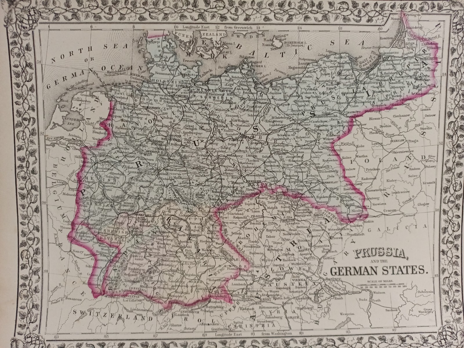


1873 Mitchell's Map of Prussia and the German States, Authentic Hand-colored
US $100.00
Approximately£73.92
or Best Offer
Condition:
“Very good condition with slight wear and browning along the edges. No rips extend beyond the border ”... Read moreAbout condition
Oops! Looks like we're having trouble connecting to our server.
Refresh your browser window to try again.
Postage:
US $11.95 (approx £8.83) Economy Shipping.
Located in: Swampscott, Massachusetts, United States
Delivery:
Estimated between Fri, 13 Jun and Sat, 21 Jun to 94104
Returns:
30 days return. Buyer pays for return postage. If you use an eBay delivery label, it will be deducted from your refund amount.
Payments:
Shop with confidence
Seller assumes all responsibility for this listing.
eBay item number:326224630517
Item specifics
- Seller notes
- Year
- 1873
- Date Range
- 1800-1899
- Type
- Political Map
- Printing Technique
- Lithography
- Format
- Atlas Map
- State
- Bavaria
- Cartographer/Publisher
- Samuel Augustus Mitchell
- Original/Reproduction
- Antique Original
- Country/Region
- Prussia, Germany
Item description from the seller
About this seller
bigstarchild1968
100% positive Feedback
Registered as a private sellerThereby, consumer rights stemming from EU consumer protection law do not apply. eBay buyer protection still applies to most purchases.
Seller Feedback
No Feedback yet
More to explore:
- Manuscript/Hand drawn Antique Maps, Atlases & Globes,
- Antique S & N Buck European Maps & Atlases,
- S & N Buck Antique Maps, Atlases & Globes,
- Topographical Map Antique Atlas Maps,
- City Map Antique Atlas Maps,
- City Map Antique Folding Maps,
- County Map Antique Folding Maps,
- County Map Antique Sheet Maps,
- Geological Map Antique Sheet Maps,
- Topographical Map Antique Folding Maps