
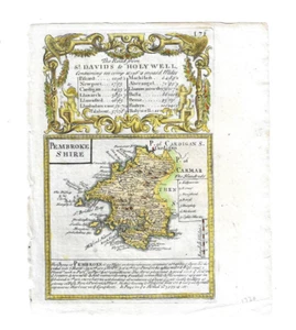
c.1720 MAP OF PEMBROKESHIRE WALES HAND-COLOURED FROM BOWLES BRITANNIA DEPICTA?
£45.96£45.96
incl. £2.06 for fee
Sun, 13 Jul, 18:28Sun, 13 Jul, 18:28
Picture 1 of 2

Gallery
Picture 1 of 2


Have one to sell?
c.1720 MAP OF PEMBROKESHIRE WALES HAND-COLOURED FROM BOWLES BRITANNIA DEPICTA?
Condition:
“Please look at scans and e-mail if more information is required. Uneven edge on left where removed ”... Read moreAbout condition
Ended: 13 Jul, 2025 18:28:35 BST
Oops! Looks like we're having trouble connecting to our server.
Refresh your browser window to try again.
Postage:
Located in: London, United Kingdom
Delivery:
Varies
Returns:
No returns accepted.
Payments:
Get more time to pay. See payment informationfor PayPal Credit - opens in a new window or tab
Shop with confidence
Seller assumes all responsibility for this listing.
eBay item number:336052817814
Item specifics
- Seller notes
- Antique
- Yes
- Date Range
- c.1720
- Type
- County Map
- Format
- Sheet Map
- Year
- 1720
- Original/Reproduction
- Antique Original
- Cartographer/Publisher
- ?John Bowen Emmanuel Owen
- Country/Region
- Wales
- County
- Pembrokeshire, Surrey
Item description from the seller
About this seller
moscow1910
100% positive Feedback•2.2K items sold
Registered as a private sellerThereby, consumer rights stemming from EU consumer protection law do not apply. eBay buyer protection still applies to most purchases.
Seller Feedback (1,267)
- *****- Feedback left by buyer.Past 6 monthsVerified purchaseBest thing I’ve bought this year , certainly lived up to the description was well wrapped for something so delicate arriving on time at reasonable cost thanks again A* eBayer
- *****- Feedback left by buyer.Past 6 monthsVerified purchaseSuch a lovely thing, I’m so happy to have it! This was wrapped very well, shipped quickly, and arrived to me in the US in perfect shape. Exactly as described, only even more lovely in person. Excellent experience, wonderful seller!
- *****- Feedback left by buyer.Past 6 monthsVerified purchaseGreat seller! The book arrived just as described and was well packaged. Thank you
This is a private listing and your identity will not be disclosed to anyone except the seller.
More to explore:
- Pembrokeshire Antique Europe County Maps,
- Pembrokeshire Antique Europe Atlas Maps,
- Antique European Maps & Atlases Pembrokeshire,
- Pembrokeshire Antique Europe Sheet Maps,
- Pembrokeshire Antique Europe Ordnance Survey Maps,
- Pembrokeshire Antique Original Antique European Maps & Atlases,
- Antique European Maps & Atlases Pembrokeshire 1700-1799 Date Range,
- New South Wales Antique Australia/Oceania Sheet Maps,
- New South Wales Melbourne Antique Australia/Oceania Maps & Atlases,
- Manuscript/Hand drawn Antique Maps, Atlases & Globes