Picture 1 of 14


Gallery
Picture 1 of 14


Have one to sell?
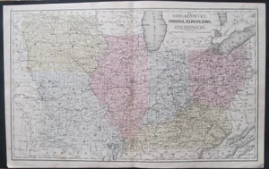
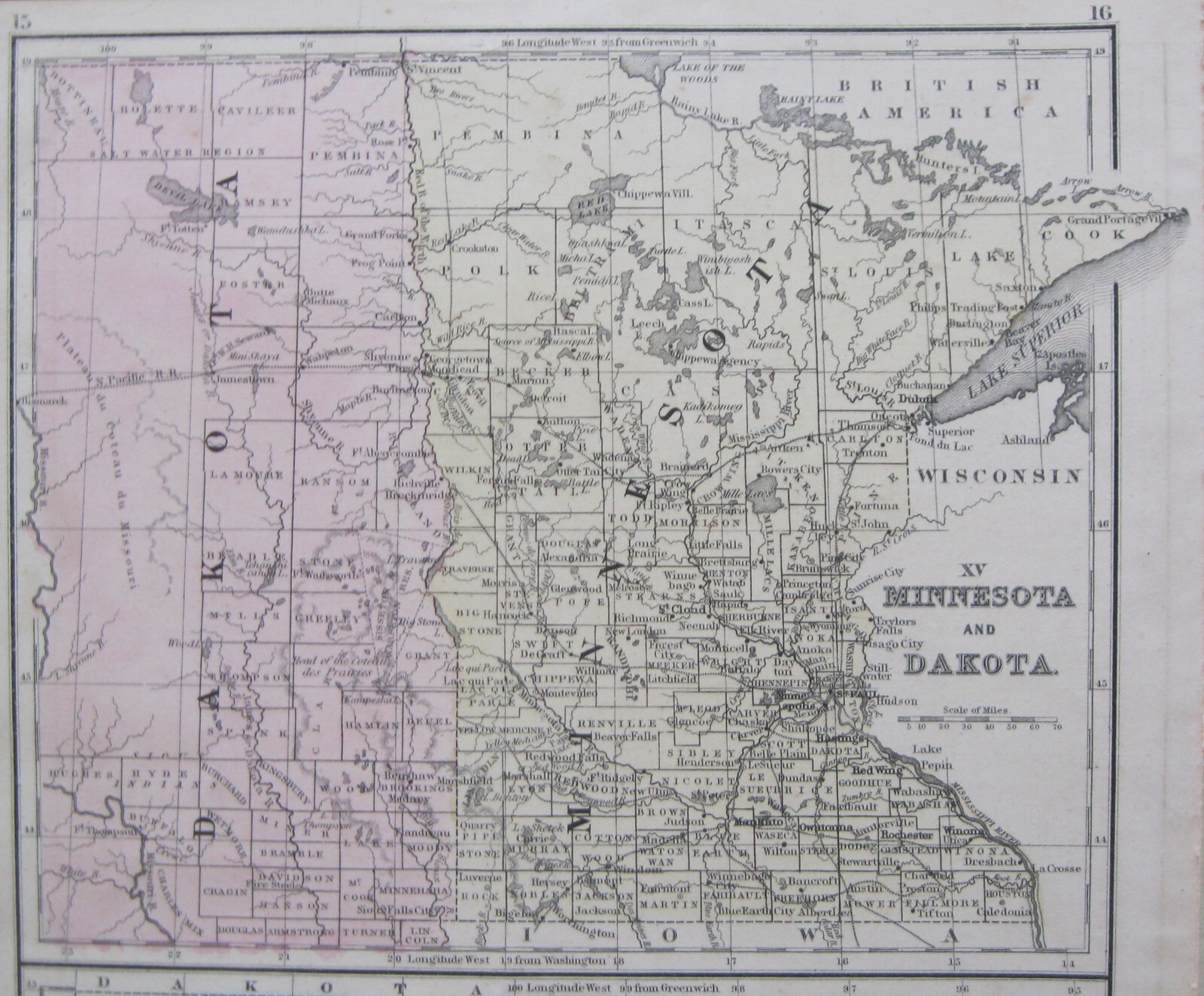
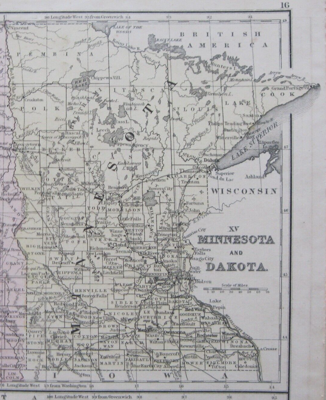
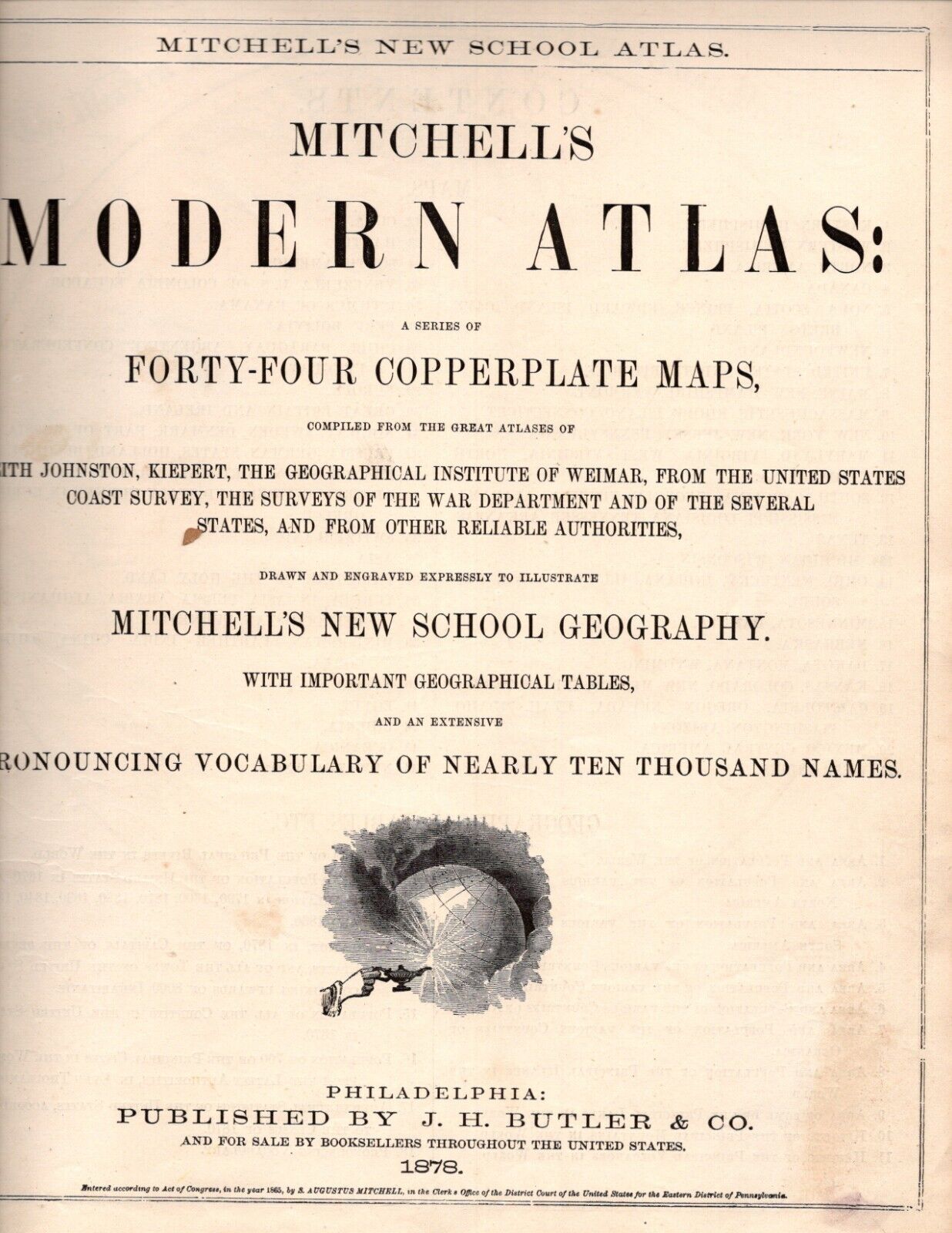
4 Mitchell Maps of 1870 Midwest-1.OH,K

US $44.95
Approximately£33.96
or Best Offer
Condition:
“good-very sharp, bright and clean-double sided double folded”
- Buy it now4 Mitchell Maps of 1870 Midwest-1.OH,KY,IN,IL,IA&MO-2.Dakota,MN-3.NE, 4.WI & MI
Oops! Looks like we're having trouble connecting to our server.
Refresh your browser window to try again.
Postage:
US $8.75 (approx £6.61) USPS Ground Advantage®.
Located in: Bar Harbor, Maine, United States
Delivery:
Estimated between Sat, 2 Aug and Wed, 6 Aug to 94104
Returns:
No returns accepted.
Payments:
Shop with confidence
Seller assumes all responsibility for this listing.
eBay item number:355943757258
Item specifics
- Seller notes
- “good-very sharp, bright and clean-double sided double folded”
- Date Range
- 1870-1880
- Format
- Atlas Map
- Printing Technique
- Copper Plate
- US State
- Illinois, Indiana, Iowa, Kentucky, Michigan, Minnesota, Missouri, Nebraska, Ohio, Wisconsin
- Year
- 1870
- U.S. Territories
- Dakota
- Size
- 9.2" x 11.5
- Original/Reproduction
- Antique Original
- Cartographer/Publisher
- Samuel Augustus Mitchell
- Publisher
- J. H. Butler & Co.
- Country/Region
- United States of America
Item description from the seller
About this seller
studioc
100% positive Feedback•2.4K items sold
Registered as a private sellerThereby, consumer rights stemming from EU consumer protection law do not apply. eBay buyer protection still applies to most purchases.
Seller Feedback (1,536)
- s***t (422)- Feedback left by buyer.Past yearVerified purchaseA+ seller, fast shipping, well packaged, just as described. Great value.Original 1876 Mitchell Map of Asia with Palestine or the Holy Land insert (#356272854592)
- 0***3 (577)- Feedback left by buyer.Past yearVerified purchaseItem arrived WELL packaged, undamaged and on time. Item was as described. Easy transaction, Great Service. Thank you!!Rare ca.1912 Original Antique Hammond Map Grand Duchy of Finland showing Lapland (#356265319303)
- l***a (567)- Feedback left by buyer.Past 6 monthsVerified purchaseAs advertised, quick delivery,A++
More to explore:
- Antique North American Maps & Atlases North Dakota,
- North Dakota Antique North American Maps & Atlases 1920-1929 Date Range,
- North Dakota Antique North American Maps & Atlases 1900-1909 Date Range,
- Nautical Map Antique Folding Maps,
- City Map Antique Sheet Maps,
- River Map Antique Sheet Maps,
- Topographical Map Antique Atlas Maps,
- County Map Antique Atlas Maps,
- Topographical Map Antique Folding Maps,
- Physical Map Antique Atlas Maps
studioc
100% positive Feedback•2.4K items sold
Registered as a private sellerThereby, consumer rights stemming from EU consumer protection law do not apply. eBay buyer protection still applies to most purchases.
Seller Feedback (1,536)
- s***t (422)- Feedback left by buyer.Past yearVerified purchaseA+ seller, fast shipping, well packaged, just as described. Great value.Original 1876 Mitchell Map of Asia with Palestine or the Holy Land insert (#356272854592)
- 0***3 (577)- Feedback left by buyer.Past yearVerified purchaseItem arrived WELL packaged, undamaged and on time. Item was as described. Easy transaction, Great Service. Thank you!!Rare ca.1912 Original Antique Hammond Map Grand Duchy of Finland showing Lapland (#356265319303)
- l***a (567)- Feedback left by buyer.Past 6 monthsVerified purchaseAs advertised, quick delivery,A++