Picture 1 of 5


Gallery
Picture 1 of 5


Have one to sell?
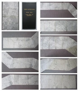
THE RIVER SOAR Leicestershire LARGE 15 Foot Folding MAP Trent River Board 1956

£125.00
From £11.12 per month for 12 months with *
Condition:
- Buy it nowTHE RIVER SOAR Leicestershire LARGE 15 Foot Folding MAP Trent River Board 1956
Oops! Looks like we're having trouble connecting to our server.
Refresh your browser window to try again.
Postage:
£19.00 Royal Mail International Tracked.
Located in: Telford, United Kingdom
Delivery:
Estimated between Tue, 12 Aug and Mon, 18 Aug to 94104
Returns:
No returns accepted.
Payments:
*From £11.12 per month for 12 months.
Shop with confidence
Seller assumes all responsibility for this listing.
eBay item number:356553833132
Item specifics
- Antique
- Yes
- Printing Technique
- Lithography
- Cartographer/Publisher
- Ordnance Survey
- City
- River Soar
- County
- Leicestershire
- Date Range
- 1950-1959
- Type
- Ordnance Survey Map
- Format
- Folding Map
- Year
- 1956
- Era
- 1950s
- State
- United Kingdom (+44)
- Original/Reproduction
- Antique Original
- Country/Region
- United Kingdom
Item description from the seller
Seller business information
VAT number: GB 283902977
CRN: 08950303

Seller Feedback (15,826)
- r***t (416)- Feedback left by buyer.Past 6 monthsVerified purchaseExcellent , fast dispatch / delivery , very well wrapped and packed with bubble wrap , strong card surround. Book as described . Very pleased with purchase and seller . 10/10Arthur Conan Doyle THE LOST WORLD Signed by 10 Members of MOVIE FILM CAST (#356557177307)
- 8***6 (447)- Feedback left by buyer.Past 6 monthsVerified purchasevery carefully packed, sent promptly & kept informed of progress. great seller, thanks
- 8***1 (168)- Feedback left by buyer.Past monthVerified purchasePostage was good, quick, well packaged. As described and good value, beautiful thank you
More to explore:
- Leicestershire Antique Europe Folding Maps,
- Antique River Maps,
- River Map Antique Sheet Maps,
- Antique Europe River Maps,
- Antique World River Maps,
- Antique Africa River Maps,
- 1800-1899 Date Range Antique River Maps,
- 1920-1929 Date Range Antique River Maps,
- Leicestershire Antique Europe Topographical Maps,
- 1910-1919 Date Range Antique Europe River Maps
Seller Feedback (15,826)
- r***t (416)- Feedback left by buyer.Past 6 monthsVerified purchaseExcellent , fast dispatch / delivery , very well wrapped and packed with bubble wrap , strong card surround. Book as described . Very pleased with purchase and seller . 10/10Arthur Conan Doyle THE LOST WORLD Signed by 10 Members of MOVIE FILM CAST (#356557177307)
- 8***6 (447)- Feedback left by buyer.Past 6 monthsVerified purchasevery carefully packed, sent promptly & kept informed of progress. great seller, thanks
- 8***1 (168)- Feedback left by buyer.Past monthVerified purchasePostage was good, quick, well packaged. As described and good value, beautiful thank you