
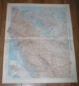
1957 VINTAGE MAP OF BRITISH COLUMBIA ALBERTA NORTHWEST TER. / SCALE 1:5,000,000
US $41.60US $41.60
Thu, 31 Jul, 03:28Thu, 31 Jul, 03:28
Picture 1 of 16


Gallery
Picture 1 of 16


Have one to sell?
1957 VINTAGE MAP OF BRITISH COLUMBIA ALBERTA NORTHWEST TER. / SCALE 1:5,000,000
US $41.60
Approximately£31.33
or Best Offer
Condition:
“WAVED ALONG THE CENTERFOLD”
Oops! Looks like we're having trouble connecting to our server.
Refresh your browser window to try again.
Postage:
Free Standard Shipping from Canada.
Located in: Montreal, Quebec, Canada
Delivery:
Estimated between Wed, 6 Aug and Mon, 11 Aug to 94104
Returns:
60 days return. Seller pays for return postage.
Payments:
Shop with confidence
Seller assumes all responsibility for this listing.
eBay item number:406073305086
Item specifics
- Seller notes
- “WAVED ALONG THE CENTERFOLD”
- Date Range
- 1950-1959
- US State
- Alaska
- Year
- 1957
- Canadian Province
- Alberta, British Columbia, Northwest Territories, Saskatchewan, Yukon
- City
- Vancouver
Item description from the seller
Seller business information
Seller Feedback
No Feedback yet
More to explore:
- Antique North American Maps & Atlases British Columbia,
- British Columbia Antique North America Atlas Maps,
- Antique North American Maps & Atlases Alberta,
- British Columbia Antique Original Antique North America Maps & Atlases,
- District of Columbia Antique North American Maps & Atlases,
- Vintage Original County Map Antique Sheet Maps,
- Vintage Original Nautical Map Antique Sheet Maps,
- Vintage Original Antique Sheet Maps,
- Vintage Original Antique School Maps,
- Vintage Original Antique Atlas Maps