Hi
!
Hello.
Sign in
or
register
Local
Daily Deals
Fashion
Help & Contact
Sell
Watch List
Expand watch list
My eBay
Expand My eBay
Summary
Recently Viewed
Bids/Offers
Watch List
Purchase History
Selling
Saved feed
Saved Searches
Saved Sellers
My Garage
Sizes
Messages
Expand Notifications
Please
sign in
to view notifications.
Expand Basket
Loading...
eBay Home
Shop by category
Enter your search keyword
All Categories
Search
Advanced
breadcrumb
eBay
Media
Books, Comics & Magazines
Media
Books, Comics & Magazines
Textbooks, Education & Reference
Maps & Atlases
Picture 1 of 4
Picture 1 of 4
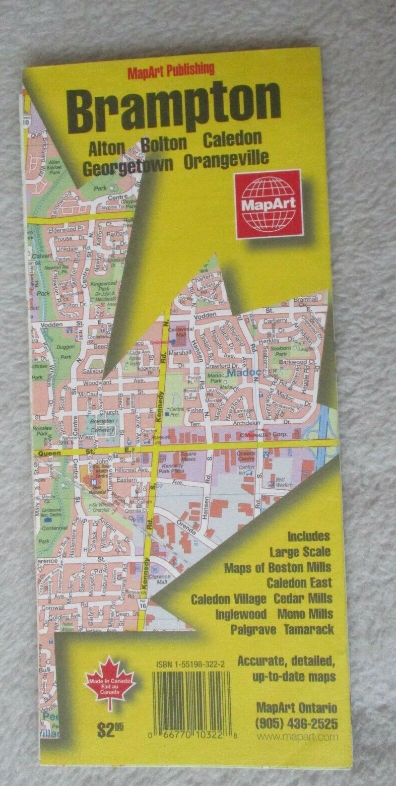
Brampton, Acton, Bolton, Caledon by Mapart Publishing (Sheet map, folded, 1999)
O
oliver335-2013 (1968)
100% positive Feedback
Price:
£5.16
Free delivery in 2-3 days
Estimated between
Sat, 19 Jul
and
Mon, 21 Jul
Returns:
14 days return
.
Buyer pays for return postage. If you use an eBay delivery label, it will be deducted from your refund amount
.
Condition:
Very Good
Very Good
Double sided folding paper map.
See full description
Buy it now
Canada Street Plan Brampton MapArt Publishing folding paper map
Sign in to check out
Check out as guest
Add to basket
See all details
Oops! Looks like we're having trouble connecting to our server.
Refresh your browser window to try again.
About this product
Product Identifiers
Publisher
Mapart Publishing
ISBN-10
1551983222
ISBN-13
9781551983226
eBay Product ID (ePID)
202258241
Product Key Features
Subject
Atlases, Maps & Travel, Travel & Holiday Guides: General
Language
English
Format
Sheet Map, Folded
Additional Product Features
Date of Publication
01/01/1999
Country/Region of Manufacture
United States
Show more
Show less
No ratings or reviews yet
Be the first to
write a review
Best-selling in Maps & Atlases
See all
The Peak District: White Peak Area (Sheet map, 2020)
£9.99 New
£9.99 New
£7.19 Used
£7.19 Used
Michelin Road Atlas Europe by Michelin (Spiral bound, 2012)
(2)
£12.01 New
£12.01 New
£10.09 Used
£10.09 Used
Michelin France Road Atlas by Michelin (Paperback / softback, 2014)
(3)
£12.01 New
£12.01 New
£8.09 Used
£8.09 Used
Canal and River Cruising Planner of Great Britain: 2018 (Sheet map, 2018)
(2)
£8.33 New
£8.33 New
£6.49 Used
£6.49 Used
Lake District & Cumbria (Sheet map, 2020)
(6)
£6.24 New
£6.24 New
£4.79 Used
£4.79 Used
Battle of Normandy - Michelin Historical Map 102: Map (Sheet map, 1997)
(7)
£6.98 New
£6.98 New
£5.99 Used
£5.99 Used
Bob Graham Round: Lakeland Fells by Harvey Map Services Ltd. (Sheet map, 2009)
(6)
£16.34 New
£16.34 New
£10.46 Used
£10.46 Used
Save on Maps & Atlases
Trending price is based on prices over last 90 days.
NC500 Pocket Map: Plan Your Adventure on Scotland’s North Coast 500 Route
£5.62
Trending at
£5.62
MacGillycuddy's Reeks & Killarney National Park, O
£16.79
Trending at
£17.05
Northern Spain: Travel Maps International Adventure Map by National Geographic M
£13.45
Trending at
£14.20
Cheltenham A-Z Pocket Street Map
£5.06
Trending at
£5.94
Donegal Ireland 2018 Xploreit County Map Xploreit County Series 6
£14.94
Trending at
£15.96
Scarborough Bridlington and Flamborough Head Explorer Map 301
£9.95
Trending at
£11.36
You may also like
Sheet and Folded Maps for European Region
Sheet and Folded Maps for UK Region
Maps & Atlases Folding Map 1950-1999 Publication Year
Cycling Maps Folding Maps
City Maps Folding Maps
Folding Map Maps & Atlases