Hi
!
Hello.
Sign in
or
register
Local
Daily Deals
Fashion
Help & Contact
Sell
Watch List
Expand watch list
My eBay
Expand My eBay
Summary
Recently Viewed
Bids/Offers
Watch List
Purchase History
Selling
Saved feed
Saved Searches
Saved Sellers
My Garage
Sizes
Messages
Expand Notifications
Please
sign in
to view notifications.
Expand Basket
Loading...
eBay Home
Shop by category
Enter your search keyword
All Categories
Search
Advanced
breadcrumb
eBay
Media
Books, Comics & Magazines
Media
Books, Comics & Magazines
Textbooks, Education & Reference
Maps & Atlases
Picture 1 of 1
Stock photo
Picture 1 of 1
Stock photo
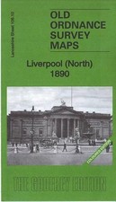
Liverpool (North) 1890: Lancashire Sheet 106.10A: Coloured Edition by Kay Parrott (Sheet map, 2015)
BookCurl (1142)
99.7% positive Feedback
Price:
£7.25
Free postage
Estimated by
Sat, 21 Jun - Thu, 26 Jun
Estimated delivery Sat, 21 Jun - Thu, 26 Jun
Returns:
14 days return
.
Buyer pays for return postage. If you use an eBay delivery label, it will be deducted from your refund amount
.
Condition:
New
New
See full description
Buy it now
Liverpool (North) 1890: Lancashire Sheet 978-1847849236 NEW Free Delivery
Sign in to check out
Check out as guest
Add to basket
See all details
Oops! Looks like we're having trouble connecting to our server.
Refresh your browser window to try again.
About this product
Product Identifiers
Publisher
Alan Godfrey Maps
ISBN-13
9781847849236
eBay Product ID (ePID)
233732979
Product Key Features
Publication Year
2015
Subject
History
Language
English
Publication Name
Liverpool (North) 1890: Lancashire Sheet 106.10 A: Coloured Edition
Type
Textbook
Author
Kay Parrott
Format
Sheet Map
Additional Product Features
Country/Region of Manufacture
United Kingdom
Title_Author
Kay Parrott
Series Title
Old Ordnance Survey Maps of Lancashire
Topic
Local History
Show more
Show less
All listings for this product
Listing type
Buy it now
Buy it now
Condition
-
New
Last one
MAP OF Liverpool (North) 1890: Lancashire Sheet 106.10A: Coloured Edition NEW
item 1 MAP OF Liverpool (North) 1890: Lancashire Sheet 106.10A: Coloured Edition NEW
£2.65
+ £2.50 postage
Last one
Liverpool North 1890 by Kay Parrott | Sheet Map | 2015
item 2 Liverpool North 1890 by Kay Parrott | Sheet Map | 2015
£5.35
Free postage
Coloured Edition (Old Ordnance Survey Maps of Lancashire) by Kay Parrott
item 3 Coloured Edition (Old Ordnance Survey Maps of Lancashire) by Kay Parrott
£6.22
Free postage
Liverpool North 1890 Lancashire Sheet 106.10A by Kay Parrott NEW Sheet map fol
item 4 Liverpool North 1890 Lancashire Sheet 106.10A by Kay Parrott NEW Sheet map fol
£6.35
Free postage
Kay Parrott Liverpool (North) 1890: Lancashire Sheet 106.10A (Map)
item 5 Kay Parrott Liverpool (North) 1890: Lancashire Sheet 106.10A (Map)
£7.18
Free postage
Liverpool (North) 1890: Lancashire Sheet 978-1847849236 NEW Free Delivery
item 6 Liverpool (North) 1890: Lancashire Sheet 978-1847849236 NEW Free Delivery
£7.25
Free postage
Liverpool (North) 1890: Lancashire Sheet 106.10A: Colou - Sheet map, folded NEW
item 7 Liverpool (North) 1890: Lancashire Sheet 106.10A: Colou - Sheet map, folded NEW
£7.55
Free postage
Liverpool (North) 1890: Lancashire Sheet 106.10A,
item 8 Liverpool (North) 1890: Lancashire Sheet 106.10A,
£7.88
Free postage
LIVERPOOL NORTH 1890 (Map) (9781847849236)
item 9 LIVERPOOL NORTH 1890 (Map) (9781847849236)
£8.76
Free postage
See all 9
listings for this product
No ratings or reviews yet
Be the first to
write a review
Best-selling in Maps & Atlases
See all
Lonely Planet Europe Planning Map by Lonely Planet (Sheet map, 2017)
(3)
£6.98 New
£6.98 New
£5.09 Used
£5.09 Used
Lonely Planet Vietnam Planning Map by Lonely Planet (Sheet map, 2018)
(5)
£7.17 New
£7.17 New
£5.49 Used
£5.49 Used
Canal and River Cruising Planner of Great Britain: 2018 (Sheet map, 2018)
(2)
£7.66 New
£7.66 New
£5.29 Used
£5.29 Used
Battle of Normandy - Michelin Historical Map 102: Map (Sheet map, 1997)
(6)
£6.92 New
£6.92 New
£6.49 Used
£6.49 Used
Llangollen and Montgomery Canal by Heron Maps (Paperback, 2020)
(3)
£7.42 New
£7.42 New
---- Used
No used products available
Lonely Planet Southeast Asia Planning Map by Lonely Planet (Sheet map, 2019)
(2)
£5.98 New
£5.98 New
£5.70 Used
£5.70 Used
North York Moors - Eastern Area by Ordnance Survey (Sheet map, 2015)
(13)
£9.99 New
£9.99 New
£6.50 Used
£6.50 Used
Save on Maps & Atlases
Trending price is based on prices over last 90 days.
Walking the South West Coast Path: National Trail From Minehead to South Haven P
£14.33
Trending at
£15.25
NEW OS Explorer OL27 North York Moors Eastern Area OS Explorer Map
£9.95
Trending at
£10.72
Cheltenham A-Z Pocket Street Map
£5.06
Trending at
£5.99
Lincolnshire Wolds South: Ordnance Survey Explorer Map 2015 Mobile Download NEW
£11.11
Trending at
£11.34
Cycling the Canal Du MIDI: Across Southern France from - Paperback NEW Lyons, D
£11.99
Trending at
£12.51
Cairn Gorm and Aviemore Ordnance Survey Explorer Map OL 57
£9.99
Trending at
£10.88
You may also like
Sheet and Folded Maps for European Region
Sheet and Folded Maps for UK Region
Revised Edition Maps & Atlases
Special Edition Maps & Atlases
1st Edition Maps & Atlases
Wales 1st Edition Maps & Atlases