Picture 1 of 1

Picture 1 of 1
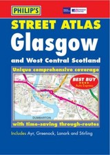
Glasgow and West Central Scotland Street Atlas: Pocket Edition by Great Britain (Paperback, 2002)

The Cotswold Library (778242)
99.3% positive Feedback
Price:
£2.49
Free postage
Returns:
30 days return. Buyer pays for return postage. If you use an eBay delivery label, it will be deducted from your refund amount.
Condition:
Edition: 3rd Revised edition. Weight: 322 Gms. Authors: Britain, Great. Pages: 312. Publish Date: 11/11/2002.
- Buy it nowGlasgow and West Central Scotland Street Atlas: Pocket Edition (Pocket Street At
Oops! Looks like we're having trouble connecting to our server.
Refresh your browser window to try again.
About this product
Product Information
This atlas uses Ordnance Survey mapping to give coverage of all urban and rural areas. The mapping is at a standard scale of 2.5 inches to 1 mile and shows postcode boundaries. There is a route-planning map and anan administrative map at the front of the atlas. The main maps show every named road, street and lane, with through-routes highlighted. School locations are marked and emergency services, hospitals, police stations, car parks and rail and bus stations are all featured. The index shows all street names and postcodes.Product Identifiers
PublisherOctopus
ISBN-139780540082780
eBay Product ID (ePID)86410046
Product Key Features
Number of Pages312 Pages
Publication NameGlasgow and West Central Scotland Street Atlas: Pocket Edition
LanguageEnglish
SubjectTransportation
Publication Year2002
TypeCity Map
AuthorGreat Britain
FormatPaperback
Dimensions
Item Height192 mm
Item Weight320 g
Item Width132 mm
Additional Product Features
Country/Region of ManufactureUnited Kingdom
Title_AuthorGreat Britain
All listings for this product


Be the first to write a review


