Picture 1 of 2

Stock photo


Picture 1 of 2
Stock photo
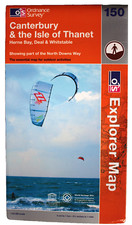
Canterbury and the Isle of Thanet by Ordnance Survey (Sheet map, 2007)

World of Books Ltd (10345585)
98.5% positive Feedback
Price:
£7.49
Free postage
Returns:
30 days return. Buyer pays for return postage. If you use an eBay delivery label, it will be deducted from your refund amount.
Condition:
Canterbury and the Isle of Thanet: Sheet 150 (OS Explorer Map). Author:Ordnance Survey. Publisher:Ordnance Survey. Book Binding:Sheet map, folded. In 2002, World of Books was founded on an ethos to do good, protect the planet, and support charities by enabling more goods to be reused.
- Buy it nowCanterbury and the Isle of Thanet (Explo... by Ordnance Survey Sheet map, folded
Oops! Looks like we're having trouble connecting to our server.
Refresh your browser window to try again.
About this product
Product Information
OS Explorer Map is the Ordnance Survey's most detailed map and is recommended for anyone enjoying outdoor activities like walking, horse riding and off-road cycling. Providing complete GB coverage the series details essential information such as youth hostels, pubs and visitor information as well as rights of way, permissive paths and bridleways.Product Identifiers
PublisherOrdnance Survey
ISBN-139780319239285
eBay Product ID (ePID)88444011
Product Key Features
Publication Year2007
SubjectTransportation, Sports
LanguageEnglish
Publication NameCanterbury and the Isle of Thanet
TypeTravel Maps
Map Scale1:25,000
AuthorOrdnance Survey
FormatSheet Map
Dimensions
VolumeSheet 150
Additional Product Features
Country/Region of ManufactureUnited Kingdom
Title_AuthorOrdnance Survey
Series TitleOs Explorer Map
All listings for this product


Ratings and reviews
Most relevant reviews
- 05 Dec, 2018
OS Map
It's what I wanted.Verified purchase: YesCondition: Pre-owned


![Morocco - Michelin National Map 742: Map by Michelin [Sheet map, folded]](https://i.ebayimg.com/images/g/h5kAAeSw9rJoUhXg/s-l225.jpg)