Picture 1 of 1
Stock photo

Picture 1 of 1
Stock photo

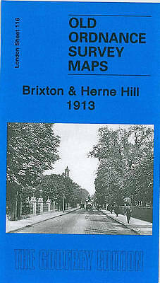
Brixton and Herne Hill 1913: London Sheet 116.3 by Pamela Taylor (Sheet map, 2008)

GENERATIONS GONE BY EDDIE 10_10 (52653)
100% positive Feedback
Price:
£4.50
+ £2.50 postage
Returns:
30 days return. Buyer pays for return postage. If you use an eBay delivery label, it will be deducted from your refund amount.
Condition:
We have published three versions of this map, showing how the area developed across the years. The left half of the map comprises Brixton, with Brixton Hill running north-south through the map. Further east is Herne Hill, and Herne Hill itself runs northward through the map, lined with villas, many in grounds.
- Buy it nowMAP OF Brixton and Herne Hill 1913: London Sheet 116.3 by Pamela Taylor NEW
Oops! Looks like we're having trouble connecting to our server.
Refresh your browser window to try again.
About this product
Product Information
An Old Ordnance Survey Map of Brixton & Herne Hill in 1913. It includes an historical introduction by Pamela Taylor.Product Identifiers
PublisherAlan Godfrey Maps
ISBN-139781847841940
eBay Product ID (ePID)89860108
Product Key Features
Publication Year2008
SubjectHistory
LanguageEnglish
Publication NameBrixton and Herne Hill 1913: London Sheet 116.3
TypeTextbook
AuthorPamela Taylor
SeriesOld Ordnance Survey Maps of London
FormatSheet Map
Additional Product Features
Country/Region of ManufactureUnited Kingdom
Title_AuthorPamela Taylor
Be the first to write a review


